Marron and Associates is Now NV5

Decades of experience in New Mexico and the southwest

Marron and Associates (now NV5) is an environmental consulting firm with a long tradition of providing a full range of environmental and geotechnical engineering services within New Mexico and the southwest.  NV5 offers our clients a staff of professionals in a wide range of technical fields.  We specialize in preparing all levels of environmental documentation (often pursuant to NEPA), biological and cultural resource investigations and reporting, and regulatory permitting and compliance.

Marron is dedicated to helping clients achieve project success by delivering reliable, high-quality environmental services. Our team provides expertise across Environmental Science and Planning, Natural Resources, Cultural Resources, GIS, and MS4 Permitting, combining practical problem-solving, careful planning, and efficient project management to ensure timely, successful outcomes.

Marron is deeply invested in our staff, our community, and the state of New Mexico. Our highly qualified, motivated, and stable team is the cornerstone of our success, allowing us to provide exceptional service while fostering a supportive, collaborative work environment.

We serve public and private clients, as well as tribal entities, across New Mexico. Marron has delivered environmental services and clearances for projects including airports, bridges, commercial and industrial developments, communication and fiber optic networks, highways and utilities corridors, land transfers, oil and gas pipelines, ports of entry, schools, solar and wind farms, transmission lines, and water and wastewater treatment facilities.

All photography provided by Paul Knight

SERVICES

ENVIRONMENTAL SCIENCE AND PLANNING

DECADES OF EXPERIENCE IN THE SOUTHWEST

Marron’s staff is well-versed in the National Environmental Policy Act (NEPA) and agency-specific procedures for preparing Categorical Exclusions (CEs), Environmental Assessments (EAs), and Environmental Impact Statements (EISs). Our team analyzes proposed actions and alternatives, assesses potential impacts, and develops effective mitigation measures to support successful environmental clearances.

Marron’s environmental analysts have prepared thousands of NEPA documents for local, state, and federal agencies. We maintain strong relationships with regulatory agencies, tribes, and pueblos, and bring deep experience across sectors including energy, infrastructure, housing, transportation, and utilities. Our technical staff is supported by GIS, IT, editorial, and administrative professionals.

  • NEPA Compliance 
  • CEs, EAs, and EISs
  • ERs, Environmental Information Documents, and Other Agency Formats
  • Administrative Records
  • Visual and Viewshed Analysis
  • Environmental Justice and Socioeconomic Studies
  • Air and Noise Studies
  • Public Involvement and Community Outreach
  • Agency Coordination and Consultation
  • Phase I Environmental Site Assessments for Hazardous Materials

CULTURAL RESOURCES

Marron offers comprehensive cultural resource compliance and consultation services. Our work spans all aspects of cultural resource management — from site file searches to data recovery, from project team meetings to presentations before the Cultural Properties Review Committee (CPRC), and from drafting programmatic agreements to coordinating with the Advisory Council on Historic Preservation.

Our archaeologists are qualified under the Secretary of the Interior’s Professional Qualification Standards and have extensive experience across New Mexico’s public and state lands. We are well-versed in the Section 106 process of the National Historic Preservation Act, state preservation laws, and the specific requirements of agencies such as the Bureau of Land Management (BLM), U.S. Forest Service (USFS), and New Mexico State Land Office (SLO).

Marron maintains strong relationships with regulatory and resource agencies, including the State Historic Preservation Officer (SHPO), as well as with many New Mexico tribes and pueblos, supporting effective consultation on sensitive and traditional cultural properties.

Our team includes specialists in prehistoric and historic archaeology, history, architectural history, historic preservation planning, artifact curation, urban archaeology, and HABS/HAER documentation, supported by GIS, IT, editorial, and administrative staff.

  • Archival Research
  • Alternatives and Fatal Flaw Analyses
  • Cultural Resource Surveys
  • Cultural Resource Inventories and Reports
  • Historic Building Inventories (one permitted Historian on staff)
  • Historic Preservation (historic buildings and districts, historic roads and bridges)
  • Artifact Analysis and Long-term Curation of Artifacts and Materials
  • Treatment Plans
  • Testing and Data Recovery
  • Historic Contexts
  • Cultural Landscapes
  • Section 106 Coordination
  • Native American and Traditional Cultural Properties Consultation
  • Construction Oversight and Monitoring
  • Recommendations for National Register of Historic Places eligibility
  • State and Tribal Historic Preservation Officer Coordination

NATURAL RESOURCES

Marron provides expert biological and wetland services across New Mexico, delivering actionable insights for terrestrial, aquatic, and riparian habitats. Our team conducts general and species-specific surveys, habitat assessments, and vegetation studies, and produces technical reports, biological evaluations, and agency-ready documentation. We identify sensitive resources including rare species, migratory birds, raptors, bat roosts, and wildlife corridors, while maintaining permits for work on Navajo Nation lands.

Our wetland expertise includes hundreds of delineations, mitigation plans, and long-term monitoring projects, coordinated with the U.S. Army Corps of Engineers. Marron also supports Clean Water Act permitting, including Section 404/401 approvals and Section 402 stormwater compliance, helping clients navigate regulatory requirements efficiently.

  • Endangered Species Act Compliance
  • Migratory Bird Act Compliance
  • Clean Water Act (Section 404/401) Permitting and Compliance
  • Alternatives and Fatal Flaw Analysis
  • Biological Surveys (general plant and animal)
  • Biological Surveys for Threatened and Endangered Species
  • Protocol Surveys (e.g., southwestern willow flycatcher, eagles, prairie chicken etc.)
  • Avian Morbidity/Mortality Studies
  • Fish Studies
  • Pre-construction Nest Surveys and Relocation
  • Wetland Determinations, Delineations, Reporting, Mitigation, and Design
  • Biological Assessments and Evaluations
  • Resource Management Plans (RMPs)
  • Habitat Conservation Plans (HCPs)
  • Section 7 Consultations
  • Invasive and non-native Species Management
  • Mitigation Plans, Implementation, and Monitoring
  • Construction Oversight and Monitoring
  • Conditional Letter of Map Revision (CLOMR)

PHASE I AND PHASE II ESA

Marron provides comprehensive Phase I and II Environmental Site Assessments (ESAs) across New Mexico on public, private, and tribal lands, including locations such as Acoma Pueblo, Albuquerque, Carlsbad, Clovis, Farmington, Gallup, Jicarilla Apache Nation, Laguna Pueblo, Las Cruces, Navajo Nation, Santa Fe, and more. Our Phase I ESAs identify potential hazardous materials to help government agencies, private companies, and financial institutions minimize liability and complete secure property transactions. Following ASTM Standard E 1527-13, we conduct thorough historical research and property investigations. When contamination is suspected, Marron’s Phase II ESAs determine the type and extent of pollutants, addressing petroleum products, chlorinated hydrocarbons, heavy metals, pesticides, herbicides, and munitions.

We tailor investigations to the property’s conditions and future use, from small vacant lots to large industrial facilities, providing actionable insights for confident decision-making.

Geographic Information Systems (GIS)

Marron’s New Mexico office (Albuquerque) includes two full-time GIS specialists with over 18 years of combined professional experience. Our team applies GIS across environmental science and planning, working closely with clients to develop customized mapping solutions for both immediate needs and long-term planning. Marron’s national network of GIS specialists allows us to deliver robust GIS services at any scale. We specialize in ESRI software and Trimble hardware, and also provide AutoCAD and Topcon Total Station solutions when needed. Many Marron staff are trained in GIS and can support large-scale projects both in the office and in the field.

  • Data management and integration
  • Translation of CAD formats into and out of GIS
  • Archaeological database searches via New Mexico Cultural Resources Information System (NMCRIS)
  • GIS database development
  • GPS field data collection and post-processing
  • Land cover and vegetation data collection and classification
  • Habitat mapping and suitability modeling
  • Wetland design
Resources:
  • ESRI ArcGIS 10.6
  • Trimble TerraFlex and Terrasync Professional
  • AutoDesk AutoCAD Civil 3D
  • Trimble Insphere and GPS Pathfinder Office
  • Trimble Mapping GPS Receivers and Total Station
  • GoogleEarth Pro

geotechnical engineering services

  • Site-specific subsurface investigations
  • Laboratory testing of subsurface materials for determining physical, mechanical and engineering properties of soil and rock
  • Site characterization
  • Engineering analyses
  • Evaluation of shallow and deep foundations and design
  • Retaining walls
  • Slope stability analyses
  • Pavement design

Ecological and Cultural Resource Studies for Navajo Area Uranium Mines
Picuris Pueblo Solar Generation Facility

Ecological and Cultural Resource Studies for Navajo Area Uranium Mines

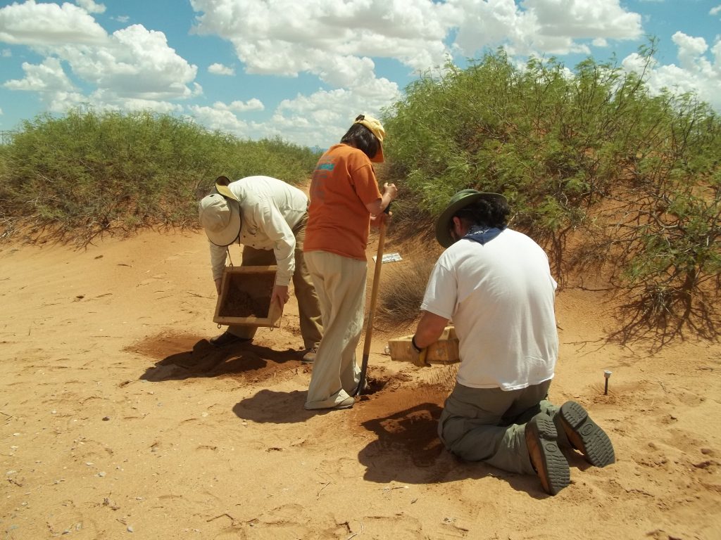
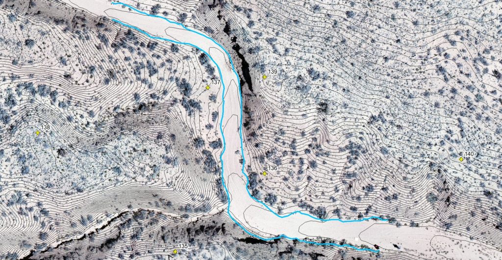
The USEPA proposed to remove mine waste from four former uranium mines in the Ambrosia Lake Sub-District, north of Grants, McKinley County. Marron was tasked with completing ecological and cultural resource studies over 2,300 acres, which included private, state and federal lands. The ecological services included surveys for rare, threatened and endangered species, and identifying critical habitats. Marron also installed monitoring vegetation transects, developed a vegetation map, identified and mapped wetlands, compiled wildlife data and information on ecological conditions, surveyed for raptors, and documented soil types and waterways. After fieldwork was completed and an analysis of the findings was conducted, Marron prepared a Natural Resources Evaluation Report that included a biological evaluation section to address potential impacts to threatened and endangered species and included recommendations to minimize impacts. With respect to cultural resources, seven sites and 180 isolated occurrences were found and recorded. As part of the survey process, client representatives accompanied the field crew and completed Ludlum Scaler Ratemeter readings for every cultural resource found. A variety of cultural sites were recorded including Ancestral Pueblo and historic artifact scatters, historic homesteading, and mining-related sites. Treatment recommendations were based on site eligibility, proposed activities in the area, the Ludlum Scaler Ratemeter reading, and the specific cultural resource found. Marron worked closely with the client to determine treatment recommendations and the survey. All documents were completed on time and within budget.

Picuris Pueblo Solar Generation Facility

The Pueblo of Picuris (Pueblo) and the Northern Pueblos Housing Authority proposed to construct and operate a solar photovoltaic facility, which would consist of a ground-mounted, single-axis array. When operational, the solar panels would tilt to track the angle of the sun to obtain maximum energy.  The electric power produced would be fed into the grid and be purchased by a local electrical co-operative.  The revenue stream from the sale of power would go primarily to the Pueblo and to provide a return to a private equity investor.  The Pueblo would use a portion of the revenue to cover energy costs for the Pueblo and its members, making Picuris Pueblo energy independent and creating a viable model for other tribes.  Additionally, by using solar energy, the Pueblo would reduce fossil fuel energy use and carbon dioxide emissions, which contribute to global climate change.

Marron prepared an environmental assessment (EA) for the approval of a lease for development of the property.  Funding for the project included grants from the Department of Energy, Bureau of Indian Affairs, and Enterprise Community Partners. Marron also conducted biological and cultural resource investigations for this project. The Bureau of Indian Affairs issued a Finding of No Significant Impact.

Laguna Wastewater and Sewer Project

This large survey incorporated all resource- and inventory‑related tasks, including an environmental assessment and biological and cultural surveys and corresponding reports. The undertaking consisted of an extensive stimulus‑funded upgrade to the waste water system of Laguna Pueblo with the project area consisting of a web of linear pipeline corridors covering much of the Pueblo. The project involved extensive preliminary planning and consultation with the agencies, tribal officials, and engineers. Resources encountered during the survey included a wide variety of prehistoric and historic archaeological sites, numerous historic buildings (commercial, residential, and civic), five extensive acequia systems, portions of historic Route 66, and traditional cultural properties. Biological resources such as wetlands, waterways, protected species habitat, and migratory bird nesting habitat were identified. Marron completed its assigned task on schedule and assisted in the preparation of a Federal Emergency Management Agency Programmatic Agreement to allow the project to move forward with the assurance that additional necessary work will be conducted as needed. Marron was awarded the second phase of this long multi‑year project.

Fill out the form below to download the handbook.

Form #1 - Redirection to PDF

Form #2 - Sends email containing the link to the PDF

"*" indicates required fields

This field is for validation purposes and should be left unchanged.

eNewsletter - NV5 Real Estate Transaction Services

Contact NV5 Real Estate Transaction Services

Download NV5 2022 Compliance Calendar

Please fill out the form below. After successful form submission, you will be redirected to the requested file. Thank you.

"*" indicates required fields

This field is for validation purposes and should be left unchanged.
We are an equal opportunity employer. All applicants will be considered for employment without attention to race, color, religion, sex, sexual orientation, gender identity, national origin, veteran or disability status. We ensure nondiscrimination in all programs and activities in accordance with Title VI of the United States Civil Rights Act of 1964. If you need more information or special assistance for persons with disabilities or limited English proficiency, contact MaryJo OBrien at (954) 495-2112. Persons with hearing-and speech-impairments can contact the NV5 by using the Virginia Relay Service, a toll-free telecommunication device for the deaf (TDD). Call 711 for TTY/TDD.
This field is hidden when viewing the form

Hyperspectral Imaging - Technically Speaking

Our internal innovation and development team constantly analyzes new technology and develops solutions to meet our client’s challenges. Our Technically Speaking series is one way we share our technical findings with the professional community. 

Please tell us a little about yourself by filling out the form below, and we’ll share the document with you, thanks!

Accuracy Part 1- Technically Speaking

Our internal innovation and development team constantly analyzes new technology and develops solutions to meet our client’s challenges. Our Technically Speaking series is one way we share our technical findings with the professional community. 

Please tell us a little about yourself by filling out the form below, and we’ll share the document with you, thanks!

Prune Optimization Webinar Recording

NV5 Geospatial releases a new predictive modeling platform for vegetation management that uses existing lidar and historical data to identify the relative level of asset risk from trees by quantifying the potential for causing asset damage. 

Please tell us a little about yourself by filling out the form below, and we’ll share the document with you, thanks!

Topobathy Lidar - Technically Speaking

Our internal innovation and development team constantly analyzes new technology and develops solutions to meet our client’s challenges. Our Technically Speaking series is one way we share our technical findings with the professional community. 

Please tell us a little about yourself by filling out the form below, and we’ll share the document with you, thanks!

Contact Geospatial

Contact Geospatial