Historical Archive Offers Window into the Life of Amelia Earhart

March 13th marks the 80th anniversary of Amelia’s first attempt to circumvent the world. While much focus is put on what may or may not have happened on her fateful last flight, many often overlook what she accomplished as an aviation pioneer and early feminist. During her almost 40 years, Amelia became the first female aviator to fly solo across the Atlantic Ocean, an accomplishment that garnered her a U.S. Distinguished Flying Cross. She also set many other aviation records, wrote best-selling books about her flying experiences, and played an important role in creation of The Ninety-Nines, an international organization formed in 1929 that, to this day, continues to provide professional support to women pilots.

Amelia took special pride in mentoring and providing career counseling to women students while she was an aeronautical engineering advisor at Purdue University. She was politically active, as a member of the National Woman’s Party and an early supporter of the Equal Rights Amendment.

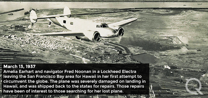
In my blog last week, I shared how Quantum Spatial has amassed a vast historical photo archive, which originated from a collection of images taken by iconic photographer Clyde Sunderland, dating back to 1922. Clyde, through his connections to the Oakland (California) Airport, captured many historical moments and prominent aviation figures, including Amelia.

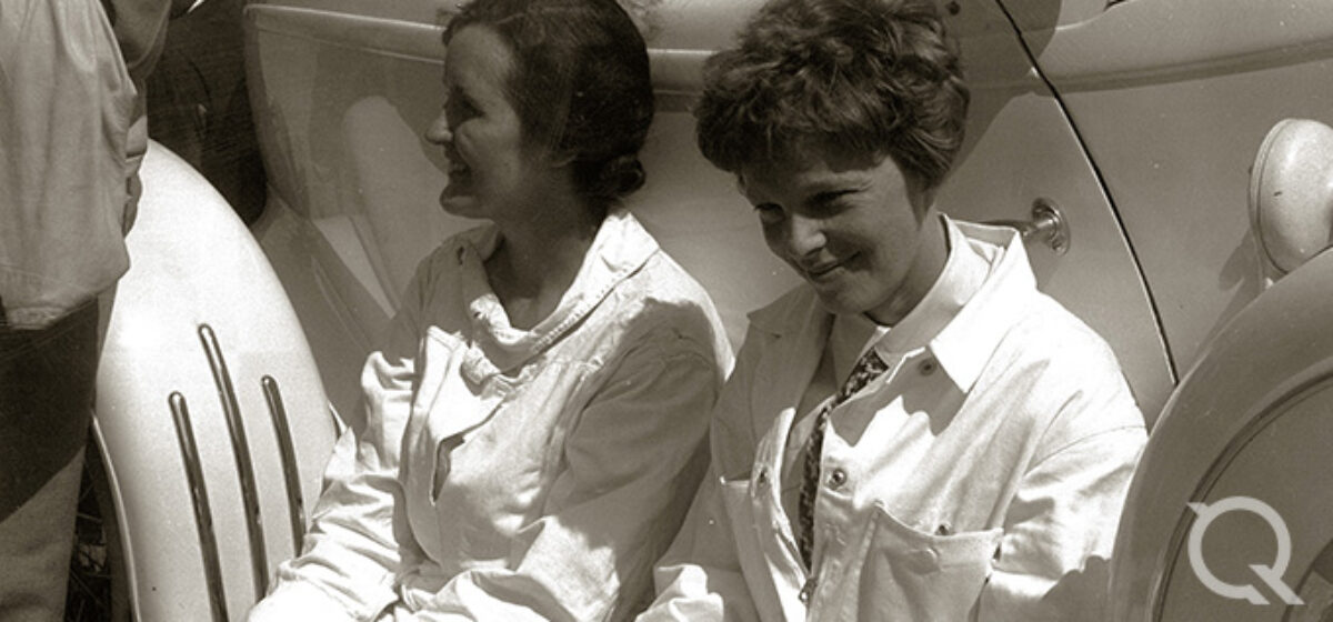
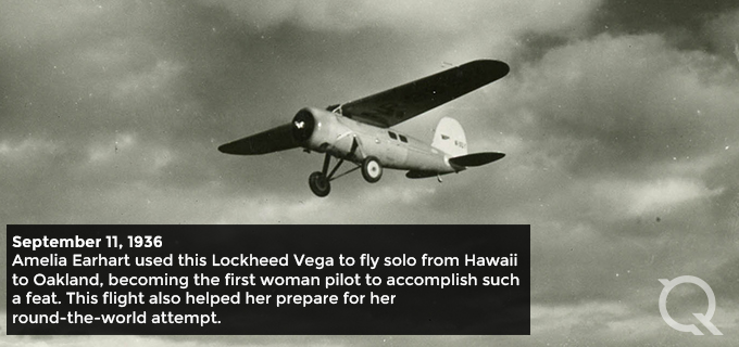
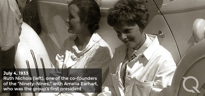
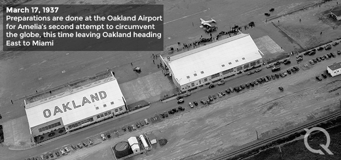
Clyde’s photos of Amelia offer a unique window into her life as a female aviator and aviation pioneer. Take a look at some of those in our collection:

These images are just a sample of the more than 28 Amelia Earhart photos the Quantum Spatial collection. There also are photos of many other historical moments in aviation, including ones Clyde took of the Pan American Exposition on Treasure Island, and aviators Charles Lindbergh and Howard Hughes, as well as marketing shots for Pan American airlines, featuring images of the company’s Clipper planes flying above San Francisco.

I invite you to learn more about our archive, and if you’re interested in acquiring images for publication or your personal collection, complete our Archive Inquiry form and let us know what photos you’re seeking.

Additionally, browse our newly launched Image Catalog. It takes some time to upload a collection of 6 million photos, so check back frequently because we continually update with more images. We look forward to being able to share these unique resources and to assist with your geospatial needs.

Written by David Ruiz, Quantum Spatial Imagery Analyst / Data Archivist.

Fill out the form below to download the handbook.

Form #1 - Redirection to PDF

Form #2 - Sends email containing the link to the PDF

"*" indicates required fields

This field is for validation purposes and should be left unchanged.

eNewsletter - NV5 Real Estate Transaction Services

Contact NV5 Real Estate Transaction Services

Download NV5 2022 Compliance Calendar

Please fill out the form below. After successful form submission, you will be redirected to the requested file. Thank you.

  • We are an equal opportunity employer. All applicants will be considered for employment without attention to race, color, religion, sex, sexual orientation, gender identity, national origin, veteran or disability status. We ensure nondiscrimination in all programs and activities in accordance with Title VI of the United States Civil Rights Act of 1964. If you need more information or special assistance for persons with disabilities or limited English proficiency, contact MaryJo OBrien at (954) 495-2112. Persons with hearing-and speech-impairments can contact the NV5 by using the Virginia Relay Service, a toll-free telecommunication device for the deaf (TDD). Call 711 for TTY/TDD.

Hyperspectral Imaging - Technically Speaking

Our internal innovation and development team constantly analyzes new technology and develops solutions to meet our client’s challenges. Our Technically Speaking series is one way we share our technical findings with the professional community. 

Please tell us a little about yourself by filling out the form below, and we’ll share the document with you, thanks!

Accuracy Part 1- Technically Speaking

Our internal innovation and development team constantly analyzes new technology and develops solutions to meet our client’s challenges. Our Technically Speaking series is one way we share our technical findings with the professional community. 

Please tell us a little about yourself by filling out the form below, and we’ll share the document with you, thanks!

Prune Optimization Webinar Recording

NV5 Geospatial releases a new predictive modeling platform for vegetation management that uses existing lidar and historical data to identify the relative level of asset risk from trees by quantifying the potential for causing asset damage. 

Please tell us a little about yourself by filling out the form below, and we’ll share the document with you, thanks!

Topobathy Lidar - Technically Speaking

Our internal innovation and development team constantly analyzes new technology and develops solutions to meet our client’s challenges. Our Technically Speaking series is one way we share our technical findings with the professional community. 

Please tell us a little about yourself by filling out the form below, and we’ll share the document with you, thanks!

Contact Geospatial

Contact Geospatial