The End of Esri’s Geometric Network: Why It’s Time to Move—and How to Transition with Confidence
By Michael Parma, Senior Solutions Architect, NV5 The clock is ticking on Esri’s Geometric Network (GN), and for utilities still relying on it there are

By Michael Parma, Senior Solutions Architect, NV5 The clock is ticking on Esri’s Geometric Network (GN), and for utilities still relying on it there are

Hi there, join us for this upcoming webinar! Wednesday, September 24 Noon ET / 11am CT With Esri’s geometric network retiring in March 2026, water utilities are

Helping Infrastructure, Transportation and Utility Leaders Stay Ahead of Landslides, Subsidence, and Slope Failures Geohazards such as slope instability, erosion, settlement, or seepage pose ongoing

Wednesday, August 27 at 2 PM ET / 1PM CT In this live webinar, you’ll discover how our latest hydrographic survey innovations, developed and refined

The defense and intelligence community is entering a new era of autonomy, one defined by AI-driven workflows that are reshaping how we handle geospatial intelligence

Join us for Geo Sessions, a premier online thought leadership event happening September 16–18. This three-day event welcomes over 20 experts from public organizations, academia, and commercial
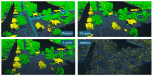
In the remote sensing industry, we’re observing a growing market demand for lower-cost, lower-resolution solutions. This raises a critical question: what level of accuracy is
Challenge KBC Advisors, a fast-moving full-service real estate advisory firm, relies on ArcGIS Enterprise to deliver location-driven insights to its national network of brokers and

View our June edition to learn about our latest geospatial projects. CLICK HERE. June Newsletter

Executive Summary When the world’s busiest airport needed to modernize its GIS and asset management capabilities, NV5 delivered. Through a multi-agency partnership with the City