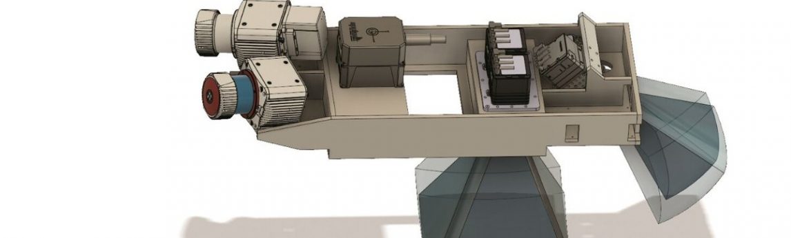
Quantum Spatial, Inc., an NV5 company, and the nation’s largest independent geospatial data firm, today announced its new sensor platform, which is designed to improve the efficiency of data collection, while delivering high-density, high-resolution and highly accurate results. The Comprehensive Low-Altitude Sensor Solution (CLASS) combines dual-look lidar, RGB and NIR nadir imagery and forward-looking oblique imagery into one platform that can be affixed to a rotary wing platform.
source: the geospatial network