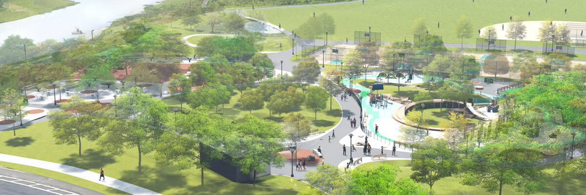
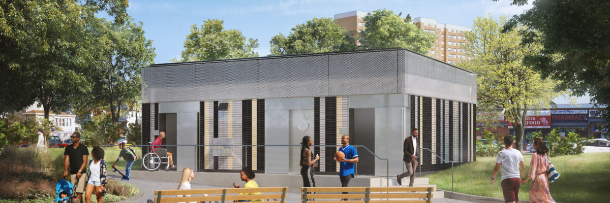
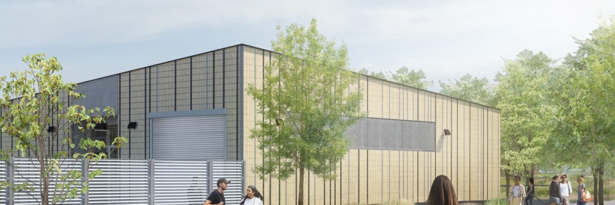
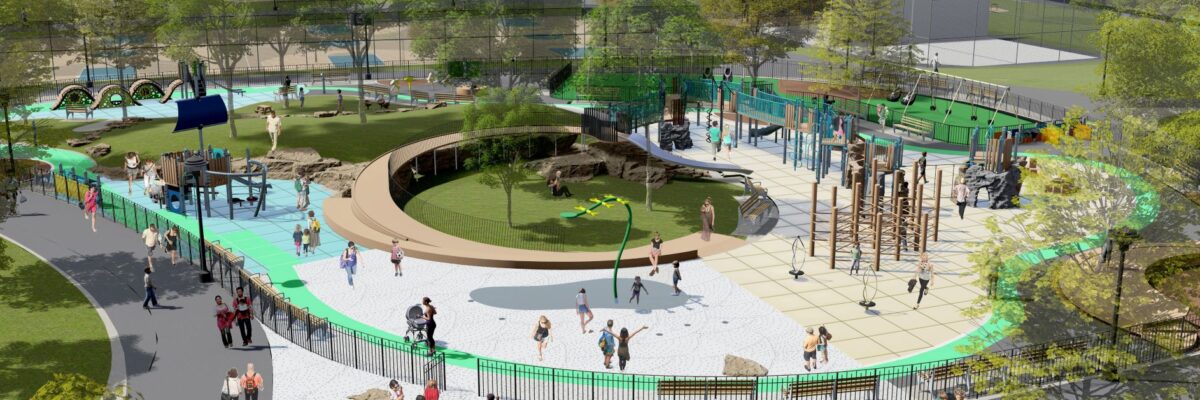
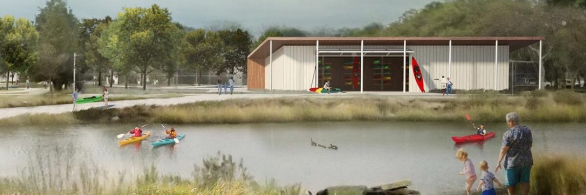
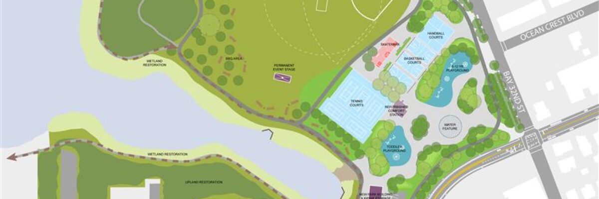
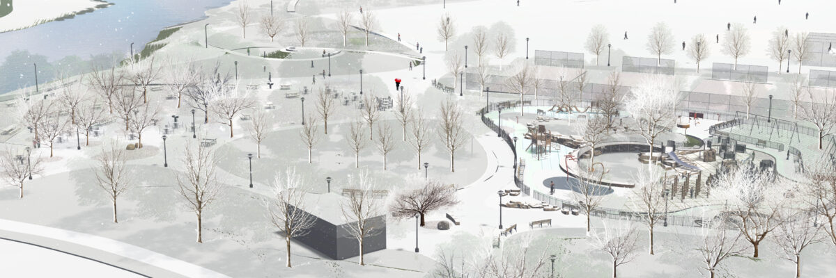
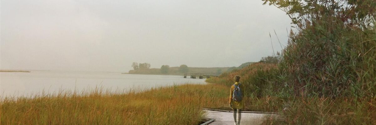
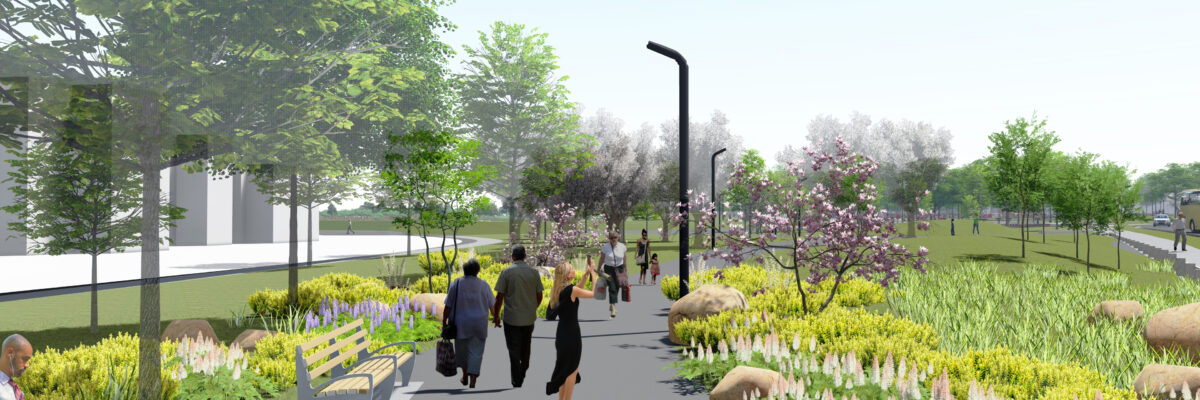
The $50+ Million FEMA-funded project is located on the shores of Jamaica Bay on the Rockaway Peninsula in Queens. This project will reconstruct the entire 25-acre park, upgrading existing features and creating new passive and active recreational features, including: new playgrounds, spray grounds, picnic areas, sports courts, athletic fields, plazas and green spaces, park entrances, walking and jogging paths and perimeter sidewalks. Also included is a new comfort station, maintenance building, kayak launch and shade pavilions. The $3.5 Million nature-themed playground with interactive spray ground and neighboring picnic area is carefully integrated into an existing grove of mature trees and grassy knolls, and is designed to maximize motor sensory and social skill development.
Form #2 - Sends email containing the link to the PDF
"*" indicates required fields
eNewsletter - NV5 Real Estate Transaction Services
Contact NV5 Real Estate Transaction Services
Download NV5 2022 Compliance Calendar
Please fill out the form below. After successful form submission, you will be redirected to the requested file. Thank you.
"*" indicates required fields
Hyperspectral Imaging - Technically Speaking
Our internal innovation and development team constantly analyzes new technology and develops solutions to meet our client’s challenges. Our Technically Speaking series is one way we share our technical findings with the professional community.
Please tell us a little about yourself by filling out the form below, and we’ll share the document with you, thanks!
Accuracy Part 1- Technically Speaking
Our internal innovation and development team constantly analyzes new technology and develops solutions to meet our client’s challenges. Our Technically Speaking series is one way we share our technical findings with the professional community.
Please tell us a little about yourself by filling out the form below, and we’ll share the document with you, thanks!
Prune Optimization Webinar Recording
NV5 Geospatial releases a new predictive modeling platform for vegetation management that uses existing lidar and historical data to identify the relative level of asset risk from trees by quantifying the potential for causing asset damage.
Please tell us a little about yourself by filling out the form below, and we’ll share the document with you, thanks!
Topobathy Lidar - Technically Speaking
Our internal innovation and development team constantly analyzes new technology and develops solutions to meet our client’s challenges. Our Technically Speaking series is one way we share our technical findings with the professional community.
Please tell us a little about yourself by filling out the form below, and we’ll share the document with you, thanks!