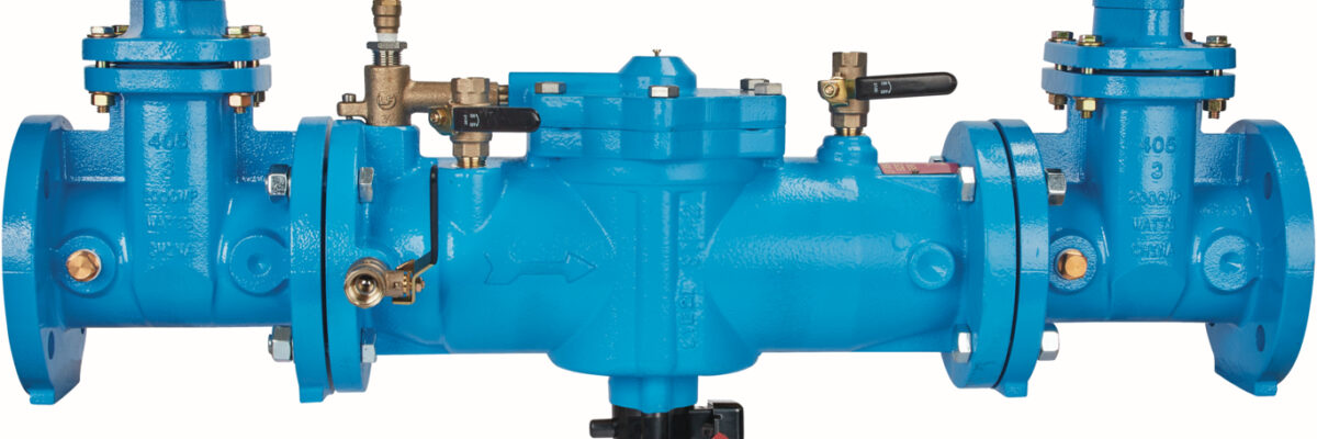
Did you know a single reduced pressure zone (RPZ) assembly can discharge hundreds of gallons per minute during a backflow event? For plumbing engineers, that’s not just a detail—it’s a design challenge that can’t be overlooked. In many commercial buildings, RPZ assemblies are essential for protecting the domestic water system[...]
In order to pull off transportation projects that improve safety and efficiency for travelers, the planning phase is critical. There are massive amounts of data to consider, including the status of existing infrastructure, current traffic behavior, and the surrounding natural environment where improvements are being considered. Luckily, GIS technology exists[...]
Tualatin Valley Water District (TVWD) is taking a data-driven approach to capital planning, using ArcGIS Utility Network and custom tracing tools developed with NV5 to better understand outage impacts and strengthen system resilience. Their work demonstrates how GIS can move utilities from static maps to actionable intelligence, informing smarter decisions[...]
In today’s data-driven world, organizations managing public infrastructure, utilities, and facilities face the common issue of disconnected systems. For years, asset management meant switching between platforms, juggling reports, and trying to make sense of siloed data streams. That’s exactly what the new Trimble Unity: Your Road to AI-Ready Asset Management[...]
Form #2 - Sends email containing the link to the PDF
"*" indicates required fields
eNewsletter - NV5 Real Estate Transaction Services
Contact NV5 Real Estate Transaction Services
Download NV5 2022 Compliance Calendar
Please fill out the form below. After successful form submission, you will be redirected to the requested file. Thank you.
"*" indicates required fields
Hyperspectral Imaging - Technically Speaking
Our internal innovation and development team constantly analyzes new technology and develops solutions to meet our client’s challenges. Our Technically Speaking series is one way we share our technical findings with the professional community.
Please tell us a little about yourself by filling out the form below, and we’ll share the document with you, thanks!
Accuracy Part 1- Technically Speaking
Our internal innovation and development team constantly analyzes new technology and develops solutions to meet our client’s challenges. Our Technically Speaking series is one way we share our technical findings with the professional community.
Please tell us a little about yourself by filling out the form below, and we’ll share the document with you, thanks!
Prune Optimization Webinar Recording
NV5 Geospatial releases a new predictive modeling platform for vegetation management that uses existing lidar and historical data to identify the relative level of asset risk from trees by quantifying the potential for causing asset damage.
Please tell us a little about yourself by filling out the form below, and we’ll share the document with you, thanks!
Topobathy Lidar - Technically Speaking
Our internal innovation and development team constantly analyzes new technology and develops solutions to meet our client’s challenges. Our Technically Speaking series is one way we share our technical findings with the professional community.
Please tell us a little about yourself by filling out the form below, and we’ll share the document with you, thanks!