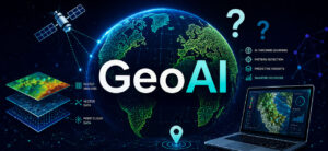
NV5 Named Solution Company of the Year by Geospatial World
NV5 was recognized as “Solution Company of the Year” at the Geospatial World Leadership Awards 2026. The recognition reflects how we’re advancing geospatial intelligence across

NV5 was recognized as “Solution Company of the Year” at the Geospatial World Leadership Awards 2026. The recognition reflects how we’re advancing geospatial intelligence across

In the latest issue of T&D World, Peter Stoltman, senior manager of Wildfire Prevention for Liberty Utilities (CalPeco Electric) LLC, details how lidar analytics have

NV5 today announced that GeoAgent™ has achieved “Awardable” status through the Chief Digital and Artificial Intelligence Office’s (CDAO) Tradewinds Solutions Marketplace.

Vicki Lukas was with the USGS for over three decades and helped to shape the 3D Elevation Program (3DEP). Now part of NV5, Vicki continues to advance the next generation of national mapping.

These days, you can’t talk about geospatial data without including AI—but GeoAI isn’t one-size-fits-all. Every organization faces unique challenges, constraints, and opportunities when it comes to adopting AI.

Municipal utilities have no shortage of data. What they often lack is connection. Across facilities, asset information lives in multiple systems such as 3D models,

GoGeomatics published a new article that explores how AI-powered geospatial analysis is transforming the way organizations turn data into decisions. Titled, “From Imagery to Insight”

Modern Defense & Intelligence situational awareness hinges on the ability to turn the constant influx of information into timely, actionable understanding. But as volumes grow and threats accelerate,

Transportation agencies have collected large-scale infrastructure data for years. Yet many DOTs are still stuck in a familiar pattern: they invest heavily in collection, receive massive datasets,

Local governments have been using Geographic Information Systems (GIS) in some capacity for decades now, making it easier to collect, manage, and share large sets
Fill out the form below to download the handbook.
"*" indicates required fields
Please fill out the form below. After successful form submission, you will be redirected to the requested file. Thank you.
"*" indicates required fields
Our internal innovation and development team constantly analyzes new technology and develops solutions to meet our client’s challenges. Our Technically Speaking series is one way we share our technical findings with the professional community.
Please tell us a little about yourself by filling out the form below, and we’ll share the document with you, thanks!
NV5 Geospatial releases a new predictive modeling platform for vegetation management that uses existing lidar and historical data to identify the relative level of asset risk from trees by quantifying the potential for causing asset damage.
Please tell us a little about yourself by filling out the form below, and we’ll share the document with you, thanks!
Our internal innovation and development team constantly analyzes new technology and develops solutions to meet our client’s challenges. Our Technically Speaking series is one way we share our technical findings with the professional community.
Please tell us a little about yourself by filling out the form below, and we’ll share the document with you, thanks!