Spatial data is incredibly powerful, enabling data-driven decisions through location-based insights. However, uncovering those insights is often more complex than it appears. Traditional GIS systems require expert knowledge, complex workflows, and manual interpretation. Although AI tools have promised to solve this problem, they have fallen short because they lack a true understanding of geographic data.
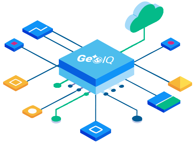
GeoIQ is NV5’s spatially aware AI solution that is designed to transform how people interact with spatial data. It reasons about geography the way humans do—through spatial awareness, proximity, clustering, relationships, and scale.
GeoIQ takes a different approach than other solutions, closing the gap between spatial data and real decision making.
Instead of navigating complex GIS tools, GeoIQ lets users ask questions in plain language and receive clear, explainable answers. This enables anyone—from GIS professionals to non-technical users—to perform advanced spatial reasoning, analysis, and querying across large, complex geospatial databases.
Not Just “Chat for GIS.”It’s a Spatial Reasoning Engine.
Understands maps, locations, and relationships
Works directly inside your GIS tools and applications
Explains how answers are produced
Supports auditability and trust
Eliminates the need for extensive GIS expertise
GeoIQ analyzes spatial data in an innovative way and unlocks insights that can’t be achieved using traditional tools.
GeoIQ integrates directly into the environments you already use, including QGIS, custom web applications, and soon ArcGIS Experience Builder and ArcGIS Pro. Because GeoIQ operates inside your existing tools, users don’t need to move between platforms to gain insight from AI. Spatial questions and answers live in the same workspace where decisions are made.
Supports for Spatial Reasoning Across aWide Range of Domains.
Example Questions GeoIQ Answers:
“What does the distribution of turtle nesting sites look like along Florida’s Gulf Coast?”
“Which neighborhoods lack adequate public transportation coverage?”
“Which paved roads can support a 30-ton emergency vehicle?”
“Which airfields can accommodate a C-17 for landing and refueling?”
Spatial Analysis:Now Faster, Smarter, and More Intuitive
GeoIQ accelerates spatial insight while reducing reliance on specialized GIS expertise. Its transparent, explainable outputs improve trust, strengthen collaboration between technical and non-technical teams, and create clearer narrative for decision makers. The result is less time finding and managing layers and tools and more time making spatially intelligent decisions.
GeoIQ is ready to show and discuss. Let’s talk about your users, your workflows, and how we can tailor GeoIQ to meet your team’s needs.
Fill out the form below to download the handbook.
Form #1 - Redirection to PDF
Form #2 - Sends email containing the link to the PDF
"*" indicates required fields
eNewsletter - NV5 Real Estate Transaction Services
Contact NV5 Real Estate Transaction Services
Download NV5 2022 Compliance Calendar
Please fill out the form below. After successful form submission, you will be redirected to the requested file. Thank you.
"*" indicates required fields
Hyperspectral Imaging - Technically Speaking
Our internal innovation and development team constantly analyzes new technology and develops solutions to meet our client’s challenges. Our Technically Speaking series is one way we share our technical findings with the professional community.
Please tell us a little about yourself by filling out the form below, and we’ll share the document with you, thanks!
Accuracy Part 1- Technically Speaking
Our internal innovation and development team constantly analyzes new technology and develops solutions to meet our client’s challenges. Our Technically Speaking series is one way we share our technical findings with the professional community.
Please tell us a little about yourself by filling out the form below, and we’ll share the document with you, thanks!
Prune Optimization Webinar Recording
NV5 Geospatial releases a new predictive modeling platform for vegetation management that uses existing lidar and historical data to identify the relative level of asset risk from trees by quantifying the potential for causing asset damage.
Please tell us a little about yourself by filling out the form below, and we’ll share the document with you, thanks!
Topobathy Lidar - Technically Speaking
Our internal innovation and development team constantly analyzes new technology and develops solutions to meet our client’s challenges. Our Technically Speaking series is one way we share our technical findings with the professional community.
Please tell us a little about yourself by filling out the form below, and we’ll share the document with you, thanks!