

NV5 and CCCCC Advance Caribbean Climate Resilience With High-Resolution Lidar
As part of a multi-year partnership, NV5 regularly delivers imagery and topographic and topobathymetric lidar, creating the Caribbean’s first consistent, comparable baseline for climate adaptation.

NGA Selects NV5 for Geophysical Data Purchasing and Survey Sourcing Contract
Single-award contract with a potential five-year term builds on NV5’s experience helping NGA acquire and deliver geophysical data supporting intelligence missions.

Mitigating Risk and Prioritizing Work for Distribution Vegetation Management with Lidar Analysis
From Ground Patrols to Geospatial Intelligence: A New Approach to Distribution Vegetation Management For electric utilities, vegetation management has always required balancing risk, resources and

From AI Pilots to Operational GeoAI – NV5 Featured in LIDAR Magazine
AI pilots are everywhere. Operational GeoAI is another story. In LIDAR Magazine, NV5’s Chancee Vincent shares what it takes to turn AI models into workflows that deliver actionable insights.

New Planning Guide Maps Version Dependencies Across the Utility Network Stack
NV5’s Utility Network experts distilled their upgrade experience into one resource — a cross-platform compatibility guide that maps version dependencies across Enterprise, Pro, Cityworks, and Trimble Unity.

NV5 to Showcase Power of Geospatial Analysis for Vegetation Management at Trees & Utilities Conference
Comprehensive remote sensing and analytics solution, and AR demo, demonstrate how geospatial insights improve safety, reliability and community alignment HOLLYWOOD, Fla., September 17, 2026 –

Online Thought Leadership Event to Explore the Future of GeoAI and Geospatial Data & Analysis
Geo Sessions will benefit anyone who is using or considering using spectral, SAR, and lidar data — or who is determining how AI can enhance their geospatial workflows and analysis.
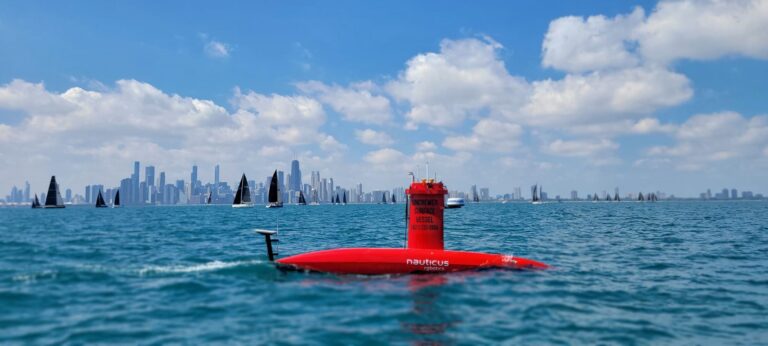
Going Uncrewed: DriX Takes on Lake Michigan
NV5 used the DriX H-8 uncrewed surface vessel to help the Illinois State Geological Survey map the lakebed off Chicago, part of a NOAA-supported effort to understand Lake Michigan’s nearshore geology.
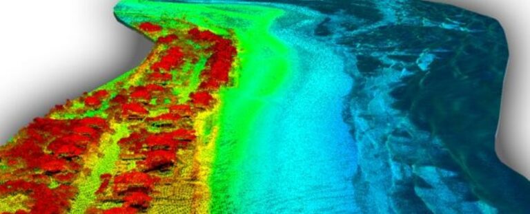
Beyond Infrastructure: How Digital Twins Are Being Used to Monitor Rivers, Coastlines, and Watersheds
Digital twins have long been associated with buildings, utilities, and transportation networks: complex assets with long lifecycles and enormous volumes of operational data. But as