
Rapid Intelligence Collection
NV5 owns and operates assets in the air, on the ground, and in the water, deploying them rapidly in support of client missions. When we aren’t deploying our assets, our technology understands precisely where collection platforms will be geolocated in the future, sensor characteristics, and optimal future overflights to ensure clients receive the most effective data.
Automated Data Analysis
Our industry-leading geospatial analytics and AI transform massive amounts of complex data into mission-ready intelligence for our clients. NV5 systems ingest, process, and analyze information at scale to detect significant events and support rapid response workflows. This intelligent automation accelerates workflows and frees analysts to focus on strategic decision-making.

Real-time Information Sharing
Our off-the-shelf and custom-built technologies enable secure, real-time collaboration, even in dynamic or bandwidth constrained environments. We also negotiate software and hardware licensing for our customers, ensuring they have the right tools on hand exactly when they need them.
Advanced Decision Support
NV5’s decision-support solutions seamlessly integrate multimodal data streams into a single operating picture, providing clear, timely insights that enhance situational awareness. By turning complexity into clarity, we help clients anticipate challenges before they arise and make confident, informed decisions in rapidly evolving environments.
We Own the Input and the Intelligence
Because we capture, process, and analyze data in one continuous ecosystem, NV5 delivers mission-ready insights without handoffs or delays.
Working With Us Is Simple and Easy
Our clients have one point of contact and one team of experts to achieve mission objectives fast and efficiently.
We Do All Forms of Analysis
Visualization. Exploitation. Automation. Our fully interoperable solutions support edge deployment and can be adapted by end users or customized by our expert team.
Trusted and Proven
NV5 has delivered high-impact geospatial intelligence to defense and intelligence partners for years. We understand the mission, we know the stakes, and we perform every day at operational tempo.
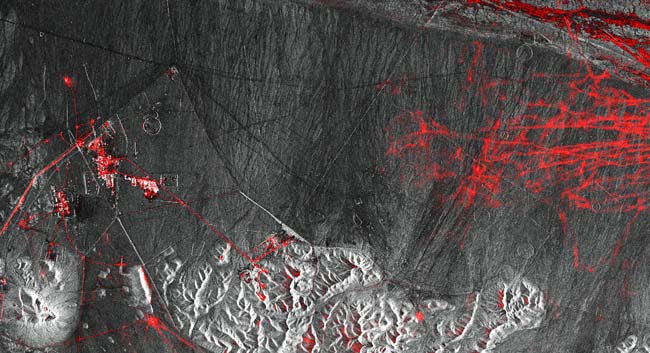
Accurate Domain Monitoring in a Fraction of the Time
NV5 developed a solution for a customer that delivers all-weather, day-night monitoring using commercial SAR data and an AI-driven detection pipeline. Our computer-vision models achieve ~96% accuracy across air, maritime, and ground targets, with results in minutes and hours instead of days or weeks. NV5’s cloud-native, automated workflow scales to support both standing and ad hoc requests.
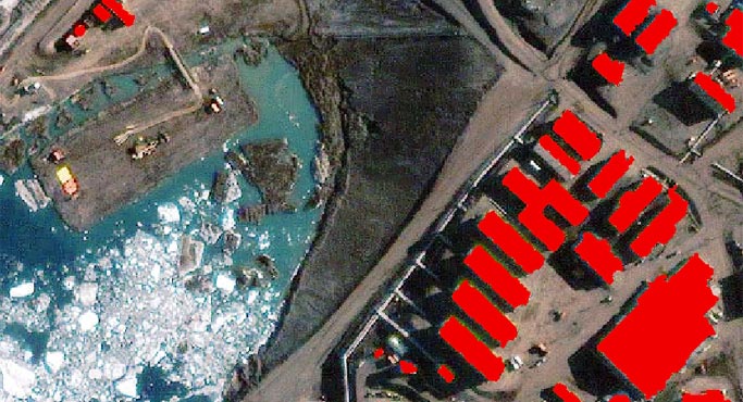
On-Demand Human Activity Monitoring for National Security Partner
NV5 addresses a national security partner’s need to monitor human activity by rapidly transforming data into actionable insights. The solution combines proven technology, deep expertise, and a scalable, web-hosted processing platform to deliver timely results. We integrate and exploit data from multiple sensor types, including SAR, multispectral, and hyperspectral sources.
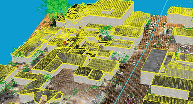
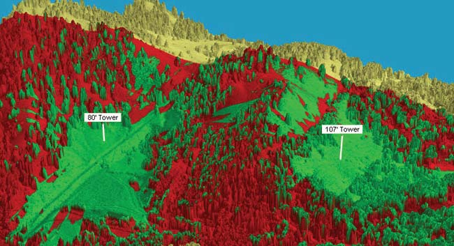
Multi-modal Mission Ready Products for the Military
NV5 rapidly integrated lidar, imagery, and terrain data to produce mission-ready 3D models and RF analysis outputs, enabling the military to make operational decisions in hours rather than days. NV5 also applied AI-assisted feature extraction and high-performance cloud processing to further compress timelines while preserving operational accuracy.
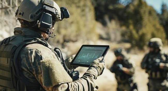
GEOINT at the Tactical Edge
NV5 has conducted successful RDT&E with the US Marine Corps to ensure battalions have access to geospatial intelligence. By employing NV5 technology including ENVI®, DTAK, and ATAK software and hardware, these battalions can collect, process, and disseminate intelligence at the tactical edge. With this, they gain speed, autonomy, and survivability in contested environments.