SAND SEARCH
Marine science meets survey expertise.
Sand is at the root of all successful beach restoration projects. However, delineating depositional environments, identifying modern and paleo-geomorphologies, assessing cultural resources, and understanding all the marine spatial planning issues at play can be perhaps the most challenging task facing coastal engineers and practitioners today.
Customized Approach
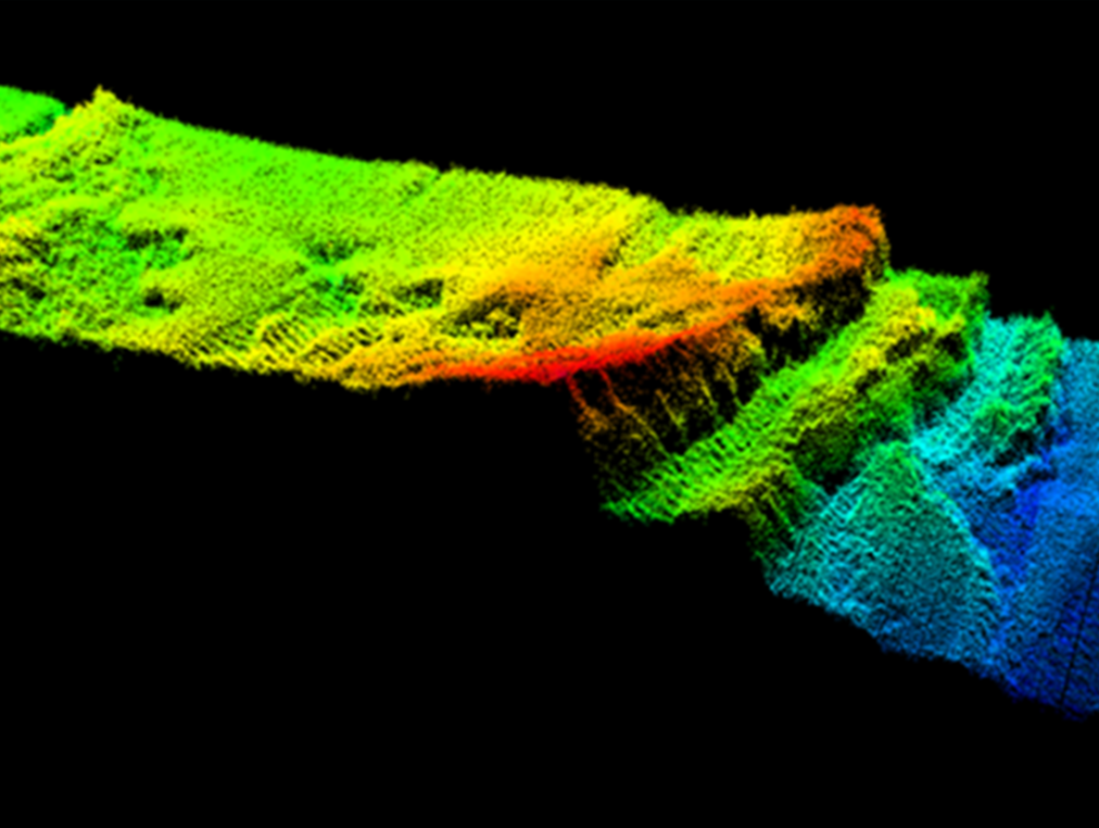
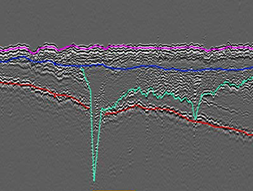
Our High Resolution Geophysical (HRG) approach includes the use of multibeam echosounder sonar, side-scan sonar, magnetometer, parametric sub-bottom profilers for shallow depth penetration, and single channel ultra-high resolution seismic solutions for deeper investigations. Explore our sensors>>
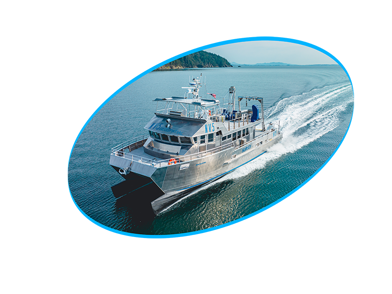
Custom Vessels
NV5 owns and operates survey vessels to support multi-sensor HRG surveys within coastal, nearshore, and deep offshore waters. Capable of 24-hour survey schedules, we maximize data acquisition while minimizing vessel and crew expense. Visit our fleet>>
Planning
NV5 offers unique end-to-end services for sediment resource assessment projects – we understand State and federal coverage requirements and can assist with developing and articulating sensor types and parameters, overall survey boundaries, line spacing, and other planning and logistical components of a successful HRG survey.
Permitting & Reporting
We have institutional knowledge and expertise in preparing and securing BOEM permits for investigations in federal waters and a deep understanding of the requisite reporting requirements as well. With numerous cultural resources projects in our portfolio, we can also manage Marine Archeological Resource Assessments and incorporate these findings into final deliverables.
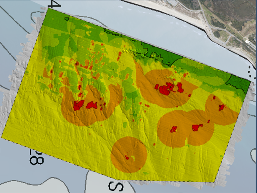
Advanced Sand Search Tool (ASST)
Project Experience
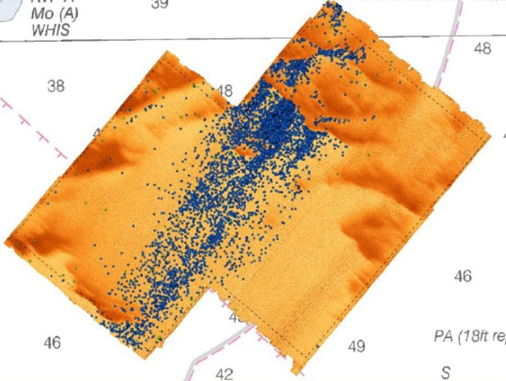
Bogue Banks Sand Survey
Overview: Expansive offshore sediment evaluation survey located within both State and federal waters (270 NMI2 footprint). Read In Depth>>
Oak Island Geophysical Surveys
Overview: Two discretely located survey areas in State and federal waters within the Frying Pan Shoal complex, presenting challenging operational conditions with detailed, multifaceted State and federal requirements for surveying activities and associated environmental commitments. Read In Depth>>
Ft. Fisher Seawater Intake Hydrographic & Sub-bottom Survey
Overview: Survey of discrete areas of sand to support the sighting of a proposed saltwater intake for the N.C. Aquarium in an area with known hardbottoms and significant cultural resources. Read In Depth>>
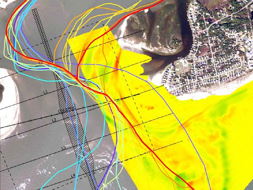
Wrightsville Beach
Overview: Seafloor surface and sub-bottom survey to assess bathymetry and the presence or absence of both hard bottom and cultural resources within a potential offshore sand borrow area. Read In Depth>>
Emerald Isle Point Monitoring
Overview: Semiannual survey with customized metrics including “virtual transects” used to consistently measure the inlet’s position relative to existing property and infrastructure. Read In Depth>>
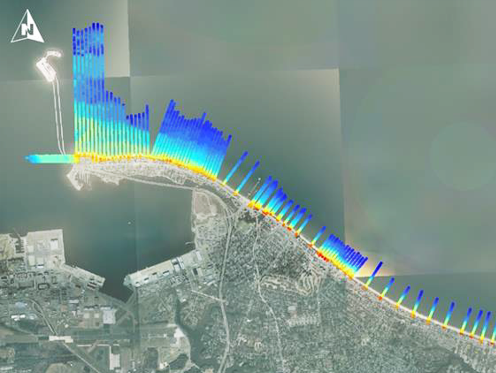
Topographic + Bathymetric Monitoring & Feature Mapping
Overview: Seamless beach and hydrographic surveys are conducted for ,emergency monitoring of all beach profiles in the wake of hurricanes or nor’easter storm events. Read In Depth>>
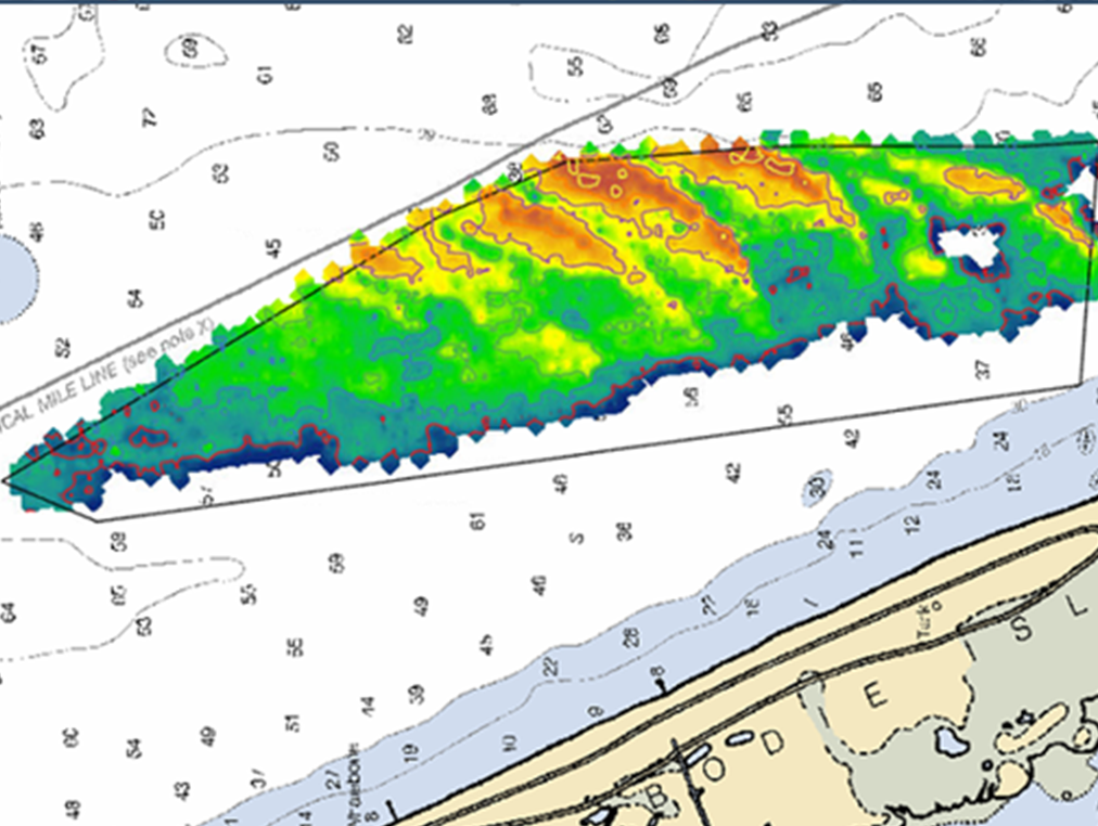
Nags Head Geophysical Survey
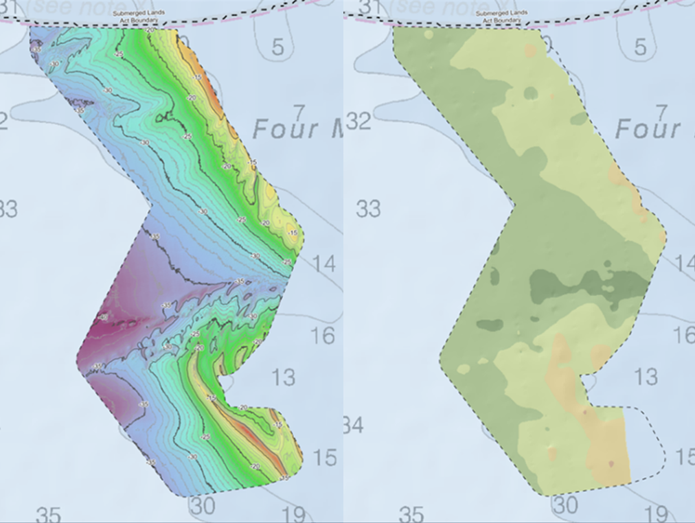
Overview: Analyzed a +7 sq nmi borrow site area in accordance with the State’s regulations for beachfill projects. Vibracores previously collected within the borrow area were integrated into the SBP analysis, which enabled a clear “base sand” horizon to be identified and subtracted from the depicted seafloor. Read In Depth>>
Holden Beach Geophysical Survey
Overview: Seafloor and subseafloor investigations achieved across 13 square mile footprint using multibeam echosounder, sub-bottom profiling, and side scan sonar sensors. Read In Depth>>