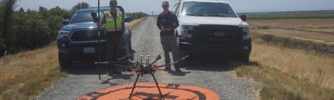
Dan Cassell, Field Support from Quantum Spatial an NV5 company, and Dylan Robbins, Unmanned Aircraft Systems (UAS) pilot from NV5, collaborated to complete orthophotography and lidar of a 6 mile canal/channel waterway off El Centro Blvd. in Sacramento, CA. This project was performed for a Quantum Spatial client to complete[...]
HOLLYWOOD, Aug. 05, 2020 (GLOBE NEWSWIRE) — NV5 Global, Inc. (Nasdaq: NVEE) (“NV5” or the “Company”), a provider of professional and technical engineering, geospatial, and consulting solutions, today reported financial results for the second quarter ended June 27, 2020. In the second quarter, Gross Revenues increased 27% and Gross Revenues,[...]
Sandra Storerhas over 26 years of experience in the environmental industry conducting building-related hazardous materials investigations, remediation oversight, and air monitoring, as well as proposal, specification, survey, and closeout report preparation. Sandy’s area of expertise is conducting asbestos and lead inspections and investigations of large facilities. For the past several[...]
Form #2 - Sends email containing the link to the PDF
"*" indicates required fields
eNewsletter - NV5 Real Estate Transaction Services
Contact NV5 Real Estate Transaction Services
Download NV5 2022 Compliance Calendar
Please fill out the form below. After successful form submission, you will be redirected to the requested file. Thank you.
"*" indicates required fields
Hyperspectral Imaging - Technically Speaking
Our internal innovation and development team constantly analyzes new technology and develops solutions to meet our client’s challenges. Our Technically Speaking series is one way we share our technical findings with the professional community.
Please tell us a little about yourself by filling out the form below, and we’ll share the document with you, thanks!
Accuracy Part 1- Technically Speaking
Our internal innovation and development team constantly analyzes new technology and develops solutions to meet our client’s challenges. Our Technically Speaking series is one way we share our technical findings with the professional community.
Please tell us a little about yourself by filling out the form below, and we’ll share the document with you, thanks!
Prune Optimization Webinar Recording
NV5 Geospatial releases a new predictive modeling platform for vegetation management that uses existing lidar and historical data to identify the relative level of asset risk from trees by quantifying the potential for causing asset damage.
Please tell us a little about yourself by filling out the form below, and we’ll share the document with you, thanks!
Topobathy Lidar - Technically Speaking
Our internal innovation and development team constantly analyzes new technology and develops solutions to meet our client’s challenges. Our Technically Speaking series is one way we share our technical findings with the professional community.
Please tell us a little about yourself by filling out the form below, and we’ll share the document with you, thanks!