HOLLYWOOD, FL, June 24, 2021 – NV5 Global, Inc. (the “Company” or “NV5”) (Nasdaq: NVEE), a provider of compliance, technology, and engineering solutions, announced today that it has been awarded three utility infrastructure contracts by a Western utility totaling approximately $9 million. NV5 will provide surveying, permitting, and technical services[...]
Hollywood, FL – June 21, 2021 – NV5 Global, Inc. (the “Company” or “NV5”) (Nasdaq: NVEE), a provider of compliance, technology, and engineering solutions, announced today that the City of Fresno, California has selected NV5 for a $6.3 million contract to provide program management services for the Veterans Boulevard Interchange[...]
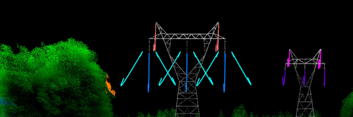
Electric utilities have been under intense scrutiny in recent years, plagued with questions about reliability because of expansive power outages and facing potential culpability for sparking damaging fires. Eric Merten, NV5 Geospatial’s vice president and general manager for commercial markets, details how geospatial data analysis is improving efficiency and efficacy[...]
The 2013 ASTM Standards for Phase 1 Environmental Site Assessments (ESA) are sunsetting and are currently under revision by the ASTM Committee. Proposed Changes to ASTM Standards for the Phase 1 Environmental Site Assessment The American Society for Testing and Material (ASTM) requires a revision every eight years that fosters[...]
Transaction parties are often looking at options to save due diligence costs or expedite the delivery of reports to get projects to closing. Regarding land surveys, assumptions may be made that the prior surveyor should be able to simply add another party to the certification or update an existing survey[...]
Tracy Cozzens, senior editor of Geospatial Solutions, writes about the women of NV5 Geospatial’s eGIS team, and the diverse work they do to support science and industry within a digital mapping context. Read the full article HERE. “Seeing so many women in GIS is not unusual for me because I[...]
Business Development Specialist Julie Woodman recently caught up with Acoustical Consultant Stalin Vera for this conversation about some of the ways acoustics supports architecture. Julie: As we come out of COVID, I am really looking forward to in-person visits with my local library system. How do acoustics come into play[...]
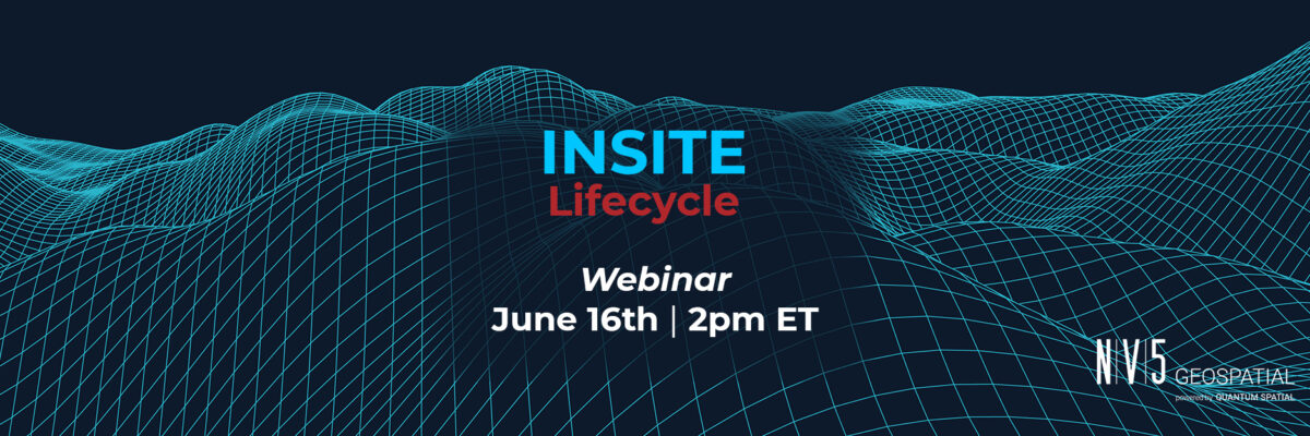
Register Here NV5 Geospatial’s INSITE LIFECYCLE combines project tracking with data quality assurance and control. Providing instant access to geospatial data allows for a collaborative QA/QC of imagery and lidar derivatives, letting you track progress in real-time and review and flag issues for more responsive reprocessing. LIFECYCLE app puts data[...]
Evon Silvia, solutions architect with NV5 Geospatial, is chair of the ASPRS LAS Working Group. Dedicated to the development and standardization of lidar data, Evon details the events of the latest meeting for Lidar Magazine; topics include the release of the Standard System Identifiers as well as updates to specification[...]
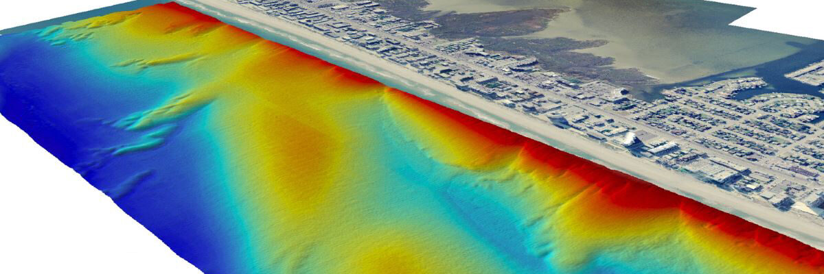
With the recent acquisition of Geodynamics LLC, NV5 Geospatial has built one of the most comprehensive suites of solutions for geospatial surveys of deep water and near-shore environments. The combination brings together complementary, advanced technologies – Geodynamics’ full-ocean depth sonar-based hydrographic and geophysical surveying with NV5 Geospatial’s topographic and bathymetric[...]
Form #2 - Sends email containing the link to the PDF
"*" indicates required fields
eNewsletter - NV5 Real Estate Transaction Services
Contact NV5 Real Estate Transaction Services
Download NV5 2022 Compliance Calendar
Please fill out the form below. After successful form submission, you will be redirected to the requested file. Thank you.
"*" indicates required fields
Hyperspectral Imaging - Technically Speaking
Our internal innovation and development team constantly analyzes new technology and develops solutions to meet our client’s challenges. Our Technically Speaking series is one way we share our technical findings with the professional community.
Please tell us a little about yourself by filling out the form below, and we’ll share the document with you, thanks!
Accuracy Part 1- Technically Speaking
Our internal innovation and development team constantly analyzes new technology and develops solutions to meet our client’s challenges. Our Technically Speaking series is one way we share our technical findings with the professional community.
Please tell us a little about yourself by filling out the form below, and we’ll share the document with you, thanks!
Prune Optimization Webinar Recording
NV5 Geospatial releases a new predictive modeling platform for vegetation management that uses existing lidar and historical data to identify the relative level of asset risk from trees by quantifying the potential for causing asset damage.
Please tell us a little about yourself by filling out the form below, and we’ll share the document with you, thanks!
Topobathy Lidar - Technically Speaking
Our internal innovation and development team constantly analyzes new technology and develops solutions to meet our client’s challenges. Our Technically Speaking series is one way we share our technical findings with the professional community.
Please tell us a little about yourself by filling out the form below, and we’ll share the document with you, thanks!