HOLLYWOOD, Fla., May 17, 2021 (GLOBE NEWSWIRE) — NV5 Global, Inc. (the “Company” or “NV5”) (Nasdaq: NVEE), a provider of compliance, technology, and engineering consulting solutions, announced today that it has acquired PES Environmental, Inc. (“PES Environmental”), an environmental engineering and consulting company providing environmental site assessment, water resources and[...]
HOLLYWOOD, Fla., May 12, 2021 (GLOBE NEWSWIRE) — NV5 Global, Inc. (Nasdaq: NVEE) (“NV5” or the “Company”), a leading provider of compliance, technology, and engineering consulting solutions, today reported financial results for the first quarter ended April 3, 2021. “We are pleased with our first quarter performance, which generated $48[...]
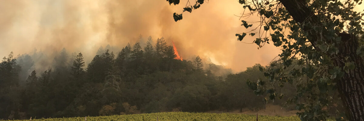
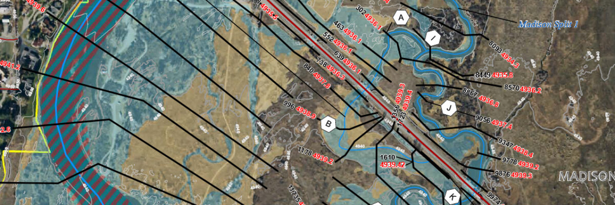
Wild fires once again threaten the west coast this season as they have each summer in recent memory. Kass Green, reporting in Lidar Magazine, details how San Francisco Bay Area land managers and stewards are turning to geospatial mapping and analysis to guide decision-making and mitigate risk. Read
Hollywood, FL – May 10, 2021 – NV5 Global, Inc. (the “Company” or “NV5”) (Nasdaq: NVEE), a provider of compliance, technology, and engineering solutions, announced today that it has been awarded a $7 million liquefied natural gas (LNG) loading system project by a major Southeast utility. The new truck loading[...]
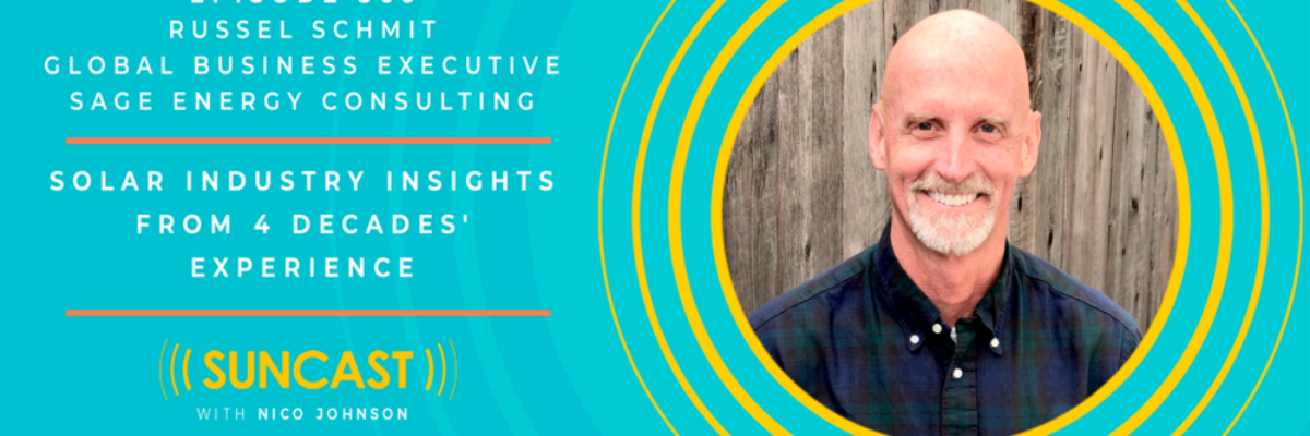
Today’s guest is Russell Schmit, a successful executive with extensive experience in energy‑related manufacturing, service, and consulting companies ranging from start‑ups to Fortune 100 corporations. At Sage Energy Consulting, he leads the growth initiatives for the company, works on selected projects that leverage his specialized experience, and guides internal operations[...]
https://www.youtube.com/watch?v=-uK4fObNyWs&authuser=0 In honor of Arbor Day, we’re sharing Dr. Andrew Brenner’s presentation on remote sensing data applications and analysis for forestry and tree sciences. For more information about what we do, visit our Forestry Page or Contact Us.
Hollywood, FL – April 26, 2021 – NV5 Global, Inc. (the “Company” or “NV5”) (Nasdaq: NVEE), a provider of compliance, technology, and engineering solutions, announced today that it has been awarded a $50 million term agreement with the New York City Department of Design and Construction (NYCDDC) to provide resident[...]
Dive into our latest Technically Speaking article to understand the intricacies of geospatial accuracy and considerations to achieve reliable, quality lidar data. This is the follow up to the previous Technically Speaking article about data accuracy. Access pdfs: Geospatial Accuracy Part II Geospatial Accuracy Part I Read
Form #2 - Sends email containing the link to the PDF
"*" indicates required fields
eNewsletter - NV5 Real Estate Transaction Services
Contact NV5 Real Estate Transaction Services
Download NV5 2022 Compliance Calendar
Please fill out the form below. After successful form submission, you will be redirected to the requested file. Thank you.
"*" indicates required fields
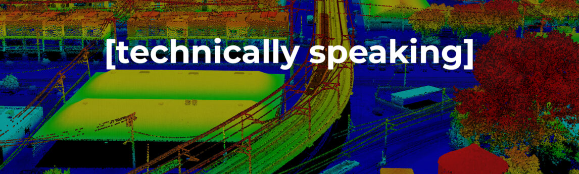
Hyperspectral Imaging - Technically Speaking
Our internal innovation and development team constantly analyzes new technology and develops solutions to meet our client’s challenges. Our Technically Speaking series is one way we share our technical findings with the professional community.
Please tell us a little about yourself by filling out the form below, and we’ll share the document with you, thanks!
Accuracy Part 1- Technically Speaking
Our internal innovation and development team constantly analyzes new technology and develops solutions to meet our client’s challenges. Our Technically Speaking series is one way we share our technical findings with the professional community.
Please tell us a little about yourself by filling out the form below, and we’ll share the document with you, thanks!
Prune Optimization Webinar Recording
NV5 Geospatial releases a new predictive modeling platform for vegetation management that uses existing lidar and historical data to identify the relative level of asset risk from trees by quantifying the potential for causing asset damage.
Please tell us a little about yourself by filling out the form below, and we’ll share the document with you, thanks!
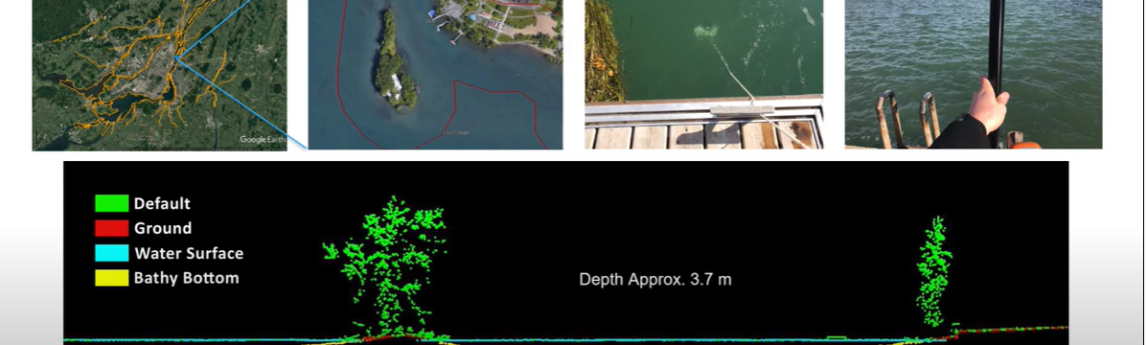
Topobathy Lidar - Technically Speaking
Our internal innovation and development team constantly analyzes new technology and develops solutions to meet our client’s challenges. Our Technically Speaking series is one way we share our technical findings with the professional community.
Please tell us a little about yourself by filling out the form below, and we’ll share the document with you, thanks!