Quantum Spatial, Inc., the nation’s largest independent geospatial data firm will have a booth at next week’s Utility Analytics Conference in Atlanta, GA. Be sure to stop by booth # 22 to learn more about our latest solutions for geospatial and remote sensing derived analytics that enhance utility operations and[...]
HOLLYWOOD, FL — (Marketwired) — 10/26/16 — JBA is a leading MEP engineering, acoustics, technology, and fire protection consulting firm Acquisition expected to be immediately accretive Provides preliminary third quarter 2016 results Revises Full Year 2016 Guidance Bank of America Senior Credit Facility expected to provide up to $140 million[...]
Quantum Spatial has developed a robust solution to assess suitability for siting transmission lines. We combine first-rate mapping intelligence with custom analytics and community engagement to determine optimal corridors for transmission routing. Our model accounts for engineering factors, existing assets, and the surrounding built and natural environments, and it’s vetted[...]
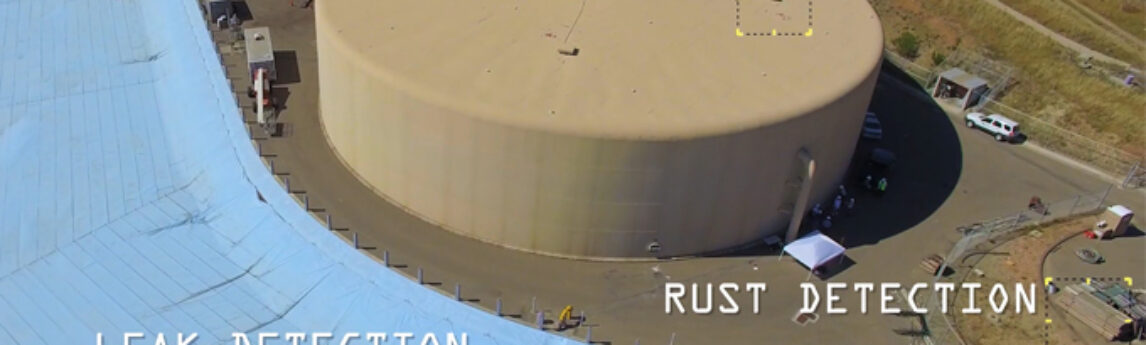
Quantum Spatial scientists have created a drone-mounted, custom sensor package that has the ability to detect underground leaks as well as other safety concerns such as rust/corrosion detection and infrastructure integrity. The sensor package combines conventional video/photography with hyperspecral (non-visible light) imaging and thermal sensing, which allows us to see[...]
To commemorate National GIS Day, Ms. Caroline Coholan’s 3rd grade class, from Llewellyn Elementary School, visited the Portland office for some hands-on experience in geography. The class of 30 students learned about aerial photography, bare-earth elevation models, and contour mapping by participating in interactive sessions where they constructed terrain models,[...]
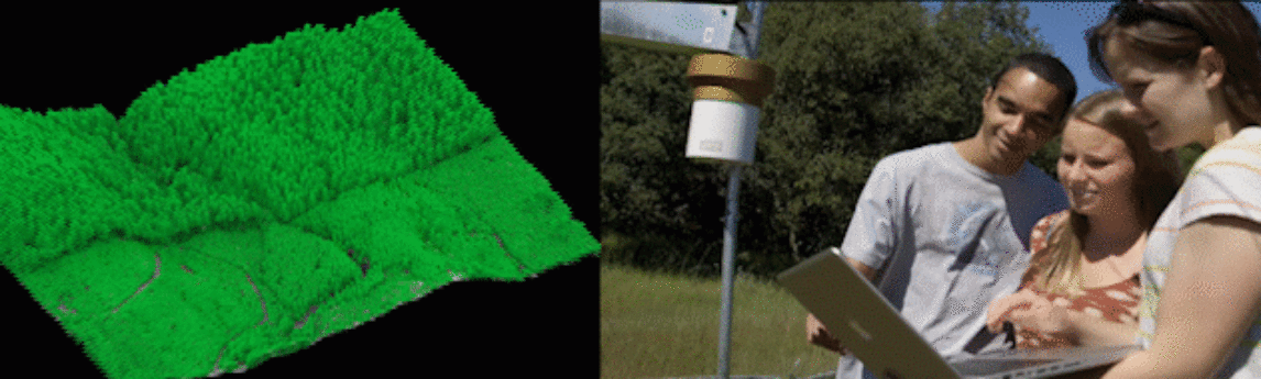
Professional scientists and students at Sonoma State University are implementing LiDAR data and other geospatial analytics to aid research and education in their environmental program. Check out the video to learn how mapping technology and their Nature!Tech initiative provides new possibilities for scientific discovery. Go to Nature!Tech
Quantum Spatial, Inc., the nation’s largest independent geospatial data firm, today announced the appointment of Drew Meren to lead the Atlantic region, focusing on state and local government clients. “Drew is a welcome addition to the Quantum Spatial team,” said Bob Vander Meer, vice president of Business Development for Quantum[...]
HOLLYWOOD, FL — (Marketwired) — 10/07/16 — NV5 Global, Inc. (the “Company” or “NV5”) (NASDAQ: NVEE), a provider of professional and technical engineering and consulting solutions, will announce its financial results for the third quarter ended September 30, 2016 on Thursday, November 3, 2016, following the close of the markets.[...]
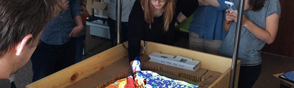
Well, if you can’t make it to the beach, bring the beach to the office. Quantum Spatial’s Willy Sercombe and Harry Zhang did just that. They teamed up to create an interactive sandbox that displays elevation and contour lines that change as the sand is moved around. The program also[...]
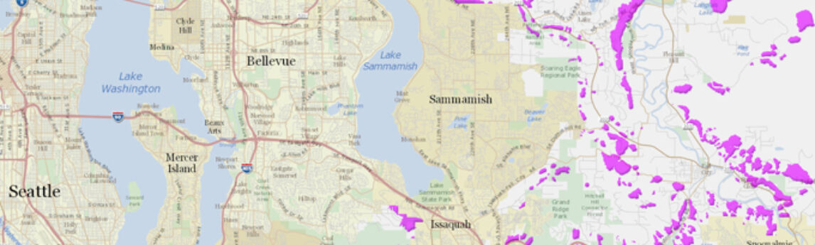
In response to the deadly Oso Landslide of 2014, government agencies have been working diligently to update landslide hazard analysis. Because LiDAR data can map terrain beneath vegetation and tree canopy, it is ideal for revealing potential hazard. King County has released a new landslide hazard map that utilizes the[...]
Form #2 - Sends email containing the link to the PDF
"*" indicates required fields
eNewsletter - NV5 Real Estate Transaction Services
Contact NV5 Real Estate Transaction Services
Download NV5 2022 Compliance Calendar
Please fill out the form below. After successful form submission, you will be redirected to the requested file. Thank you.
"*" indicates required fields
Hyperspectral Imaging - Technically Speaking
Our internal innovation and development team constantly analyzes new technology and develops solutions to meet our client’s challenges. Our Technically Speaking series is one way we share our technical findings with the professional community.
Please tell us a little about yourself by filling out the form below, and we’ll share the document with you, thanks!
Accuracy Part 1- Technically Speaking
Our internal innovation and development team constantly analyzes new technology and develops solutions to meet our client’s challenges. Our Technically Speaking series is one way we share our technical findings with the professional community.
Please tell us a little about yourself by filling out the form below, and we’ll share the document with you, thanks!
Prune Optimization Webinar Recording
NV5 Geospatial releases a new predictive modeling platform for vegetation management that uses existing lidar and historical data to identify the relative level of asset risk from trees by quantifying the potential for causing asset damage.
Please tell us a little about yourself by filling out the form below, and we’ll share the document with you, thanks!
Topobathy Lidar - Technically Speaking
Our internal innovation and development team constantly analyzes new technology and develops solutions to meet our client’s challenges. Our Technically Speaking series is one way we share our technical findings with the professional community.
Please tell us a little about yourself by filling out the form below, and we’ll share the document with you, thanks!