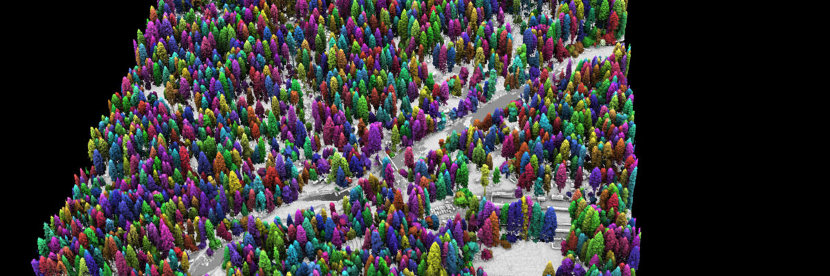
Success in Yosemite is driving the wider use of lidar surveys to support forest health and wildfire resilience, study wildlife habitats, and monitor water resources. In the latest issue of Eos, Van R. Kane and Liz Van Wagtendonk of University of Washington’s Forest Resilience Laboratory, and Andrew Brenner at NV5[...]
NV5 Geospatial and Geodynamics LLC, an NV5 company, experts Kurt Allen, Sloan Freeman, and Rudi Rudolph, hit The American Shoreline Podcast airwaves on Coastal News Today to share the latest technology and solutions for mapping the nearshore. Catch The Episode Here
Tim Saultz brings with him more than three decades of experience managing strategic programs at scale with the USGS Hollywood, Florida – 04/05/2022 – NV5 Geospatial, one of North America’s most comprehensive providers of geospatial solutions, today announced the appointment of Tim Saultz as Senior Program Manager-Government Markets. With over[...]
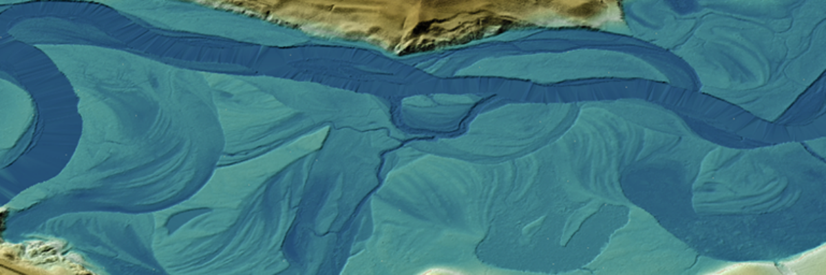
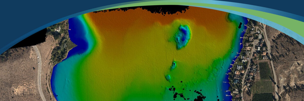
Sven Cowan, NV5 Geospatial’s Canada Program Manager, details the recent topobathy lidar project of Okanagan Basin, British Columbia, Canada in the latest issue of GoGeomatics In order to better understand the potential flood risks, and to establish new policies for flood construction levels, the Okanagan Basin Water Board (OBWB) hired[...]
Today we are happy to share that the NV5 family has received four 2021 Business Achievement Awards from Environmental Business Journal (EBJ) and Climate Change Business Journal (CCBJ). Each year EBJ and CCBJ solicit recommendations from the environmental industry community and the climate industry community for nominations for the annual[...]
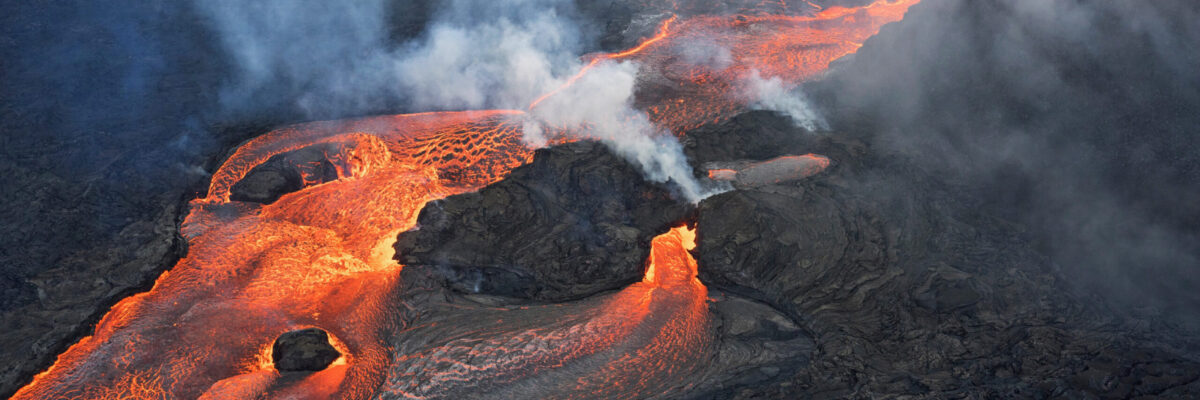
NV5 Geospatial and partner GEO1 win two awards at the 15th Annual MAPPS Awards for their lidar and image acquisition of erupting Kilauea Volcano NV5 Geospatial, North America’s most comprehensive geospatial data firm, and their partner GEO1 today announced that they won in two categories, Data Acquisition and Processing and[...]
Lidar Magazine’s Managing Editor, Stewart Walker, discusses the current and future state of lidar technology and innovation strategy with a handful of NV5 Geospatial’s technical experts and remote sensing scientists. Read the in-depth article on Lidar Magazine.
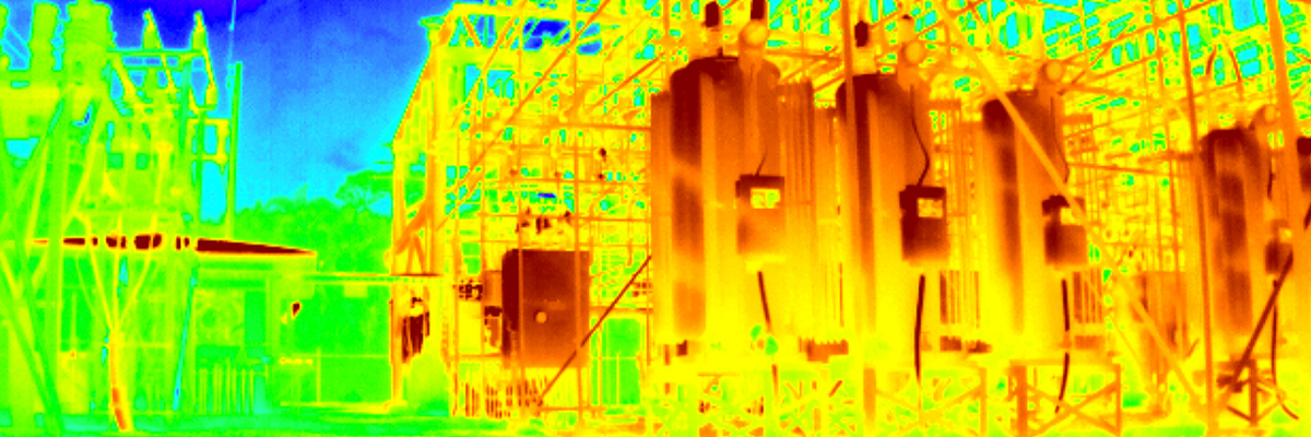
Register Webinar: The Future of Substation Inspection Feb 17th | 1 pm ET / 10am PT Explore the unlimited potential of remotely operated ground vehicles with InDro Robotics and NV5 Geospatial. As the experts on critical infrastructure inspection robotics and substation analytics respectively, we’ll disclose our first-hand findings about inspection[...]
Form #2 - Sends email containing the link to the PDF
"*" indicates required fields
eNewsletter - NV5 Real Estate Transaction Services
Contact NV5 Real Estate Transaction Services
Download NV5 2022 Compliance Calendar
Please fill out the form below. After successful form submission, you will be redirected to the requested file. Thank you.
"*" indicates required fields
Hyperspectral Imaging - Technically Speaking
Our internal innovation and development team constantly analyzes new technology and develops solutions to meet our client’s challenges. Our Technically Speaking series is one way we share our technical findings with the professional community.
Please tell us a little about yourself by filling out the form below, and we’ll share the document with you, thanks!
Accuracy Part 1- Technically Speaking
Our internal innovation and development team constantly analyzes new technology and develops solutions to meet our client’s challenges. Our Technically Speaking series is one way we share our technical findings with the professional community.
Please tell us a little about yourself by filling out the form below, and we’ll share the document with you, thanks!
Prune Optimization Webinar Recording
NV5 Geospatial releases a new predictive modeling platform for vegetation management that uses existing lidar and historical data to identify the relative level of asset risk from trees by quantifying the potential for causing asset damage.
Please tell us a little about yourself by filling out the form below, and we’ll share the document with you, thanks!
Topobathy Lidar - Technically Speaking
Our internal innovation and development team constantly analyzes new technology and develops solutions to meet our client’s challenges. Our Technically Speaking series is one way we share our technical findings with the professional community.
Please tell us a little about yourself by filling out the form below, and we’ll share the document with you, thanks!