Register Here NV5 Geospatial’s INSITE LIFECYCLE combines project tracking with data quality assurance and control. Providing instant access to geospatial data allows for a collaborative QA/QC of imagery and lidar derivatives, letting you track progress in real-time and review and flag issues for more responsive reprocessing. LIFECYCLE app puts data[...]
Utilities: Optional Table A Item 11 Revised Once Again When the 2021 ALTA/NSPS Land Title Survey Minimum Standard Detail Requirements went into effect on February 23, 2021, the definition of Optional Table A Item 11 was once again revised and simplified to manage client expectations. It is important to note[...]
Delivering Solutions, Improving Lives May 2021 Meeting Regulations During a Dry Year Garth Engelhorn, Senior Project Manager, recently discussed water regulations during a dry year vs. a wet year and how businesses and municipalities can comply with those regulations on Storm Water Solutions‘ “Dropping By” video series. Read More Lisa Kay[...]
By Mabelle Wongsanguan In California, governmental agencies designated as a Certified Unified Program Agency (CUPA) are authorized to apply statewide standards to each facility within its jurisdiction that treats on site or generates hazardous waste, stores hazardous materials, or operates underground storage tanks. These facilities are considered regulated businesses and[...]
By: Karl Jerome Bacho, CPP Per Section 7321 of the National Defense Authorization Act (NDAA), the EPA’s annual Toxics Release Inventory (TRI) Program has added certain per- and polyfluoroalkyl substances (PFAS) to the Reporting Year (RY) 2020 list of chemicals covered by the TRI under the Emergency Planning and Community[...]
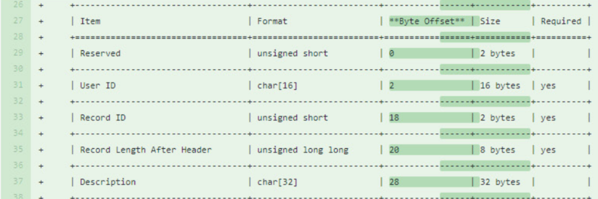
Evon Silvia, solutions architect with NV5 Geospatial, is chair of the ASPRS LAS Working Group. Dedicated to the development and standardization of lidar data, Evon details the events of the latest meeting for Lidar Magazine; topics include the release of the Standard System Identifiers as well as updates to specification[...]
The Los Angeles Unified School District (LAUSD) underwent the largest public works project in recent history comprised of a massive expansion and renovation of its facilities. NV5 was privileged to be part of this historic event, focused on providing safe and comfortable environments to the students and staff of the[...]
In late 2017, the new Wilshire Grand Center opened in Financial District of Downtown Los Angeles. The 73-story skyscraper features a 900-room hotel, restaurants, retail, and holds the record as the tallest building west of the Mississippi. Before this $1 billion dollar mega structure could break ground, the original Wilshire[...]
NV5 holds an As-Needed Environmental Assessment and Remediation Contract with Los Angeles County under which NV5 has completed numerous projects related to site assessment, hazards wastes, and remediation. Most recently, the Men’s Central Jail site assessment projects were awarded to NV5 under this contract. The County plans to demolish the[...]
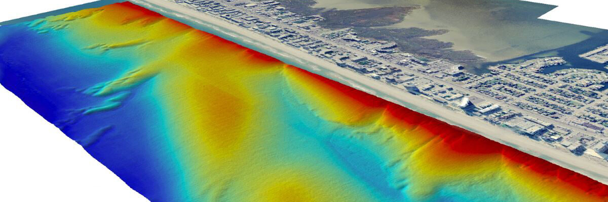
With the recent acquisition of Geodynamics LLC, NV5 Geospatial has built one of the most comprehensive suites of solutions for geospatial surveys of deep water and near-shore environments. The combination brings together complementary, advanced technologies – Geodynamics’ full-ocean depth sonar-based hydrographic and geophysical surveying with NV5 Geospatial’s topographic and bathymetric[...]
Form #2 - Sends email containing the link to the PDF
"*" indicates required fields
eNewsletter - NV5 Real Estate Transaction Services
Contact NV5 Real Estate Transaction Services
Download NV5 2022 Compliance Calendar
Please fill out the form below. After successful form submission, you will be redirected to the requested file. Thank you.
"*" indicates required fields
Hyperspectral Imaging - Technically Speaking
Our internal innovation and development team constantly analyzes new technology and develops solutions to meet our client’s challenges. Our Technically Speaking series is one way we share our technical findings with the professional community.
Please tell us a little about yourself by filling out the form below, and we’ll share the document with you, thanks!
Accuracy Part 1- Technically Speaking
Our internal innovation and development team constantly analyzes new technology and develops solutions to meet our client’s challenges. Our Technically Speaking series is one way we share our technical findings with the professional community.
Please tell us a little about yourself by filling out the form below, and we’ll share the document with you, thanks!
Prune Optimization Webinar Recording
NV5 Geospatial releases a new predictive modeling platform for vegetation management that uses existing lidar and historical data to identify the relative level of asset risk from trees by quantifying the potential for causing asset damage.
Please tell us a little about yourself by filling out the form below, and we’ll share the document with you, thanks!
Topobathy Lidar - Technically Speaking
Our internal innovation and development team constantly analyzes new technology and develops solutions to meet our client’s challenges. Our Technically Speaking series is one way we share our technical findings with the professional community.
Please tell us a little about yourself by filling out the form below, and we’ll share the document with you, thanks!