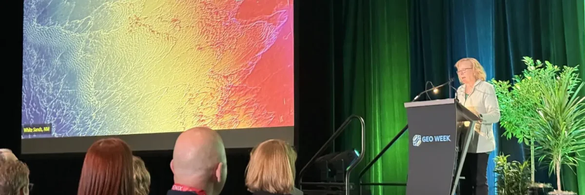
Vicki Lukas was with the USGS for over three decades and helped to shape the 3D Elevation Program (3DEP). Now part of NV5, Vicki continues to advance the next generation of national mapping.[...]
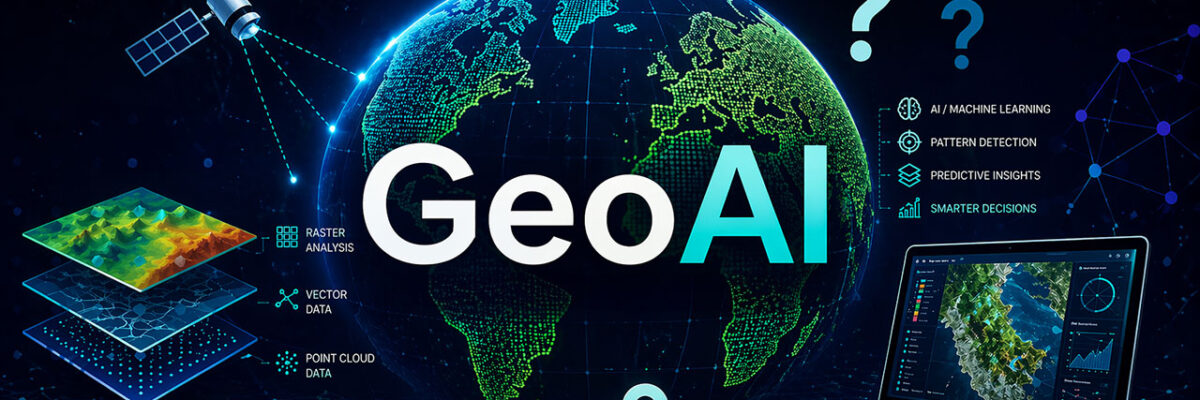
These days, you can’t talk about geospatial data without including AI—but GeoAI isn’t one-size-fits-all. Every organization faces unique challenges, constraints, and opportunities when it comes to adopting AI.[...]
At NV5, we are proud to support and celebrate colleagues who step forward to serve the civil engineering profession at the highest levels. As the ASCE election approaches, we’re excited to recognize two NV5 leaders who are candidates for national and regional ASCE offices: Rossana G. D’Antonio, PE, GE, F.ASCE[...]
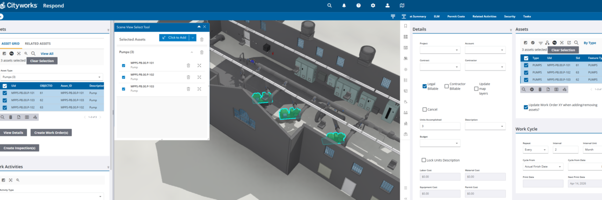
Municipal utilities have no shortage of data. What they often lack is connection. Across facilities, asset information lives in multiple systems such as 3D models, GIS platforms, and work order management tools, each capturing a different piece of the operational picture. But when those systems don’t communicate, even routine maintenance[...]
GoGeomatics published a new article that explores how AI-powered geospatial analysis is transforming the way organizations turn data into decisions. Titled, “From Imagery to Insight"[...]
Modern Defense & Intelligence situational awareness hinges on the ability to turn the constant influx of information into timely, actionable understanding. But as volumes grow and threats accelerate,[...]
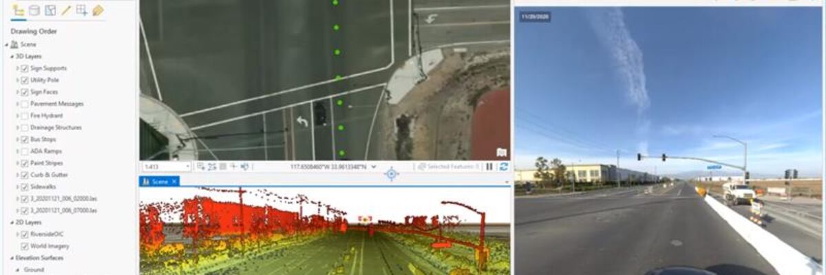
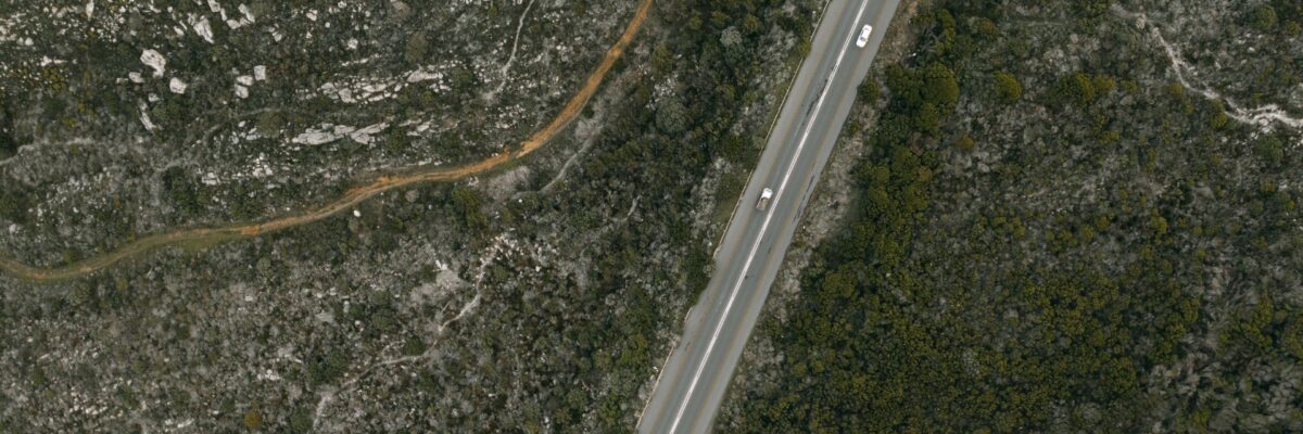
Transportation agencies have collected large-scale infrastructure data for years. Yet many DOTs are still stuck in a familiar pattern: they invest heavily in collection, receive massive datasets, and then struggle to turn that data into action. What has changed is the enabling environment. Widespread mobile lidar adoption, lower cloud storage[...]
Local governments have been using Geographic Information Systems (GIS) in some capacity for decades now, making it easier to collect, manage, and share large sets of spatial data. But the real opportunity isn’t just managing data more efficiently. It’s making the data more usable. Public data should not sit in[...]
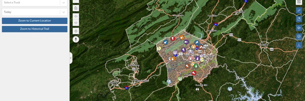
Expert NV5 Speakers to Present on Bathymetric Lidar, Airborne Mapping, Remote Sensing Innovation, Photogrammetry, ASPRS Standards, and the Future of Geospatial Intelligence Roanoke County, VA, in collaboration with NV5, is pioneering a data-driven approach to waste management by integrating real-time tracking, predictive analytics, and sensor-based monitoring into trash collection operations.[...]
By Julie Fischer, INCE, LEED AP BD+C When designing spaces that prioritize acoustic comfort, whether hospitals, schools, or office buildings, sound isolation is often a top concern. Although, one critical factor frequently overlooked is the stud gauge used in wall partitions. It’s not just a structural detail; it’s an acoustic[...]
Form #2 - Sends email containing the link to the PDF
"*" indicates required fields
eNewsletter - NV5 Real Estate Transaction Services
Contact NV5 Real Estate Transaction Services
Download NV5 2022 Compliance Calendar
Please fill out the form below. After successful form submission, you will be redirected to the requested file. Thank you.
"*" indicates required fields
Hyperspectral Imaging - Technically Speaking
Our internal innovation and development team constantly analyzes new technology and develops solutions to meet our client’s challenges. Our Technically Speaking series is one way we share our technical findings with the professional community.
Please tell us a little about yourself by filling out the form below, and we’ll share the document with you, thanks!
Accuracy Part 1- Technically Speaking
Our internal innovation and development team constantly analyzes new technology and develops solutions to meet our client’s challenges. Our Technically Speaking series is one way we share our technical findings with the professional community.
Please tell us a little about yourself by filling out the form below, and we’ll share the document with you, thanks!
Prune Optimization Webinar Recording
NV5 Geospatial releases a new predictive modeling platform for vegetation management that uses existing lidar and historical data to identify the relative level of asset risk from trees by quantifying the potential for causing asset damage.
Please tell us a little about yourself by filling out the form below, and we’ll share the document with you, thanks!
Topobathy Lidar - Technically Speaking
Our internal innovation and development team constantly analyzes new technology and develops solutions to meet our client’s challenges. Our Technically Speaking series is one way we share our technical findings with the professional community.
Please tell us a little about yourself by filling out the form below, and we’ll share the document with you, thanks!