
Municipal utilities have no shortage of data. What they often lack is connection. Across facilities, asset information lives in multiple systems such as 3D models, GIS platforms, and work order management tools, each capturing a different piece of the operational picture. But when those systems don’t communicate, even routine maintenance becomes inefficient. A supervisor planning inspection may know the assets exist, but still spend hours locating them, verifying details, and recreating context across platforms. What should take minutes becomes a fragmented, labor-intensive process.
At the same time, many utilities are entering a critical phase in their infrastructure lifecycle. Facilities built 30 to 40 years ago are now at a point where preventive maintenance can significantly extend equipment life by decades, improve reliability, and reduce the cost of emergency repairs. But that only works if teams can access the right information at the right time.
The problem is not a lack of technology. It is the absence of integration.
One Core Problem
NV5 partnered with a municipality at a pivotal stage in its infrastructure lifecycle, facing a common industry challenge – disconnected systems and limited visibility into asset data.
The city manages approximately 780 miles of water infrastructure and treats around 15 million gallons daily. Much of its asset information was still tracked through spreadsheets, paperwork orders, and institutional knowledge stored in employees’ heads. At more than 30 years old, the system had reached a stage where preventive maintenance could deliver significant value, but only if supported by better data and workflows.
The goal was not just integration. It was transformation: creating a unified operational environment where asset data, spatial context, and maintenance workflows function together.
The Integration Challenge
The challenge wasn’t a lack of capability, but rather how to connect systems that were never designed to work together. Reality capture provides a high-fidelity 3D digital twin of facilities, capturing real-world conditions in fine detail. BIM platforms transform that data into intelligent 3D models with structured asset information. GIS systems manage spatial relationships across the broader network. Work order systems track maintenance activities, inspections, and asset lifecycles.
Each platform excels within its domain, but they operate in isolation, using different data models, coordinate systems, asset identifiers, and workflows. Bringing them together required more than technical integration. It required aligning how data is structured, named, and used across workflows.
NV5’s Integrated Approach
To address this challenge, NV5 developed a structured workflow that connects these systems for a single operating framework.
The result is a fully connected operational environment already in use today.
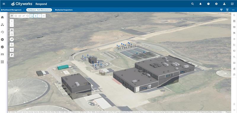
Reality Capture as the Foundation
The process begins with high accuracy lidar and 3D laser scanning of facilities. This creates a detailed representation of real-world conditions, ensuring that all downstream systems are built on a reliable foundation. Accuracy at this stage is critical, with sub-centimeter precision ensuring that assets are correctly located and represented across all platforms.
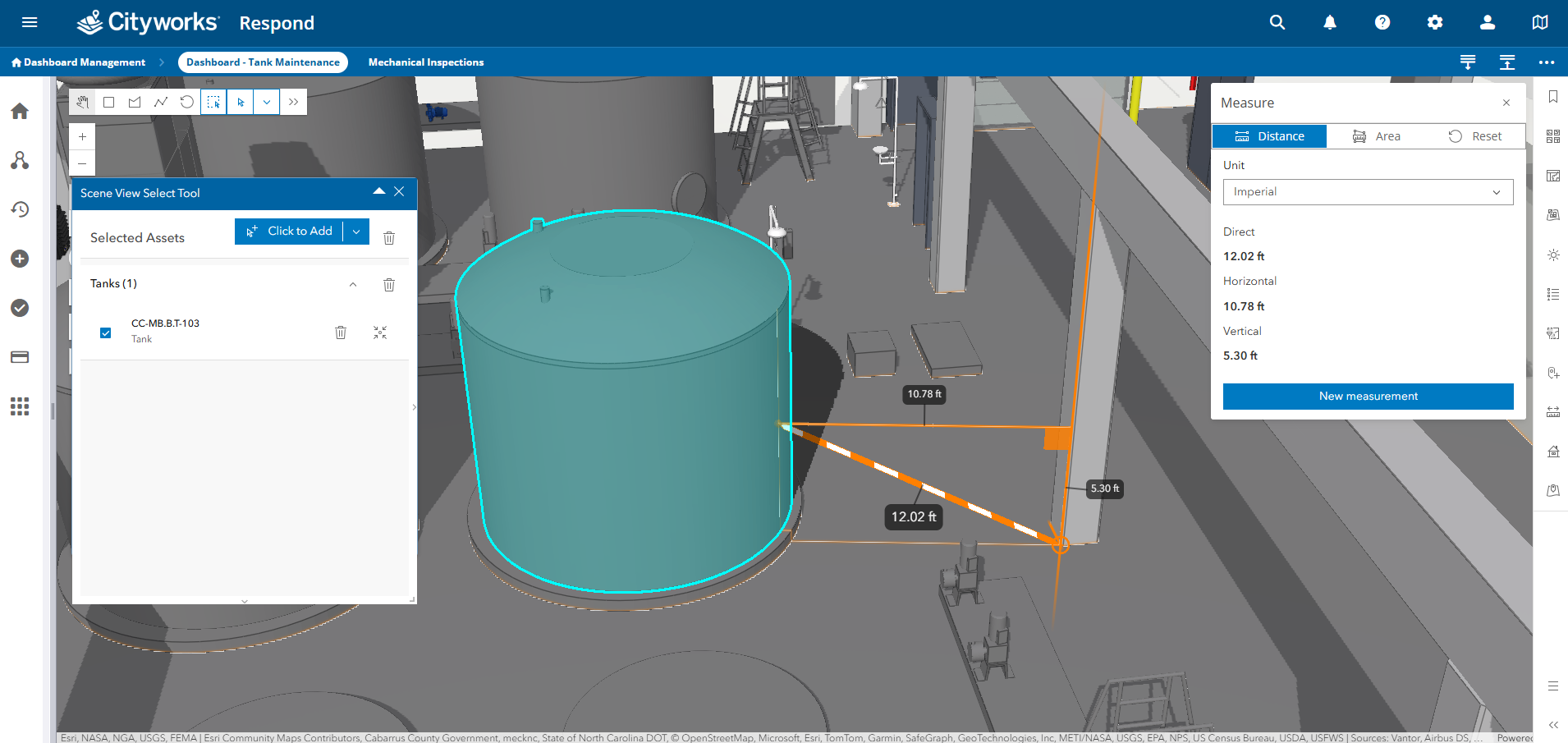
BIM Modeling with Structured Asset Data
Point clouds are transformed into intelligent 3D models using Autodesk Revit, following COBie standards. Each asset, (e.g. pumps, valves, filters, and mechanical systems) is modeled with structured attributes, including:
- Manufacturer and model
- Installation date
- Specifications and expected service life
A standardized naming convention is established at this stage, creating a consistent asset identifier that carries across all systems.
GIS Integration and Data Transformation
To bridge BIM and GIS, NV5 implemented a repeatable data transformation workflow using FME. This approach translates BIM elements into GIS feature classes while preserving attributes and 3D geometry. A JSON-based schema mapping process ensures that asset data remains consistent and usable across platforms. The result is a GIS environment that not only represents network relationships but also incorporates detailed facility-level asset data.
System Integration and Workflow Connectivity
Through API integrations, NV5 connected GIS and asset management system can reference 3D assets, while updates made during maintenance activities can be reflected into GIS and BIM environments. This creates a bi-directional system, where data remains aligned across the entire workflow.
Enabling New Workflows: Multi-Asset Selection in 3D
One of the most impactful innovations was the development of a custom 3D selection tool. Traditionally, work orders must be created one asset at a time, especially in 3D environments where multi-selection is limited or unavailable.
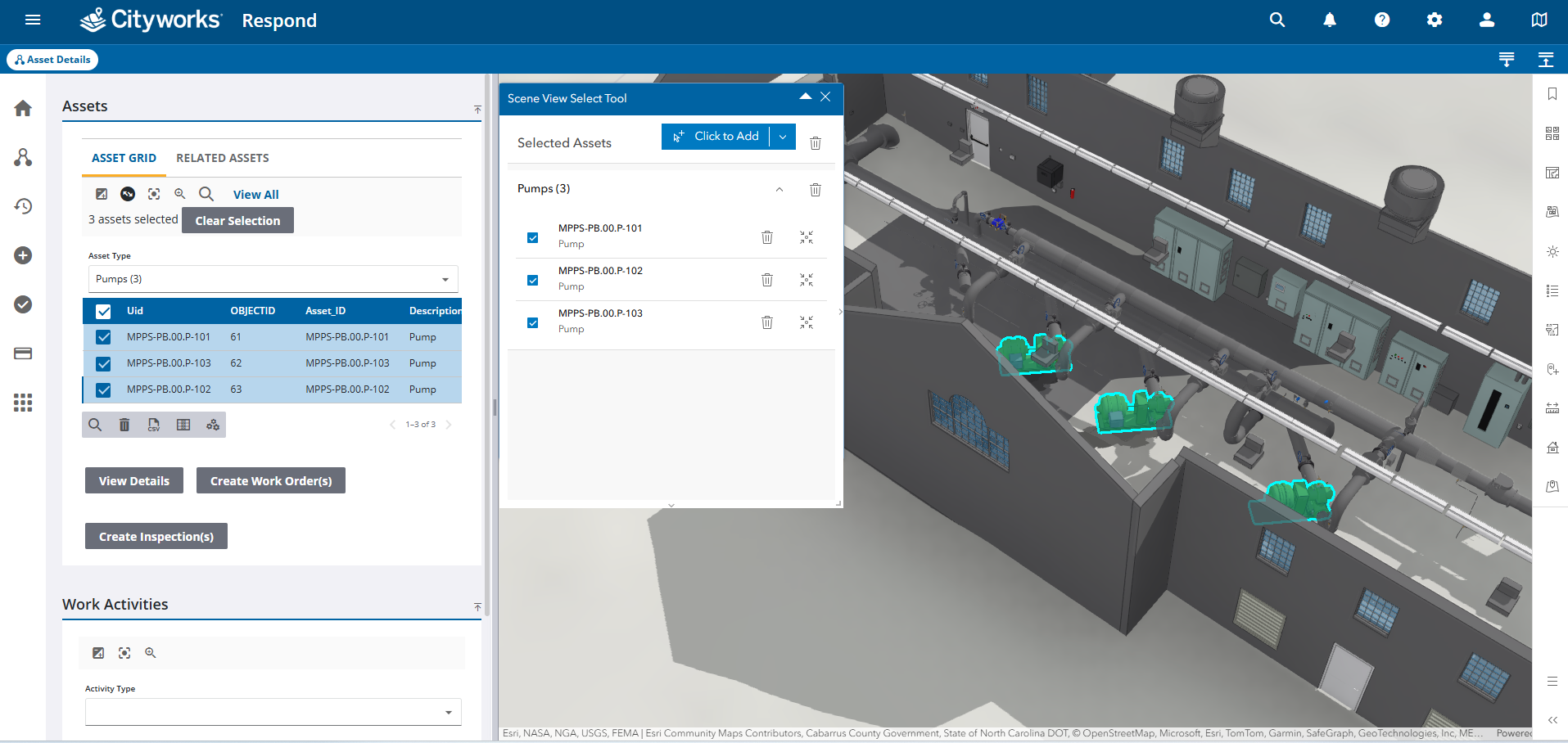
NV5’s solution enables users to:
- Select multiple assets directly within a 3D Asset Management system
- Capture assets across different areas of facilities
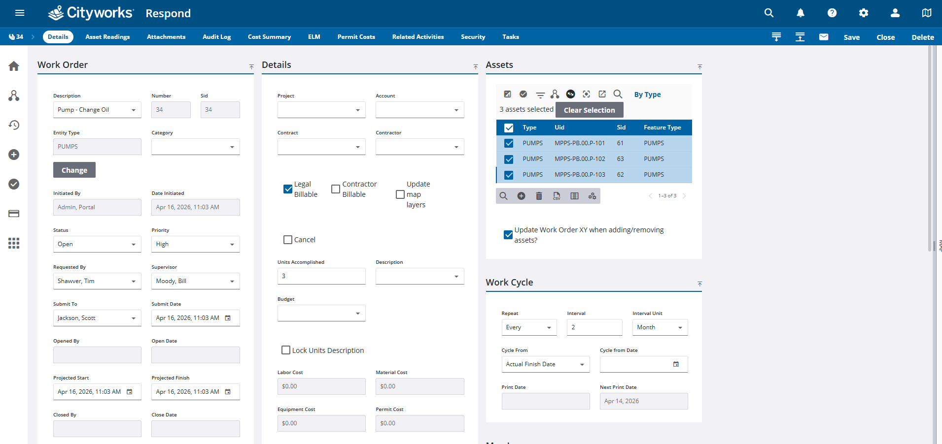
- Create consolidated work order in a single workflow
For example, a maintenance supervisor can select multiple pumps across a facility and generate a single preventative maintenance work order, rather than creating individual entries for each asset. This capability transforms maintenance planning from a fragmented task into a streamlined process. In practice, the difference looks like this:
From Pilot to Scaled Implementation
This approach demonstrates how utilities can move from limited or manual systems to fully integrated environments.
The implementation is being applied across an entire facilities portfolio to support long-term asset management, with the goal of eliminating spreadsheet-based tracking within a few months. This represents a fundamental operational shift, especially for an organization that had no formal digital asset foundation just six months ago.
Success at this level depended on treating data governance as a first-class deliverable from the outset, proactively addressing challenges like BIM-GIS alignment, consistent asset naming, and conflict-free data updates through careful planning and early-stage schema coordination.
Operational Impact
Early results and pilot workflows point to significant operational improvements:
- Reduced time for maintenance planning and site visit preparation
- Faster asset identification and validation
- Improved onboarding through visual facility context
- More efficient multi-asset work order creation
- Better alignment between asset data and maintenance workflows
Beyond efficiency gains, the deeper value lies in enabling proactive maintenance strategies, extending asset life, improving reliability, and reducing long-term costs.
Why It Matters
Utilities today are under increasing pressure to maintain aging infrastructure while managing limited resources and rising expectations. Disconnected systems introduce friction at every stage, slowing decisions, increasing risk, and limiting the effectiveness of maintenance programs. Integration changes that dynamic. By connecting reality capture, BIM, GIS, and asset management systems, utilities gain a clearer, more usable view of their infrastructure and a more practical way to manage it.
Quantifying the Value of Integration
While each utility environment is different, pilot results and workflow analysis from this implementation points to meaningful, measurable returns when systems are fully integrated.
Key areas of impact include:
- Site visit planning: Reduced from hours to minutes through access to accurate 3D facility context
- Asset location and validation: Instant visibility eliminates time spent searching across systems
- Work order creation: Multi-asset workflows replace one-by-one entry, significantly reducing administrative overhead
- Training and onboarding: Interactive 3D environments reduce reliance on institutional knowledge and accelerate ramp-up time
Beyond these measurable efficiencies, the largest long-term value comes from prevented failures and extended asset life. For utilities operating in the 30 to 40-year infrastructure window, improved maintenance workflows can:
- Extend equipment service life by years
- Reduce emergency repair frequency and costs
- Improve water quality by proactively managing aging assets
- Defer capital replacement through better lifecycle management
These benefits compound over time, shifting utilities from reactive operations to more predictive cost-controlled asset management.
Building What’s Next
As these implementations expand, the opportunity extends across additional facilities and infrastructure types, including wastewater, stormwater, and energy systems. The approach is also becoming more repeatable. What initially required months of coordination is now being streamlined into more efficient deployments. The foundation is in place for a more connected model of infrastructure management, that supports better decisions, stronger asset performance, and long-term operational resilience.
If your organization is looking to improve asset visibility, streamline maintenance workflows, or build a foundation for predictive asset management, NV5 can help. Contact our team to learn how integrated geospatial and asset management solutions can support your operational goals.
NV5’s integrated geospatial and asset management practice works with municipal utilities at every stage of digital maturity — from initial digital transformation to advancing established platforms. Whether your priority is connecting existing systems, building a new asset management foundation, or scaling proven workflows across your portfolio, our team can help you define the right path forward.