Over the past three decades, thermal infrared technology has spread into a wide range of industries with varied applications including: monitoring river temperatures to promote habitat health, geothermal energy exploration, and bridge deck inspection for early deterioration detection. NV5’s Chris Miwa and Mousa Diabat discuss the technology and applications of[...]
May 25, 2022 HOLLYWOOD, Fla., May 25, 2022 (GLOBE NEWSWIRE) — NV5 Global, Inc. (the “Company” or “NV5”) (Nasdaq: NVEE), a provider of technology, conformity assessment, and consulting solutions, announced today that it will host an Investor Day on Thursday, May 26, 2022 at 10:00 am Central Time. NV5’s 2022[...]
FOR IMMEDIATE RELEASE May 24, 2022 Standout field includes Korn Ferry Tour players with strong area ties GLENVIEW, Ill. – The road to the PGA TOUR runs through the Chicago suburbs this week, as the best players on the Korn Ferry Tour visit The Glen Club for the 2022 NV5[...]
HOLLYWOOD, Fla., May 24, 2022 (GLOBE NEWSWIRE) — NV5 Global, Inc. (the “Company” or “NV5”) (Nasdaq: NVEE), a provider of technology, conformity assessment, and consulting solutions, announced today that it has been awarded $8 million in recent contracts to provide geospatial data acquisition and data analytics services to support infrastructure,[...]
May 05, 2022 HOLLYWOOD, Fla., May 05, 2022 (GLOBE NEWSWIRE) — NV5 Global, Inc. (Nasdaq: NVEE) (“NV5” or the “Company”), a provider of technology, conformity assessment, and consulting solutions, today reported financial results for the first quarter ended April 2, 2022. “NV5 delivered a record first quarter, generating double-digit growth[...]
Hollywood, FL – May 2, 2022 – NV5 Global, Inc. (the “Company” or “NV5”) (Nasdaq: NVEE), a provider of compliance, technology, engineering, and environmental consulting solutions, announced today that it has selected the 2022 NV5 National Society of Black Engineers (NSBE) scholarship award winners. The ten scholarship awards for 2022[...]
As we continue to integrate into the NV5 family of companies, we are pleased to announce the coming launch of our new service line name, NV5 Real Estate Transaction Services. The commitment to quality products and customer service will remain unchanged, but the new name will assist us in moving[...]
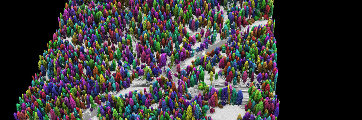
Success in Yosemite is driving the wider use of lidar surveys to support forest health and wildfire resilience, study wildlife habitats, and monitor water resources. In the latest issue of Eos, Van R. Kane and Liz Van Wagtendonk of University of Washington’s Forest Resilience Laboratory, and Andrew Brenner at NV5[...]
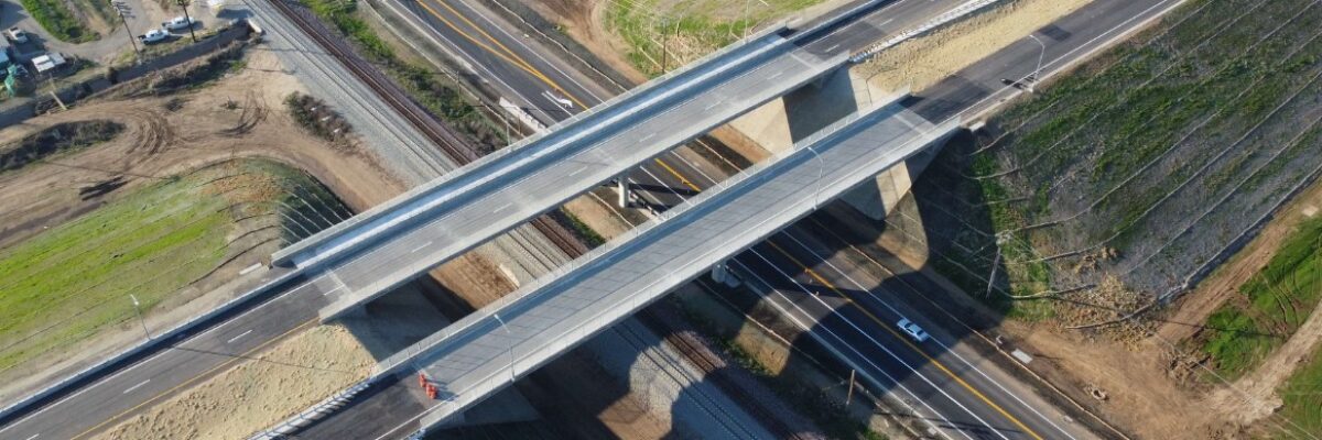
HOLLYWOOD, Fla., April 19, 2022 (GLOBE NEWSWIRE) — NV5 Global, Inc. (the “Company” or “NV5”) (Nasdaq: NVEE), a provider of compliance, technology, engineering, and environmental consulting solutions, announced today that it has been awarded a contract amendment by the California Department of Transportation (Caltrans) to expand NV5’s existing on-call construction[...]
Form #2 - Sends email containing the link to the PDF
"*" indicates required fields
eNewsletter - NV5 Real Estate Transaction Services
Contact NV5 Real Estate Transaction Services
Download NV5 2022 Compliance Calendar
Please fill out the form below. After successful form submission, you will be redirected to the requested file. Thank you.
"*" indicates required fields
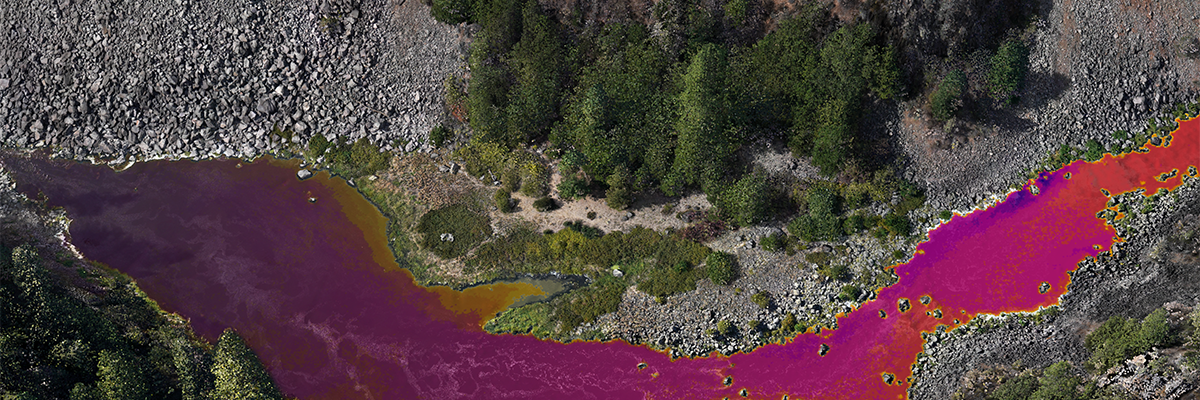
Hyperspectral Imaging - Technically Speaking
Our internal innovation and development team constantly analyzes new technology and develops solutions to meet our client’s challenges. Our Technically Speaking series is one way we share our technical findings with the professional community.
Please tell us a little about yourself by filling out the form below, and we’ll share the document with you, thanks!
Accuracy Part 1- Technically Speaking
Our internal innovation and development team constantly analyzes new technology and develops solutions to meet our client’s challenges. Our Technically Speaking series is one way we share our technical findings with the professional community.
Please tell us a little about yourself by filling out the form below, and we’ll share the document with you, thanks!
Prune Optimization Webinar Recording
NV5 Geospatial releases a new predictive modeling platform for vegetation management that uses existing lidar and historical data to identify the relative level of asset risk from trees by quantifying the potential for causing asset damage.
Please tell us a little about yourself by filling out the form below, and we’ll share the document with you, thanks!
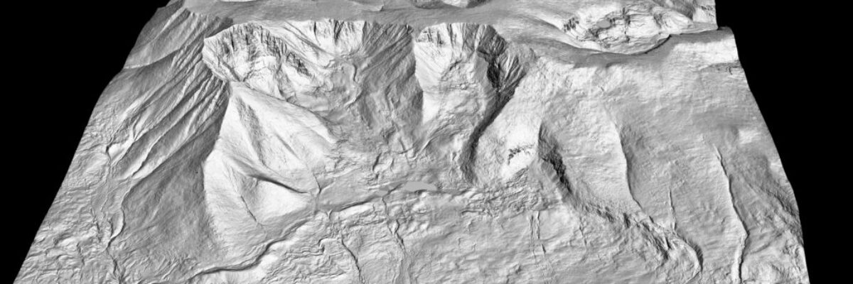
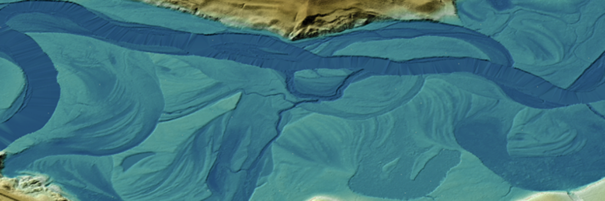
Topobathy Lidar - Technically Speaking
Our internal innovation and development team constantly analyzes new technology and develops solutions to meet our client’s challenges. Our Technically Speaking series is one way we share our technical findings with the professional community.
Please tell us a little about yourself by filling out the form below, and we’ll share the document with you, thanks!