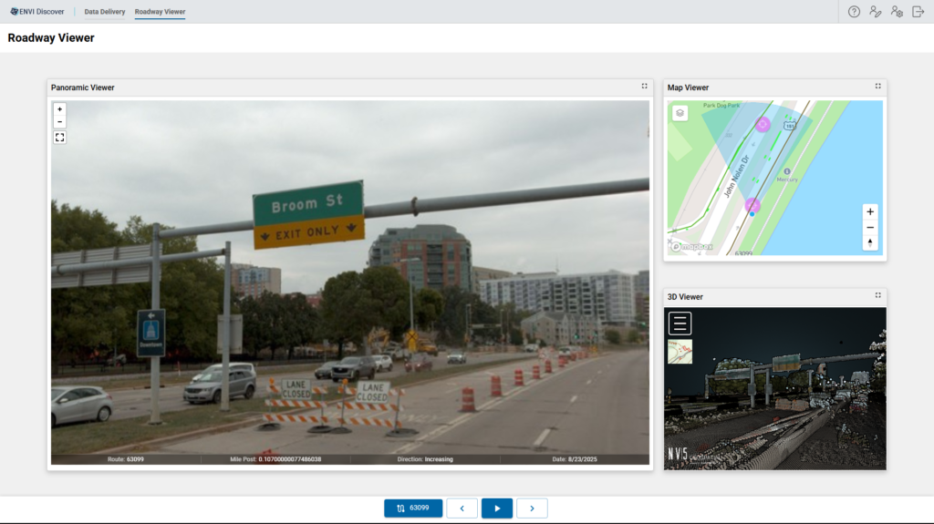
Transportation agencies have collected large-scale infrastructure data for years. Yet many DOTs are still stuck in a familiar pattern: they invest heavily in collection, receive massive datasets, and then struggle to turn that data into action.
What has changed is the enabling environment. Widespread mobile lidar adoption, lower cloud storage costs, increased network bandwidth, and more mature visualization and analysis tools have made enterprise-scale programs more practical than ever. AI is now written into many agency goals and strategic plans, and new vendors are promising faster capture and automated extraction power by AI.
But that acceleration has not eliminated the core challenge. The real risk is not the sensor choice, or the file format. It is spending millions to create a “lake” of information, then realizing the organization is not ready to ingest it, validate it, align it to business systems, and use it to drive direction.
A more mature strategy is emerging, and it can be framed simply: Acquire > Analyze > Answer. Acquisition starts the process, but the value is realized further upstream with the implementation of digital delivery, asset lifecycle management, and decision making.
Acquire: The baseline that makes everything else possible
Mobile mapping hardware is now ubiquitous, and automation is often over-promised, but data collection is a means, not an end. The real risk of the ‘commodity’ approach is the lack of a repeatable, authoritative baseline. Some acquisition models emphasize low unit rates tied to subscriptions or data-leasing structures. While these approaches may reduce upfront costs, they can limit how data is reused, integrated, or reprocessed over time.
Without ownership and geospatial rigor at the point of capture, downstream analytics and AI-driven workflows lose reliability. For DOTs, this isn’t just a technical glitch; it’s an operational one that affects safety reporting, and long-term fiscal stewardship.
High-fidelity acquisition is not about chasing specifications. It is about establishing a complete, decision-ready baseline that supports the full transportation ecosystem. With a single high-accuracy mobilization, agencies can break down traditional program silos and capture the complete corridor, not as isolated datasets, but as an integrated geospatial foundation. This means simultaneously supporting multiple programmatic needs, such as linear and point asset inventories, bridge and overheard sign clearance measurements, ADA compliance assessments, and safety requirements.
Instead of launching separate efforts for engineering, maintenance, and safety teams, a unified acquisition strategy delivers a shared, authoritative dataset that serves them all. The foundation changes the nature of future collections. Agencies will always re-collect as assets evolve, and conditions change. But when the baseline is complete and aligned, subsequent efforts become strategic refreshes that build on existing intelligence, not corrective work to fill gaps that were missed the first time. The result is not just imagery or point clouds. It is a durable digital asset that enables coordinated planning, defensible reporting, and long-term lifecycle management.
Acquire with the end use in mind. Collection is a means to an outcome.
Analyze: When Data Becomes Decision Ready
For agencies and their leadership teams, analysis is where the real work begins. A dataset can be accurate and still unusable. For example, a statewide sign inventory delivered in a generic coordinate system, disconnected from an agency’s linear referencing system, can be “good data’ that still cannot be operationalized.
Decision-ready data is different. It’s aligned to the customer’s environment, formatted for ingestion, and tied to the systems that will use it. It supports quality control workflows and business rules.
Many agencies underestimate this stage. Acquisition feels like the heavy lift. Then the data arrives and they realize the organization is not prepared to consume it.
A simple discipline helps: begin with the end in mind. Before acquiring a network wide inventory, you should be able to answer:
- What decisions will this inventory support?
- How will we maintain it over time?
- How will it connect to work orders, inspections, and compliance requirements?
- What systems will ingest it, and what formats do those systems require?
Analysis is where insight becomes implementation, aligning data, designing schemas, integrating systems, and structuring data as digital delivery. This is how geospatial collection becomes consumable with a common data environment.
Answer: Moving from Inventory to Active Asset Management
The “answer” stage is where data drives outcomes. A DOT does not ultimately want a picture of every asset; instead, it wants to understand condition, verify compliance, schedule inspections, and budget for replacement. That requires connecting geospatial assets to tasks, work orders, and lifecycle records. It requires seeing work spatially, not as a tabular list.
This is where asset lifecycle management (ALM) becomes central. When agencies assign and track work against geospatial assets, prioritization improves; patterns become visible, and resources are allocated with precision.
This is also where digital twin conversations mature. The strongest 3D models are not visualizations; they are decision environments used to test scenarios, measure impact, and justify investment.
The AI Reality Check and the GeoAgent™ Opportunity
Most agencies now have AI goals, though many are still figuring out what that means in day-to-day operations. AI does not fix fragmented systems, reconcile inconsistent data standards, or workflows that depend on manual interpretation. AI cannot see what it cannot access. When data lives in unconnected silos, AI cannot interpret relationships or extract full value. It amplifies the limitations of the environment it is given.
AI readiness requires more than ambition. It requires structured digital delivery and a connected data environment. That preparation does not require perfection. Few agencies begin with a unified architecture, and they do not need to. Mostly already possess valuable infrastructure data. It may live in multiple systems and may require alignment. But it is usable, even if it is unrealized.
This is where NV5’s GeoAgent changes the conversation. GeoAgent does not replace your systems; it sits on top of them. It connects to GIS platforms, imagery repositories, analytics tools, asset databases, and operational tools, translating user intent into executed workflows. Instead of manually stitching together outcomes, GeoAgent orchestrates the process, triggering analysis, pulling data, and delivering structured, decision-ready results.
Because we developed GeoAgent, we understand the data foundation it requires. We have already solved the alignment, integration, and schema challenges agencies face. Once that groundwork is in place, AI moves from experiment to execution. GeoAgent becomes a force multiplier, reducing friction and shortening the path from question to outcome.
The opportunity isn’t simply using AI. It’s enabling AI to do real operational work securely, within your architecture, and aligned to your mission.
That is the GeoAgent opportunity.
A Better Question for Every Agency
The industry is moving past “How much data can we collect?” toward a more strategic question: “What are we going to do with the data once it arrives?”
Agencies that answer that question early extract more value for every mile acquired. They reduce corrective re-recollection, lower long-term risk, and shorten the distance between insight and action. And they position themselves to adopt AI with confidence because they have built the operational and data foundation AI depends on.
But that foundation does not build itself. It requires a partner who understands the full lifecycle, from acquisition strategy to structured analytics, from system integration to operational execution.
NV5 brings together high-fidelity acquisition, advanced analytics, system integration, and platforms like GeoAgent that operationalize intelligence within your existing system.
The result is not just better data. It is a connected ecosystem where insight flows directly into asset management, digital delivery, and defensible decision making. That’s how transportation teams turn infrastructure data into infrastructure advantage and why the right partner matters as much as the technology itself.
The shift from information to intelligence is underway, and agencies that act early will realize the greatest operational advantage. If you’re attending GIS‑T, we invite you to continue the conversation in person. NV5 will be onsite at Booth 213, where Tim Caya and Mark Congdon will be available to discuss how to build a durable digital foundation that supports long-term delivery and AI readiness.
We are also presenting GIS-T:
Agentic Systems in Transportation Planning: Bridging Spatial Data, Automation, and Conversation presented by Chancee Vincent, NV5
This session explores how agentic systems, powered by large language models and geospatial automation, are bridging the gap between decision‑makers and technical workflows. It examines where these systems excel, where they require structured data foundations, and how they are reshaping transportation planning and infrastructure management.
For a deeper conversation before or during the event, connect with:
Tim Caya
Director of Transportation
Mark Congdon
Director of Asset Management