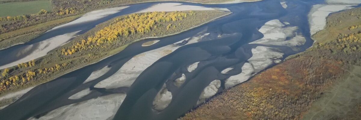
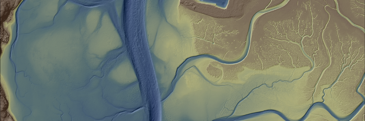
New Projects in British Columbia and Saskatchewan to Assist Agencies with Floodplain Mapping Analysis and Sustainable Water Management NV5 Geospatial, North America’s largest geospatial data firm, is building on it’s success in the Canadian market with the awards of hydrospatial projects in 2021 in British Columbia and Saskatchewan. “Topobathymetric lidar[...]
Our consultants and designers have a decidedly personal stake in much of the work they do. Here are five of their stories. Stalin Vera, Acoustical Consultant: It’s one thing to help design a healthcare facility for someone else, but when it’s your own child being treated, it becomes super-personal. Our[...]
Diane Donaghey, NV5’s Director of Business Development, sits down with Patrick O’Brien about his ongoing experience as an intern in NV5’s Hadley office. Patrick began his internship in June of 2021 and will continue part time through the fall and winter while completing his senior year at the University of[...]
A NOAA-supported analysis of California’s Morro Bay estuary found links between seagrass collapse and later erosion that will inform bay-area adaptation strategies and could influence global seagrass conservation strategies. NV5 Geospatial provided a full update of elevation data for Morro Bay from an integration of topobathymetric lidar and sonar technologies.[...]
What Are They, and Why Do I Care? I Have a Pandemic to Deal With! — by Scott Ondik PE, CPP, RCDD and Randy Riley PSP Security Consultants Scott Ondik and Randy Riley discuss higher education campus vulnerability and threat assessments, addressing what areas of vulnerability are critiqued during the[...]
— by Joseph Bocchiaro III, Ph.D., CStd, CTS-D, CTS-I, ISF-C To prepare for the “near future” in academia, building technology experts recommend the following upgrades to campus assets. Health and Physical Safety The foremost topic in post-COVID discussions is protecting the health and safety of everyone on the campus. Beyond[...]
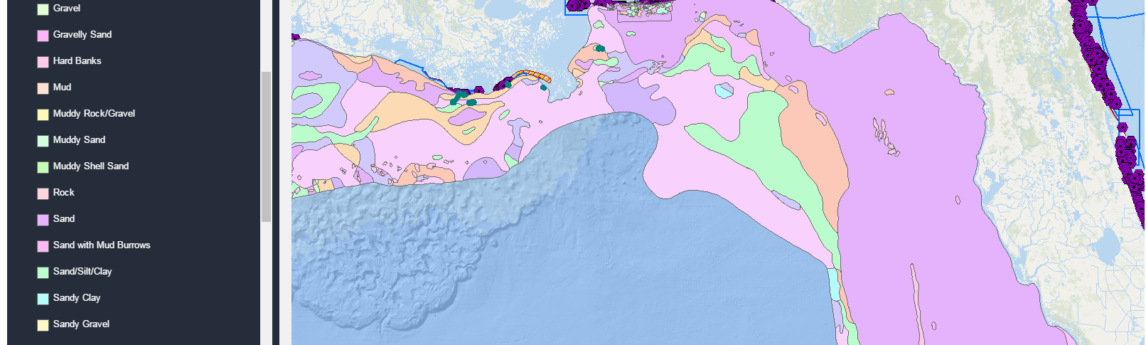
Alexa Ramirez, eGIS Project Manager for NV5 Geospatial, describes how custom eGIS applications are improving accessibility to geospatial data in an effort to improve coastal management outcomes and further scientific understanding. Access the article on page 18 of the latest issue of GPS World.
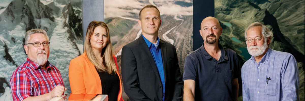
Michael B. Shillenn,CP, ASPRS senior account manager for NV5 Geospatial has been elected to serve on the board of MAPPS, the preeminent national association of private sector firms in the geospatial profession. His appointment to a two-year term was announced during the MAPPS Summer 2021 Conference, held in Asheville, N.C.[...]
The NV5 Geospatial Anchorage office focuses on conducting environmentally responsible and sustainable projects across Alaska that help us adapt to a changing landscape and climate Read the full article on Alaska Business HERE. “We can tell you where and by how much your pipeline infrastructure is shifting due to changes[...]
— By Principal Consultant Mark Gillis CTS-D After years of traveling the country — and world — with Ringling Bros. Barnum and Bailey’s Circus, and then as a technology consultant with The Sextant Group (now NV5), Mark Gillis returns to Arizona to lead the Phoenix office as Principal Consultant. Architects[...]
Form #2 - Sends email containing the link to the PDF
"*" indicates required fields
eNewsletter - NV5 Real Estate Transaction Services
Contact NV5 Real Estate Transaction Services
Download NV5 2022 Compliance Calendar
Please fill out the form below. After successful form submission, you will be redirected to the requested file. Thank you.
"*" indicates required fields
Hyperspectral Imaging - Technically Speaking
Our internal innovation and development team constantly analyzes new technology and develops solutions to meet our client’s challenges. Our Technically Speaking series is one way we share our technical findings with the professional community.
Please tell us a little about yourself by filling out the form below, and we’ll share the document with you, thanks!
Accuracy Part 1- Technically Speaking
Our internal innovation and development team constantly analyzes new technology and develops solutions to meet our client’s challenges. Our Technically Speaking series is one way we share our technical findings with the professional community.
Please tell us a little about yourself by filling out the form below, and we’ll share the document with you, thanks!
Prune Optimization Webinar Recording
NV5 Geospatial releases a new predictive modeling platform for vegetation management that uses existing lidar and historical data to identify the relative level of asset risk from trees by quantifying the potential for causing asset damage.
Please tell us a little about yourself by filling out the form below, and we’ll share the document with you, thanks!
Topobathy Lidar - Technically Speaking
Our internal innovation and development team constantly analyzes new technology and develops solutions to meet our client’s challenges. Our Technically Speaking series is one way we share our technical findings with the professional community.
Please tell us a little about yourself by filling out the form below, and we’ll share the document with you, thanks!