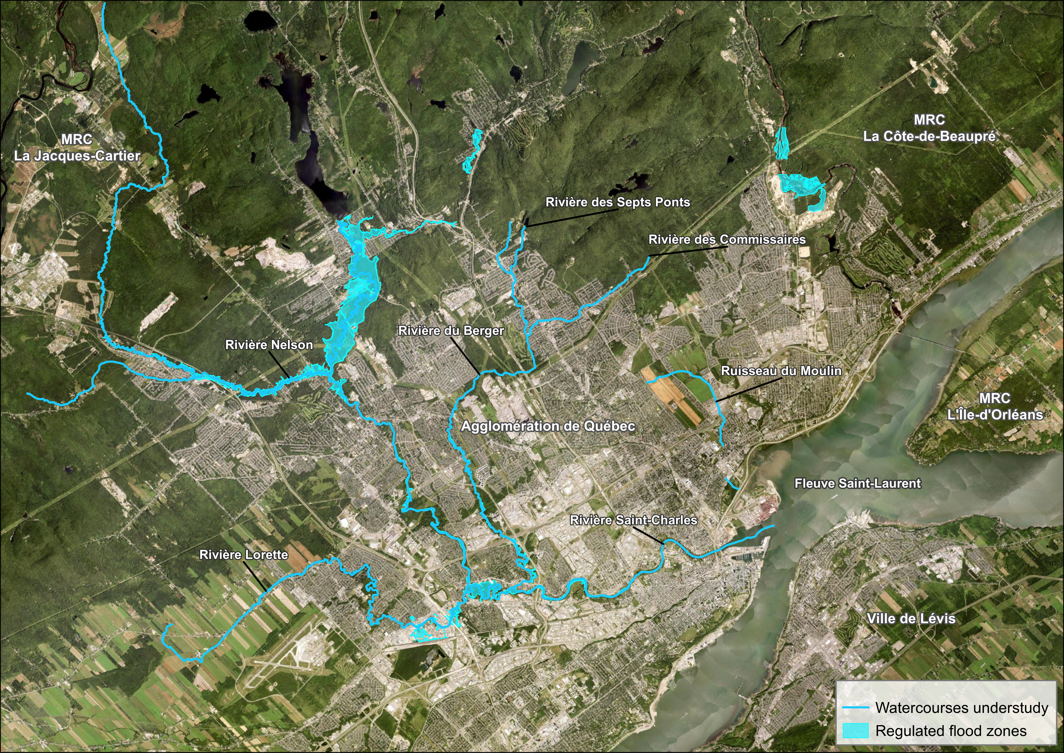
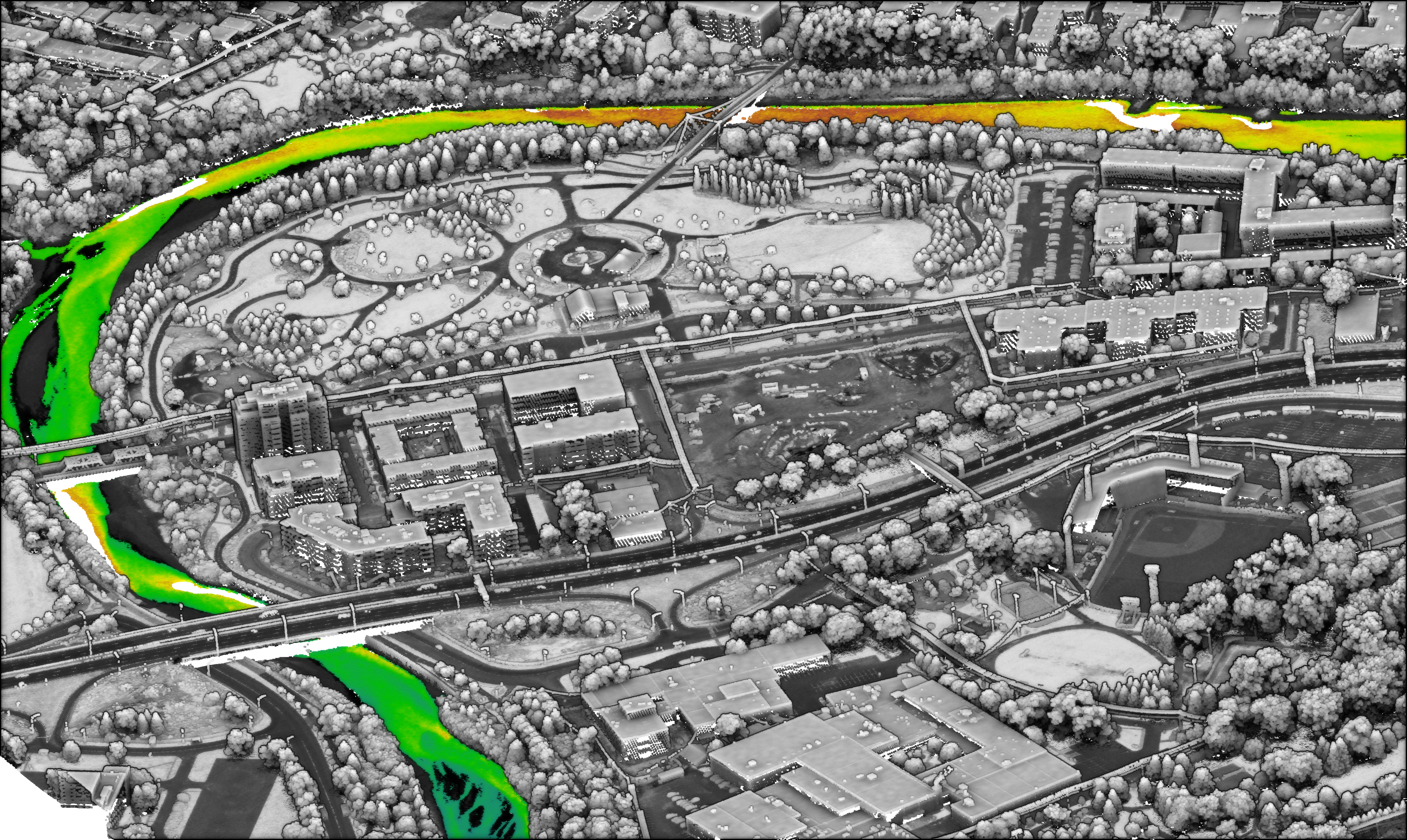
CMQuébec contracted NV5 to collect the topobathymetric Lidar data during leaf-on conditions for an area of interest containing eight rivers surrounding Québec City. The community and NV5 worked together collaboratively in order to prepare an effective flight plan. CMQuébec drew on the experience from its previous topobathymetric Lidar survey, as well as its intimate local knowledge of the watercourses and weather patterns, to provide valuable recommendations to NV5’s survey team. CMQuébec also took responsibility for pre-flight ground surveys, doing everything possible to set the project on the right course.
The completed topobathymetric Lidar survey represents an important first step, as the result will be the first complete bathymetric digital model in Québec City. CMQuébec expects the model to provide the foundation for further research and planning, particularly for hydraulic modeling. Over the long term, this information will lead to a safer and more prosperous Québec City — one that’s prepared for the next 500 years along its web of watercourses.
“NV5 stayed for a long time in Québec City, which meant we didn’t have to rush into doing the survey. This helped to maximize the data. And of course, it was nice to be able to see the results in real time. This was essential, because we could then be part of the decision on when and where to refly if necessary. NV5 allowed us to be more involved in the process, and that was really important for the end result.”
Sven, a frequent contributor of GoGeomatics Canada, lives in Vancouver, and he has over 20 years of experience in customer-facing positions within the geospatial information industry and has worked for multiple geospatial remote sensing organizations in various Account Management, Technical Services, and Customer Experience roles. His current focus includes regional strategy, business development, relationship management, and brand awareness.
Form #2 - Sends email containing the link to the PDF
"*" indicates required fields
eNewsletter - NV5 Real Estate Transaction Services
Contact NV5 Real Estate Transaction Services
Download NV5 2022 Compliance Calendar
Please fill out the form below. After successful form submission, you will be redirected to the requested file. Thank you.
"*" indicates required fields
Hyperspectral Imaging - Technically Speaking
Our internal innovation and development team constantly analyzes new technology and develops solutions to meet our client’s challenges. Our Technically Speaking series is one way we share our technical findings with the professional community.
Please tell us a little about yourself by filling out the form below, and we’ll share the document with you, thanks!
Accuracy Part 1- Technically Speaking
Our internal innovation and development team constantly analyzes new technology and develops solutions to meet our client’s challenges. Our Technically Speaking series is one way we share our technical findings with the professional community.
Please tell us a little about yourself by filling out the form below, and we’ll share the document with you, thanks!
Prune Optimization Webinar Recording
NV5 Geospatial releases a new predictive modeling platform for vegetation management that uses existing lidar and historical data to identify the relative level of asset risk from trees by quantifying the potential for causing asset damage.
Please tell us a little about yourself by filling out the form below, and we’ll share the document with you, thanks!
Topobathy Lidar - Technically Speaking
Our internal innovation and development team constantly analyzes new technology and develops solutions to meet our client’s challenges. Our Technically Speaking series is one way we share our technical findings with the professional community.
Please tell us a little about yourself by filling out the form below, and we’ll share the document with you, thanks!