
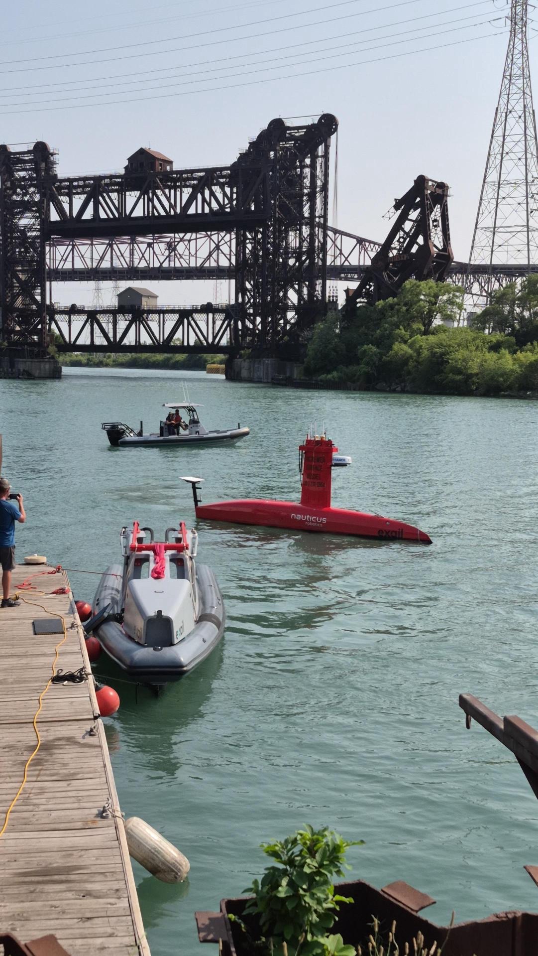
What lies beneath Lake Michigan just off the Chicago shoreline? This August, NV5 helped the Illinois State Geological Survey (ISGS) get a better look, not from a traditional survey vessel, but using DriX H-8, an eight-meter uncrewed surface vessel designed specifically for marine data collection. The project is part of an ongoing effort to better understand the geology of the shallow nearshore region of southwestern Lake Michigan. Working with ISGS and in support of research funded in part by NOAA, NV5 used DriX to collect sub-bottom profiling data that will help researchers map what lies beneath the lakebed.
The work supports several objectives: assessing regional sand resources, improving maps of bedrock topography, resolving layers beneath lake sediments, and identifying ancient drainage networks formed during periods of lower lake levels. The resulting information can contribute to a better understanding of Lake Michigan’s geologic history while supporting applications ranging from coastal resilience and resource management to future offshore infrastructure planning and archaeological research.
But the project also gave NV5 an opportunity to explore a different approach to collecting that information.
Built for Data Collection
Developed by Exail, DriX is an uncrewed surface vessel operated remotely by a team on shore. Rather than carrying a fixed set of sensors, it offers a customizable payload that can be configured for different types of hydrospatial work. For the Lake Michigan project, DriX carried a sub-bottom profiler used to examine sediment layers and the geology beneath the lakebed. Other configurations can accommodate technologies such as multibeam sonar.
What makes the platform particularly interesting for hydrographic surveying isn’t simply that there is no crew aboard. DriX was designed as a stable, low-noise platform for collecting marine data. And because people don’t have to remain aboard, some of the practical constraints of crewed survey operations change as well.
For example, DriX H-8 can operate for approximately five to seven days depending on speed. Sensor operators can monitor data collection in real time from a remote operating center, and the system can be configured to transmit data from the vessel while it is underway. That combination can create significant advantages in environments where weather, distance and human endurance affect how long a traditional survey vessel can remain productive.
More Time Collecting, Less Time Going Back to the Dock
Lake Michigan provided a good test case. Because DriX could remain on the water for extended periods, the project team was able to take advantage of favorable conditions and operate around the clock rather than repeatedly returning to shore. The survey ultimately finished sooner than the team had anticipated. Uncrewed systems also have the potential to reduce the number of people who need to work offshore, an important consideration for projects in challenging or remote environments.
That doesn’t mean uncrewed vessels are replacing traditional survey vessels. Support vessels and people remain important parts of today’s operations, including for safety, launch, recovery and other project requirements. Instead, DriX represents another tool NV5 can consider when determining the best way to approach a particular hydrospatial challenge.
Learning What Works—And Where
That may ultimately be the most important outcome of the project. NV5 isn’t committed to a single vessel, sensor or technology. Our goal is to understand the growing range of uncrewed systems available and determine where they can make hydrospatial work safer, more efficient and more effective.
Putting systems like DriX to work on real projects gives our teams firsthand experience with both their advantages and their limitations. That knowledge helps us determine when an uncrewed platform makes sense, which sensors and configurations are best suited to the mission, and how these technologies can complement more traditional approaches.
For the Great Lakes, where NV5 already performs extensive mapping and multibeam work, the Lake Michigan project adds another capability and another piece to a much larger effort to understand one of the world’s most important freshwater systems. And as uncrewed technologies continue to evolve, the question for NV5 isn’t whether every project should go uncrewed. It’s where these technologies can help us do the work better.
See what uncrewed hydrographic technology can do for your organization. Explore NV5's Hydrospatial solutions and connect with our specialists to start planning your next survey project.