NV5 Expands West Coast Environmental Services with Marine Taxonomic Services

NV5, a leading provider of geospatial, professional and technical engineering and consulting solutions, is proud to announce the expansion of its environmental and geospatial capabilities on the West Coast through its subsidiary Marine Taxonomic Services, Ltd. (MTS), a California-based firm specializing in marine biological consulting and taxonomy.

This expansion brings together NV5’s industry-leading geospatial expertise with MTS’s deep knowledge of marine ecosystems, biological monitoring, and taxonomic analysis. The integration of MTS into NV5 Geospatial enhances the company’s ability to deliver comprehensive environmental solutions for coastal infrastructure, habitat restoration, and regulatory compliance projects.

"MTS’s specialized capabilities in marine biology and taxonomy are a perfect complement to NV5 Geospatial’s core services. Their decades of experience in marine consulting and their reputation for scientific excellence will strengthen our ability to support clients with complex environmental challenges, particularly in sensitive coastal and aquatic environments."

“We’re thrilled to join forces with NV5 Geospatial. This is more than an expansion — it’s a meeting of minds. By combining our marine science expertise with NV5’s advanced geospatial technologies, we’re opening the door to innovative, data-rich solutions that will better serve our clients and protect our coastal environments.”

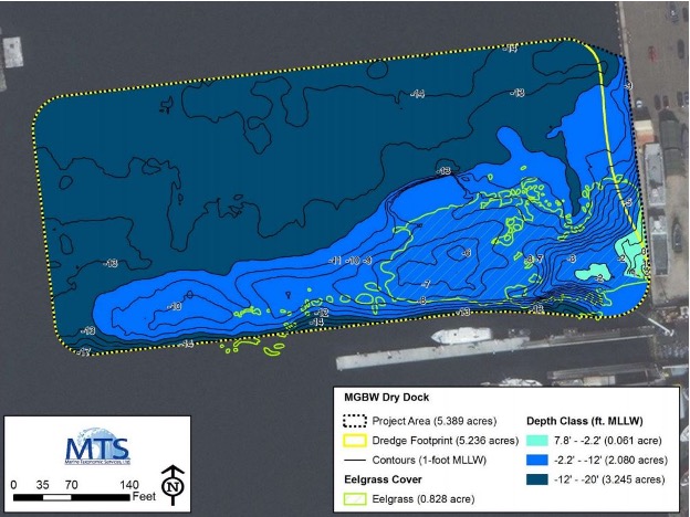
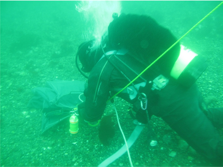
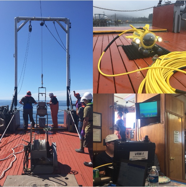
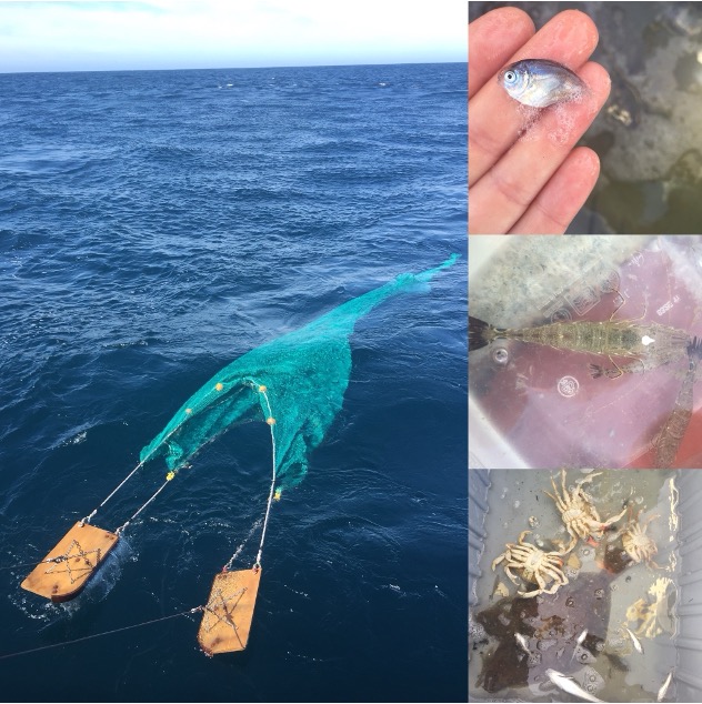
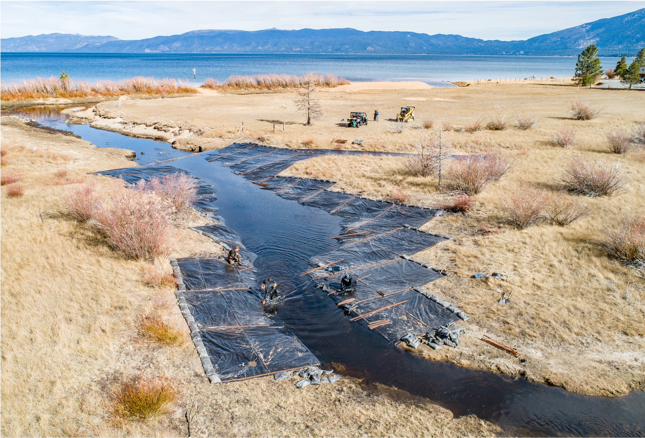
Marine Taxonomic Services has built a strong reputation for delivering high-quality biological assessments, benthic monitoring, and species identification services to government agencies, engineering firms, and environmental organizations. Their team of expert taxonomists and marine scientists operates from their San Diego, South Lake Tahoe, and Corvallis, OR locations as part of NV5’s growing environmental services portfolio.

This expansion reflects NV5’s ongoing commitment to providing integrated, science-driven solutions that support sustainable development and environmental stewardship across the United States.

About NV5 Geospatial- NV5 Geospatial is a provider of geospatial services, providing end-to-end solutions and insights to organizations that need geospatial intelligence to mitigate risk, plan for growth, better manage resources and advance scientific understanding. We combine the widest array of advanced remote sensing technologies with proprietary processes, analytics tools, algorithms, and analyses tailored to meet our clients’ needs.

Fill out the form below to download the handbook.

Form #1 - Redirection to PDF

Form #2 - Sends email containing the link to the PDF

"*" indicates required fields

This field is for validation purposes and should be left unchanged.

eNewsletter - NV5 Real Estate Transaction Services

Contact NV5 Real Estate Transaction Services

Download NV5 2022 Compliance Calendar

Please fill out the form below. After successful form submission, you will be redirected to the requested file. Thank you.

"*" indicates required fields

This field is for validation purposes and should be left unchanged.
We are an equal opportunity employer. All applicants will be considered for employment without attention to race, color, religion, sex, sexual orientation, gender identity, national origin, veteran or disability status. We ensure nondiscrimination in all programs and activities in accordance with Title VI of the United States Civil Rights Act of 1964. If you need more information or special assistance for persons with disabilities or limited English proficiency, contact MaryJo OBrien at (954) 495-2112. Persons with hearing-and speech-impairments can contact the NV5 by using the Virginia Relay Service, a toll-free telecommunication device for the deaf (TDD). Call 711 for TTY/TDD.
This field is hidden when viewing the form

Hyperspectral Imaging - Technically Speaking

Our internal innovation and development team constantly analyzes new technology and develops solutions to meet our client’s challenges. Our Technically Speaking series is one way we share our technical findings with the professional community. 

Please tell us a little about yourself by filling out the form below, and we’ll share the document with you, thanks!

Accuracy Part 1- Technically Speaking

Our internal innovation and development team constantly analyzes new technology and develops solutions to meet our client’s challenges. Our Technically Speaking series is one way we share our technical findings with the professional community. 

Please tell us a little about yourself by filling out the form below, and we’ll share the document with you, thanks!

Prune Optimization Webinar Recording

NV5 Geospatial releases a new predictive modeling platform for vegetation management that uses existing lidar and historical data to identify the relative level of asset risk from trees by quantifying the potential for causing asset damage. 

Please tell us a little about yourself by filling out the form below, and we’ll share the document with you, thanks!

Topobathy Lidar - Technically Speaking

Our internal innovation and development team constantly analyzes new technology and develops solutions to meet our client’s challenges. Our Technically Speaking series is one way we share our technical findings with the professional community. 

Please tell us a little about yourself by filling out the form below, and we’ll share the document with you, thanks!

Contact Geospatial

Contact Geospatial