NOAA Selects Geodynamics for Extensive Hydrographic Survey in North Carolina

Task Order Features Unique Survey Approach to Deliver Valuable Charting Data that Will Also Support Environmental and Coastal Resilience Efforts

Geodynamics, an NV5 company, North America’s most comprehensive geospatial data provider, has undertaken one of the largest surveys of shallow complex environments under a dual purpose task order from the National Oceanic and Atmospheric Administration’s (NOAA) Coast Survey. Using a specialized fleet of research vessels and uncrewed surface vehicles (USVs), Geodynamics is able to efficiently and cost-effectively collect data across 522 square nautical miles of the Albemarle Sound, a large estuary that extends 50 nautical miles inland from the Outer Banks barrier islands in North Carolina. The hydrographic survey will provide updated navigation charts as well as information to support federal and state environmental protection and coastal resilience efforts.

In conducting the survey, Geodynamics is leveraging six specialized survey platforms – including the RV Substantial, an endurance vessel capable of multi-day, 24-hour survey operations; three vessels for daily operation; and two XOcean uncrewed surface vehicles (USVs) that can operate continuously for eight days even in the most challenging weather.  A combination of multibeam, side scan and single beam sonar enables Geodynamics to collect high-resolution data cost effectively within a compact survey acquisition schedule.

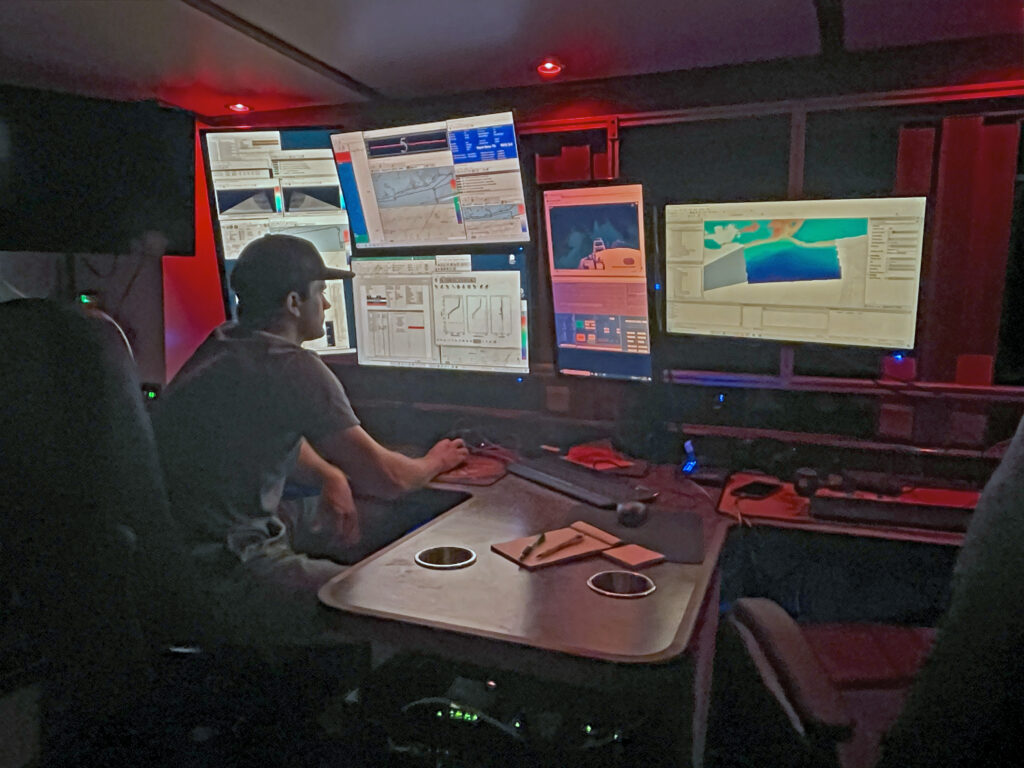
To help manage this unique, large-scale and complex project, Geodynamics implemented its Survey Information Management System (SIMS). SIMS is a collection of online applications and robust eGIS services that enhance survey planning, management and quality control in an interactive online environment where surveyors, managers and stakeholders collaborate. Survey progress and vessel tracking is enhanced with an interactive real-time survey tracker and statistical-driven dashboard, providing guidance and transparency in hydrographic surveys. A variety of data is served from the survey vessel to a cloud-based eGIS environment and integrated for situational awareness, quality control and automated reporting. Field observations – such as dangers and aids to navigation, protected species observations and survey notes – are geotagged and available in real-time for quality control and reporting. 

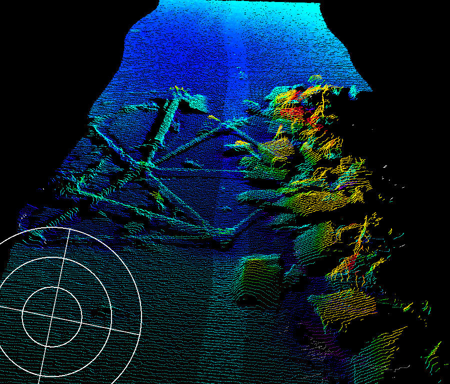
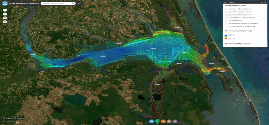
The project, which is now underway and expected to be complete this summer, is the first modern charting survey of the Albemarle Sound in more than 100 years. The data collected will be used to:

  • Update NOAA National Ocean Service charts and products;
  • Provide forecasters at NOAA’s National Water Center with bathymetric data necessary to create a multi-dimensional hydrodynamic model that incorporates water level changes from riverine, storm-induced and sea-level impacts to better understand nutrient movement and inundation;
  • Characterize the estuarine environment to help manage a healthy and sustainable seafood industry and help monitor future changes to the estuary ecology.

Fill out the form below to download the handbook.

Form #1 - Redirection to PDF

Form #2 - Sends email containing the link to the PDF

"*" indicates required fields

This field is for validation purposes and should be left unchanged.

eNewsletter - NV5 Real Estate Transaction Services

Contact NV5 Real Estate Transaction Services

Download NV5 2022 Compliance Calendar

Please fill out the form below. After successful form submission, you will be redirected to the requested file. Thank you.

  • We are an equal opportunity employer. All applicants will be considered for employment without attention to race, color, religion, sex, sexual orientation, gender identity, national origin, veteran or disability status. We ensure nondiscrimination in all programs and activities in accordance with Title VI of the United States Civil Rights Act of 1964. If you need more information or special assistance for persons with disabilities or limited English proficiency, contact MaryJo OBrien at (954) 495-2112. Persons with hearing-and speech-impairments can contact the NV5 by using the Virginia Relay Service, a toll-free telecommunication device for the deaf (TDD). Call 711 for TTY/TDD.

Hyperspectral Imaging - Technically Speaking

Our internal innovation and development team constantly analyzes new technology and develops solutions to meet our client’s challenges. Our Technically Speaking series is one way we share our technical findings with the professional community. 

Please tell us a little about yourself by filling out the form below, and we’ll share the document with you, thanks!

Accuracy Part 1- Technically Speaking

Our internal innovation and development team constantly analyzes new technology and develops solutions to meet our client’s challenges. Our Technically Speaking series is one way we share our technical findings with the professional community. 

Please tell us a little about yourself by filling out the form below, and we’ll share the document with you, thanks!

Prune Optimization Webinar Recording

NV5 Geospatial releases a new predictive modeling platform for vegetation management that uses existing lidar and historical data to identify the relative level of asset risk from trees by quantifying the potential for causing asset damage. 

Please tell us a little about yourself by filling out the form below, and we’ll share the document with you, thanks!

Topobathy Lidar - Technically Speaking

Our internal innovation and development team constantly analyzes new technology and develops solutions to meet our client’s challenges. Our Technically Speaking series is one way we share our technical findings with the professional community. 

Please tell us a little about yourself by filling out the form below, and we’ll share the document with you, thanks!

Contact Geospatial

Contact Geospatial