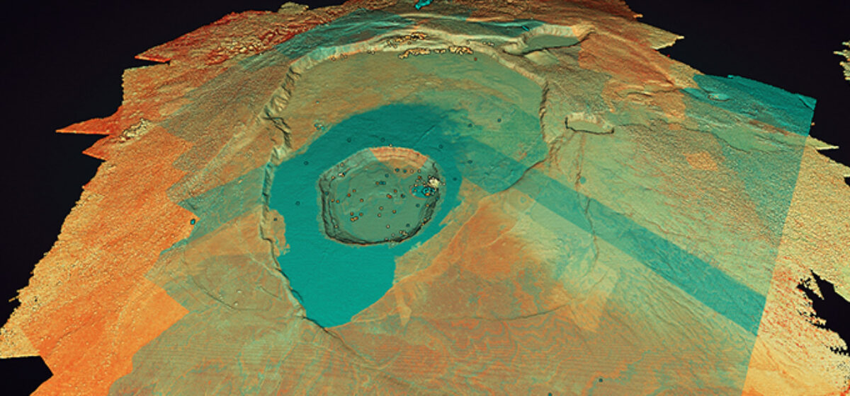
LiDAR data, collected by Quantum Spatial, is proving a useful tool in mapping the volcano and lava flows on the Big Island of Hawaii. Tracy Cozzens of Geospatial Solutions describes how remote sensing mapping technology is guiding Hawaiian agencies in effort to keep communities safe. Read the full article HERE.