by Craig Park, Associate AIA, FSMPS For most design practices, the last eighteen months reframed (upended?) our perspective on remote engagement, both internally and externally. Client connections that were almost exclusively in-person were flipped to virtual meetings practically overnight. Design teams that had used video for coordination meetings on rare[...]
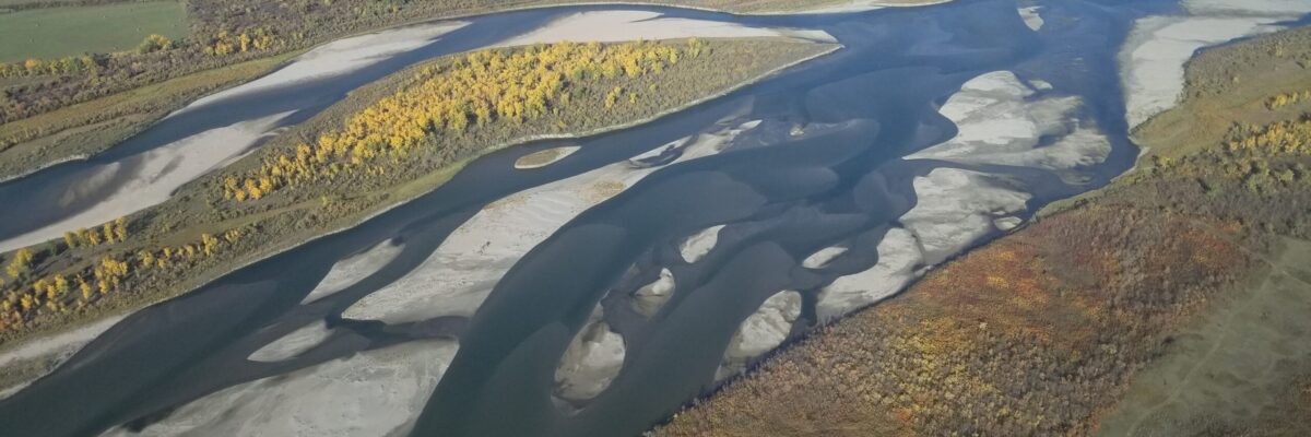
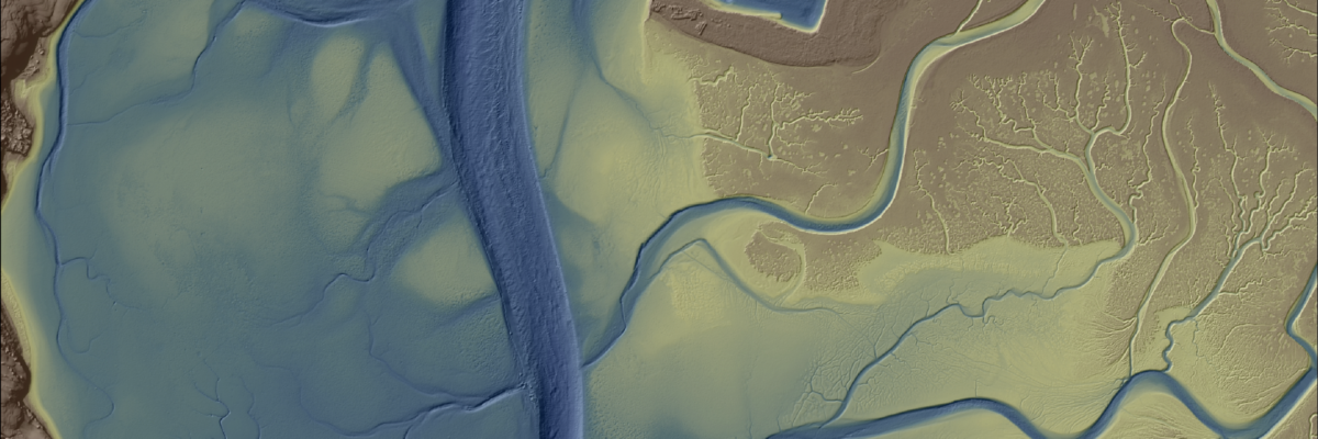
New Projects in British Columbia and Saskatchewan to Assist Agencies with Floodplain Mapping Analysis and Sustainable Water Management NV5 Geospatial, North America’s largest geospatial data firm, is building on it’s success in the Canadian market with the awards of hydrospatial projects in 2021 in British Columbia and Saskatchewan. “Topobathymetric lidar[...]
HOLLYWOOD, Fla., Nov. 01, 2021 (GLOBE NEWSWIRE) — NV5 Global, Inc. (the “Company” or “NV5”) (Nasdaq: NVEE), a provider of compliance, technology, engineering, and environmental consulting solutions, announced today that the Hong Kong Urban Renewal Authority and a large data center operator awarded NV5 two contracts totaling $3 million to[...]
Our consultants and designers have a decidedly personal stake in much of the work they do. Here are five of their stories. Stalin Vera, Acoustical Consultant: It’s one thing to help design a healthcare facility for someone else, but when it’s your own child being treated, it becomes super-personal. Our[...]
Diane Donaghey, NV5’s Director of Business Development, sits down with Patrick O’Brien about his ongoing experience as an intern in NV5’s Hadley office. Patrick began his internship in June of 2021 and will continue part time through the fall and winter while completing his senior year at the University of[...]
Over the past five years, the Greater Montréal Area has experienced multiple significant flooding events, which together displaced tens of thousands from their homes and cost millions to local and regional governments. NV5G was contracted to conduct aerial topobathymetric lidar surveys of the region’s 28 main watercourses, with the goal[...]
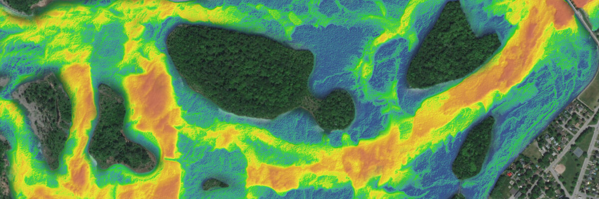
A NOAA-supported analysis of California’s Morro Bay estuary found links between seagrass collapse and later erosion that will inform bay-area adaptation strategies and could influence global seagrass conservation strategies. NV5 Geospatial provided a full update of elevation data for Morro Bay from an integration of topobathymetric lidar and sonar technologies.[...]
Hollywood, FL – October 14, 2021 – NV5 Global, Inc. (the “Company” or “NV5”) (Nasdaq: NVEE), a provider of compliance, technology, engineering, and environmental consulting solutions, announced today that the North Carolina Department of Transportation (NCDOT) has awarded NV5 a two-year, $4 million contract to assist in the development and[...]
HOLLYWOOD, Fla., Oct. 13, 2021 (GLOBE NEWSWIRE) — NV5 Global, Inc. (the “Company” or “NV5”) (Nasdaq: NVEE), a provider of compliance, technology, engineering, and environmental consulting solutions, will announce its financial results for the third quarter ended October 2, 2021 on Tuesday, November 9, 2021, following the close of the[...]
In celebration of International Podcast Day, we’re sharing podcasts where NV5 Geospatial’s expertise shed light on various topics within the industry. From discussions like how lidar provides value to organizations, how the sensors now available are changing data collection, key trends in disaster response, and more. Check them out below![...]
Form #2 - Sends email containing the link to the PDF
"*" indicates required fields
eNewsletter - NV5 Real Estate Transaction Services
Contact NV5 Real Estate Transaction Services
Download NV5 2022 Compliance Calendar
Please fill out the form below. After successful form submission, you will be redirected to the requested file. Thank you.
"*" indicates required fields
Hyperspectral Imaging - Technically Speaking
Our internal innovation and development team constantly analyzes new technology and develops solutions to meet our client’s challenges. Our Technically Speaking series is one way we share our technical findings with the professional community.
Please tell us a little about yourself by filling out the form below, and we’ll share the document with you, thanks!
Accuracy Part 1- Technically Speaking
Our internal innovation and development team constantly analyzes new technology and develops solutions to meet our client’s challenges. Our Technically Speaking series is one way we share our technical findings with the professional community.
Please tell us a little about yourself by filling out the form below, and we’ll share the document with you, thanks!
Prune Optimization Webinar Recording
NV5 Geospatial releases a new predictive modeling platform for vegetation management that uses existing lidar and historical data to identify the relative level of asset risk from trees by quantifying the potential for causing asset damage.
Please tell us a little about yourself by filling out the form below, and we’ll share the document with you, thanks!
Topobathy Lidar - Technically Speaking
Our internal innovation and development team constantly analyzes new technology and develops solutions to meet our client’s challenges. Our Technically Speaking series is one way we share our technical findings with the professional community.
Please tell us a little about yourself by filling out the form below, and we’ll share the document with you, thanks!