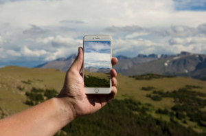
A Look at 3 Trends Shaping Remote Sensing in the Next 5 Years
Read NV5 Geospatial’s Ian Berdie’s three trends that will reshape use of remote sensing over the next five years at GIS Lounge. “Remote” took on
Read NV5 Geospatial’s Ian Berdie’s three trends that will reshape use of remote sensing over the next five years at GIS Lounge. “Remote” took on

Zpryme’s Dylan Lockwood speaks with Ian Berdie, Vice President of Innovation and Development at NV5 Geospatial and LCRA’s Garret Thompson about improving outcomes via geospatial
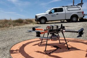
Once just an expensive toy for tech enthusiasts, drones are now being embraced in a variety of sectors to deliver tangible business benefits. For engineers,
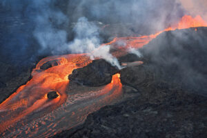
NV5 Geospatial and partner GEO1 win two awards at the 15th Annual MAPPS Awards for their lidar and image acquisition of erupting Kilauea Volcano NV5
Lidar Magazine’s Managing Editor, Stewart Walker, discusses the current and future state of lidar technology and innovation strategy with a handful of NV5 Geospatial’s technical
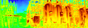
Register Webinar: The Future of Substation Inspection Feb 17th | 1 pm ET / 10am PT Explore the unlimited potential of remotely operated ground vehicles

Geo Week is right around the corner, and our team is looking forward to participating and meeting up with our peers, partners, and clients. We

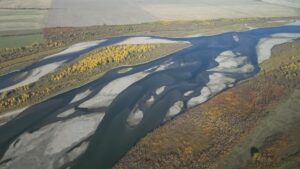
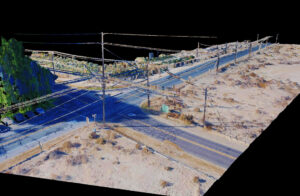
New Projects in British Columbia and Saskatchewan to Assist Agencies with Floodplain Mapping Analysis and Sustainable Water Management NV5 Geospatial, North America’s largest geospatial data
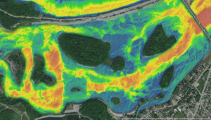
Over the past five years, the Greater Montréal Area has experienced multiple significant flooding events, which together displaced tens of thousands from their homes and