
Geospatial Newsletter – May
View our May edition to learn about our latest geospatial projects. CLICK HERE. May Newsletter
View our May edition to learn about our latest geospatial projects. CLICK HERE. May Newsletter

In today’s rapidly evolving technological landscape, organizations are constantly seeking innovative ways to harness the power of data and artificial intelligence (AI) to drive efficiency,

View our April edition to learn about our latest geospatial projects. CLICK HERE. April Newsletter Read the latest stories on what’s new with NV5’s geospatial
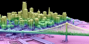
From Digital Twins to Topobathy to AI: NV5 Experts Present Game-Changing Applications for Environmental and Infrastructure Monitoring HOLLYWOOD, Fla., February 5, 2025 – NV5, the world’s
Leading Geospatial Firm to Present Innovations in SAR Analytics, AI-Powered Large Language Models and Coastal Surveying Solutions that Leverage Topobathymetry to Connect Land and Sea
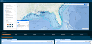
New Hydrographic Survey in Lake Michigan Among Projects Using Cutting-edge Survey Technologies and Creative Approaches to Yield Actionable Data that Supports Maritime Mapping, Resource Management
HOLLYWOOD, Fla. — NV5, a global leader providing geospatial solutions, services, and software to solve mission critical challenges, today announced it has earned requalification in

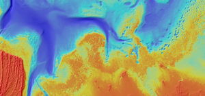
As seen in the latest issue of Hydro International Preservation of endangered species habitats along the Platte River Topobathymetric Lidar technology has become an indispensable
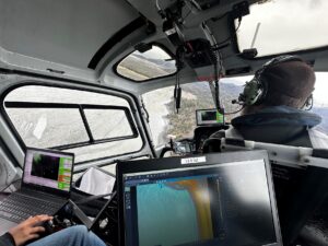
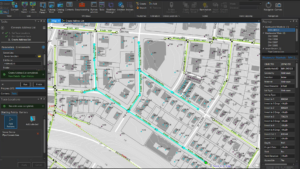
Collecting geospatial data in Alaska is not for the faint of heart. The rugged terrain makes it dangerous and expensive to send people out in

In a previous post, we introduced the Caribbean Community Climate Change Centre’s (CCCCC) initiative with NV5 to combat climate change through aerial lidar and orthoimagery