
Alaska Virtual Geospatial Gathering March 1st – 4th
Registration is open for the Alaska Virtual Geospatial Gathering March 1st – 4th. We have over two dozen speakers lined up to cover geospatial topics

Registration is open for the Alaska Virtual Geospatial Gathering March 1st – 4th. We have over two dozen speakers lined up to cover geospatial topics

NV5 Global, Inc. (the “Company” or “NV5”) (Nasdaq: NVEE), a provider of compliance, technology, and engineering consulting solutions, announced today that NV5 Geospatial, formerly Quantum Spatial,
Bob Vander Meer, vice president of business development for NV5 Geospatial (Powered by Quantum Spatial), discusses NV5 Geospatial’s work with Airports on the Airplane Geeks Podcast. Bob has over

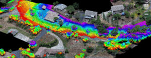
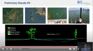
Lidar technology continues to advance, both in terms of sensor hardware and platform deployment. NV5 Geospatial and Oklahoma Department of Transportation performed a series of tests

Zpryme On The Grid · Changing Responses to Changing Disasters w/ Ian Berdie Zpryme’s Dylan Lockwood speaks with Ian Berdie, Vice President of Innovation

HOLLYWOOD, Fla., Oct. 12, 2020 (GLOBE NEWSWIRE) — NV5 Global, Inc. (the “Company” or “NV5”) (Nasdaq: NVEE), a provider of compliance, technology, and engineering consulting solutions,

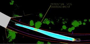
In recent years, advances in high-density lidar and hyperspectral imagery have offered new tools to states and municipalities for vegetation management. Quantum Spatial’s Andrew Brenner

HOLLYWOOD, Fla., Sept. 30, 2020 (GLOBE NEWSWIRE) — NV5 Global, Inc. (the “Company” or “NV5”) (Nasdaq: NVEE), a provider of compliance, technology, and engineering consulting solutions, announced today that its

Quantum Spatial, Inc., an NV5 company and the nation’s largest geospatial data firm, today announced that it is the first full-service geospatial company to achieve International

NV5 Awarded $4.6 Million Geospatial Vegetation and Asset Management Contract Extension HOLLYWOOD, Fla., June 11, 2020 – NV5 Global, Inc. (the “Company” or “NV5”) (Nasdaq:
Fill out the form below to download the handbook.
"*" indicates required fields
Please fill out the form below. After successful form submission, you will be redirected to the requested file. Thank you.
"*" indicates required fields
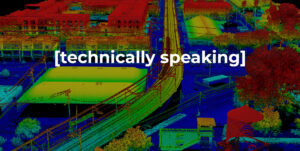
Our internal innovation and development team constantly analyzes new technology and develops solutions to meet our client’s challenges. Our Technically Speaking series is one way we share our technical findings with the professional community.
Please tell us a little about yourself by filling out the form below, and we’ll share the document with you, thanks!
Our internal innovation and development team constantly analyzes new technology and develops solutions to meet our client’s challenges. Our Technically Speaking series is one way we share our technical findings with the professional community.
Please tell us a little about yourself by filling out the form below, and we’ll share the document with you, thanks!
NV5 Geospatial releases a new predictive modeling platform for vegetation management that uses existing lidar and historical data to identify the relative level of asset risk from trees by quantifying the potential for causing asset damage.
Please tell us a little about yourself by filling out the form below, and we’ll share the document with you, thanks!
Our internal innovation and development team constantly analyzes new technology and develops solutions to meet our client’s challenges. Our Technically Speaking series is one way we share our technical findings with the professional community.
Please tell us a little about yourself by filling out the form below, and we’ll share the document with you, thanks!