What do we do to improve mining operations?
Quantum Spatial is attending the Alaska Miners Association conference, Novemember 8-10, at the Dena’ina Civic and Convention Center in Anchorage. Our Alaska-based team is expert at

Quantum Spatial is attending the Alaska Miners Association conference, Novemember 8-10, at the Dena’ina Civic and Convention Center in Anchorage. Our Alaska-based team is expert at

During November 1 Session, Matt Boyd Will Detail How to Use Spatial Analytics to Manage Risk, Reliability and Compliance Quantum Spatial, Inc., the nation’s largest independent geospatial

To commemorate National GIS Day, Ms. Caroline Coholan’s 3rd grade class, from Llewellyn Elementary School, visited the Portland office for some hands-on experience in geography.

Quantum Spatial, Inc., the nation’s largest independent geospatial data firm, today announced the appointment of Drew Meren to lead the Atlantic region, focusing on state

The suitcases have been unpacked, the souvenirs put away, the business cards classified and follow up emails written. It is time to draw the curtains

With a total of 73 industry attendees, bringing together sensor manufacturers, their operators, and data users, the emphasis of Day 1 was put mostly on
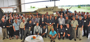
Our first Quantum Spatial Acquisition Partner summit got off to a very successful start today. We planned for about 40 participants. In the room today,
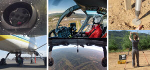
On September 20, the Quantum Spatial Remote Sensing Innovation Center will kick-off our inaugural technology summit focusing on acquisition. Seventy-three of the world’s leading geospatial

Point of Business (POB) released their list of top companies in the geospatial industry and identified Quantum Spatial in the topmost tier of businesses. Here
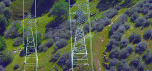
Quantum Spatial’s remote sensing analytics provide unparalleled insight into geologic hazard identification and mitigation. Advancing technologies like LiDAR, thermal sensing, and multi-spectral imaging allow us to