NV5 to Showcase Geospatial Solutions at Geo Week 2025
From Digital Twins to Topobathy to AI: NV5 Experts Present Game-Changing Applications for Environmental and Infrastructure Monitoring HOLLYWOOD, Fla., February 5, 2025 – NV5, the world’s
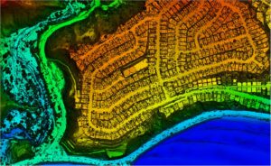
From Digital Twins to Topobathy to AI: NV5 Experts Present Game-Changing Applications for Environmental and Infrastructure Monitoring HOLLYWOOD, Fla., February 5, 2025 – NV5, the world’s

Lidar data collected by NV5 can help quantify fire damage, identify areas at risk of debris flows or flooding, and guide restoration efforts. Â Â LOS ANGELES,

Albemarle Sound Hydrographic Survey The Albemarle Sound, one of the longest estuaries in North Carolina, spans from the Outer Banks to expansive wetlands, rivers, and

Hollywood, Florida – NV5 (NYSE: NVEE) was selected by the National Geospatial-Intelligence Agency as one of the vendors for the $200 million Luno B commercial

Leading Geospatial Firm to Present Innovations in SAR Analytics, AI-Powered Large Language Models and Coastal Surveying Solutions that Leverage Topobathymetry to Connect Land and Sea

New Hydrographic Survey in Lake Michigan Among Projects Using Cutting-edge Survey Technologies and Creative Approaches to Yield Actionable Data that Supports Maritime Mapping, Resource Management

HOLLYWOOD, Fla. —  NV5, a global leader providing geospatial solutions, services, and software to solve mission critical challenges, today announced it has earned requalification in

As the largest public water and wastewater utility in the Carolinas, Charlotte Water (CLTWater) serves over a million customers in the City of Charlotte and

Ron Chapple, is the VP of Global Strategic Solutions Digital Twins, discusses NV5’s work with digital twins on the The Geotechnical Engineering Podcast.  It’s

Ron Chapple, is the VP of Global Strategic Solutions Digital Twins, discusses NV5’s work with digital twins on the Airplane Geeks Podcast.  The digital
Fill out the form below to download the handbook.
"*" indicates required fields
Please fill out the form below. After successful form submission, you will be redirected to the requested file. Thank you.
"*" indicates required fields
Our internal innovation and development team constantly analyzes new technology and develops solutions to meet our client’s challenges. Our Technically Speaking series is one way we share our technical findings with the professional community.Â
Please tell us a little about yourself by filling out the form below, and we’ll share the document with you, thanks!
Our internal innovation and development team constantly analyzes new technology and develops solutions to meet our client’s challenges. Our Technically Speaking series is one way we share our technical findings with the professional community.Â
Please tell us a little about yourself by filling out the form below, and we’ll share the document with you, thanks!
NV5 Geospatial releases a new predictive modeling platform for vegetation management that uses existing lidar and historical data to identify the relative level of asset risk from trees by quantifying the potential for causing asset damage.Â
Please tell us a little about yourself by filling out the form below, and we’ll share the document with you, thanks!
Our internal innovation and development team constantly analyzes new technology and develops solutions to meet our client’s challenges. Our Technically Speaking series is one way we share our technical findings with the professional community.Â
Please tell us a little about yourself by filling out the form below, and we’ll share the document with you, thanks!