Our acquisition summit is underway!

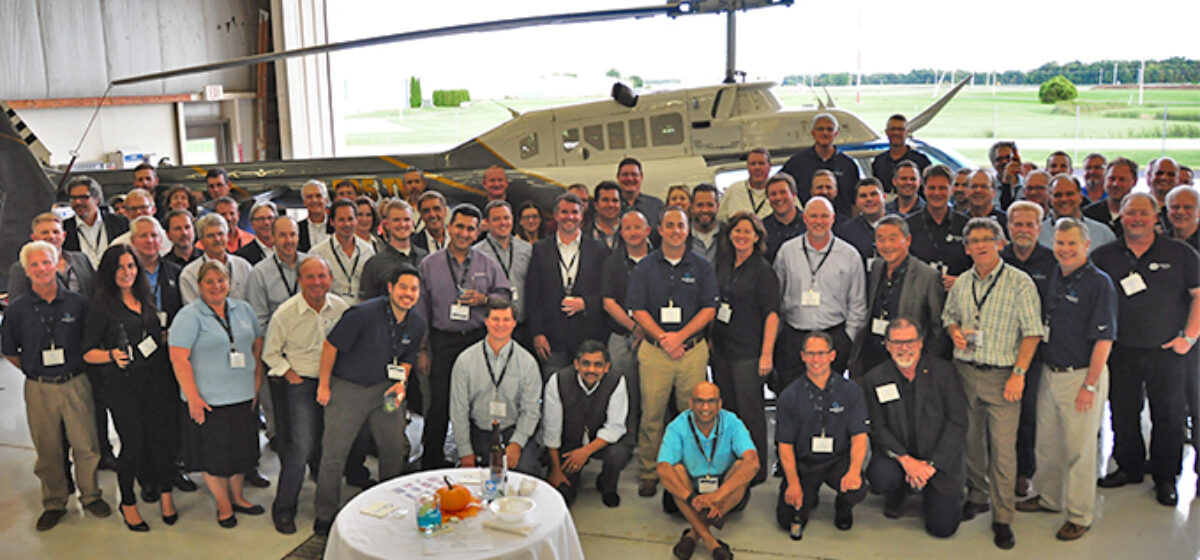
Our first Quantum Spatial Acquisition Partner summit got off to a very successful start today. We planned for about 40 participants. In the room today, we had 76 participants from all over the world.

The energy level of the partners – many of whom had flown overnight from Europe and Australia – was electrifying. Technology partners like Hexagon, Riegl, Trimble, Teledyne, Precision Hawk demonstrated their latest and greatest products in the areas of data acquisition cameras and sensors as well as UAVs (drones). There were some great presentations on the scientific and manufacturing advances made in the area of geospatial data capture.

All the 20 large operating partners who primarily help QSI capture data were present to share their strategies, their plans and their visions. There were some great discussions around some common industry challenges faced by all the partners and how to get ahead of the curve in those areas.

I talked about a future where we could move from a “transactional” level of partnership to a truly “strategic” level and what those words meant.  I know this will take some time but, after having seen this in other industries, I am convinced that such partnerships are required to help partners as well as our customers.


-Rajib Roy, CEO

Stay tuned for more from the summit.

Fill out the form below to download the handbook.

Form #1 - Redirection to PDF

Form #2 - Sends email containing the link to the PDF

"*" indicates required fields

This field is for validation purposes and should be left unchanged.

eNewsletter - NV5 Real Estate Transaction Services

Contact NV5 Real Estate Transaction Services

Download NV5 2022 Compliance Calendar

Please fill out the form below. After successful form submission, you will be redirected to the requested file. Thank you.

  • We are an equal opportunity employer. All applicants will be considered for employment without attention to race, color, religion, sex, sexual orientation, gender identity, national origin, veteran or disability status. We ensure nondiscrimination in all programs and activities in accordance with Title VI of the United States Civil Rights Act of 1964. If you need more information or special assistance for persons with disabilities or limited English proficiency, contact MaryJo OBrien at (954) 495-2112. Persons with hearing-and speech-impairments can contact the NV5 by using the Virginia Relay Service, a toll-free telecommunication device for the deaf (TDD). Call 711 for TTY/TDD.

Hyperspectral Imaging - Technically Speaking

Our internal innovation and development team constantly analyzes new technology and develops solutions to meet our client’s challenges. Our Technically Speaking series is one way we share our technical findings with the professional community. 

Please tell us a little about yourself by filling out the form below, and we’ll share the document with you, thanks!

Accuracy Part 1- Technically Speaking

Our internal innovation and development team constantly analyzes new technology and develops solutions to meet our client’s challenges. Our Technically Speaking series is one way we share our technical findings with the professional community. 

Please tell us a little about yourself by filling out the form below, and we’ll share the document with you, thanks!

Prune Optimization Webinar Recording

NV5 Geospatial releases a new predictive modeling platform for vegetation management that uses existing lidar and historical data to identify the relative level of asset risk from trees by quantifying the potential for causing asset damage. 

Please tell us a little about yourself by filling out the form below, and we’ll share the document with you, thanks!

Topobathy Lidar - Technically Speaking

Our internal innovation and development team constantly analyzes new technology and develops solutions to meet our client’s challenges. Our Technically Speaking series is one way we share our technical findings with the professional community. 

Please tell us a little about yourself by filling out the form below, and we’ll share the document with you, thanks!

Contact Geospatial

Contact Geospatial