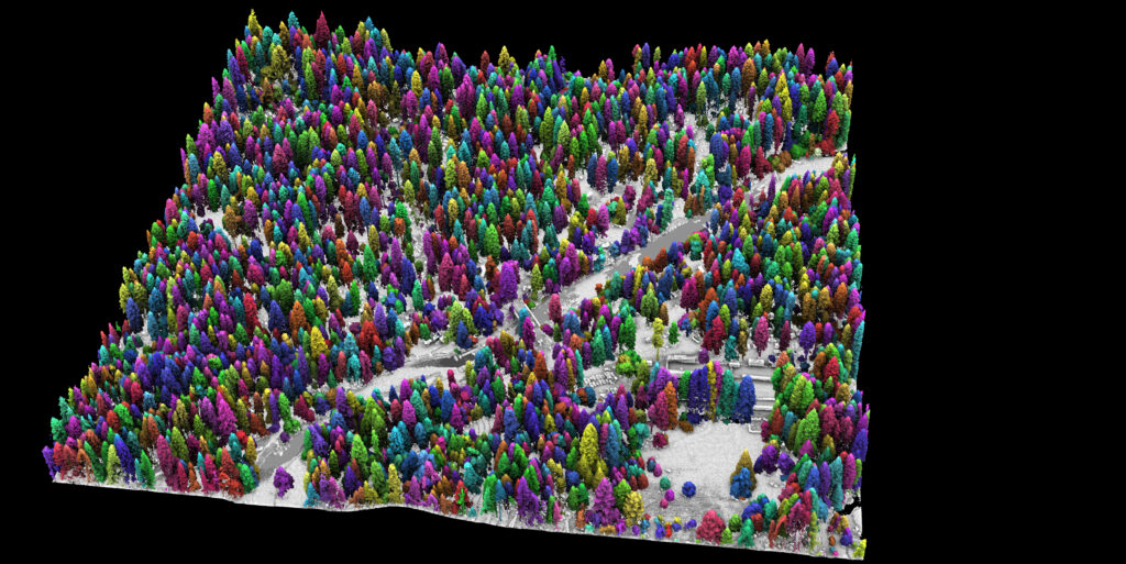
A Lidar’s-Eye View of How Forests Are Faring
Success in Yosemite is driving the wider use of lidar surveys to support forest health and wildfire resilience, study wildlife habitats, and monitor water resources.
Mapping the Nearshore with Geodynamics, an NV5 Company
NV5 Geospatial and Geodynamics LLC, an NV5 company, experts Kurt Allen, Sloan Freeman, and Rudi Rudolph, hit The American Shoreline Podcast airwaves on Coastal News
NV5 Geospatial enhances INSITE Geospatial Data Management Platform with Data Reviewer Module
INSITE Data Reviewer provides reviewers real-time access to aerial imagery, lidar data, GIS layers, and more via the cloud to standardize quality control. This increases data validation speed and reduces the costs of geospatial projects.
NV5 Geospatial Adds USGS Veteran to Federal Government Market Team
Tim Saultz brings with him more than three decades of experience managing strategic programs at scale with the USGS Hollywood, Florida – 04/05/2022 – NV5
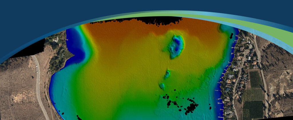
NV5 Geospatial Helps Okanagan Basin Water Board Protect Important Local Communities Through Near-Shore Topobathymetric Lidar Survey
Sven Cowan, NV5 Geospatial’s Canada Program Manager, details the recent topobathy lidar project of Okanagan Basin, British Columbia, Canada in the latest issue of GoGeomatics
NV5 Recognized by Environmental Business Journal & Climate Change Business Journal
Today we are happy to share that the NV5 family has received four 2021 Business Achievement Awards from Environmental Business Journal (EBJ) and Climate Change

A Look at 3 Trends Shaping Remote Sensing in the Next 5 Years
Read NV5 Geospatial’s Ian Berdie’s three trends that will reshape use of remote sensing over the next five years at GIS Lounge. “Remote” took on

Risk & Resiliency: How Utilities are using Data/Geospatial Analytics for Emergency Response
Zpryme’s Dylan Lockwood speaks with Ian Berdie, Vice President of Innovation and Development at NV5 Geospatial and LCRA’s Garret Thompson about improving outcomes via geospatial