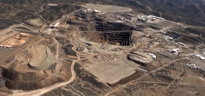
Remote sensing for minerals- Quantum Spatial engaged in USGS Survey
The remote sensing acquisition team of Quantum Spatial, in partnership with EDCON-PRJ, and working on behalf of the USGS, was recently featured in NBC News
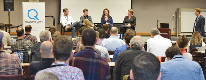
River Analytics Symposium
Quantum Spatial River Analytics Symposium -Russ Faux, Sr VP Quantum Spatial successfully hosted its first River Analytics Symposium at our Corvallis, Oregon office on October
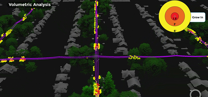
Quantum Spatial to Present at CEATI on Leveraging Lidar and Remote Sensing for Threat Mapping and Vegetation Management
Quantum Spatial, Inc., North America’s largest independent geospatial analytics firm, will deliver two presentations focusing on how utility companies use remote sensing and lidar during CEATI’s 2019

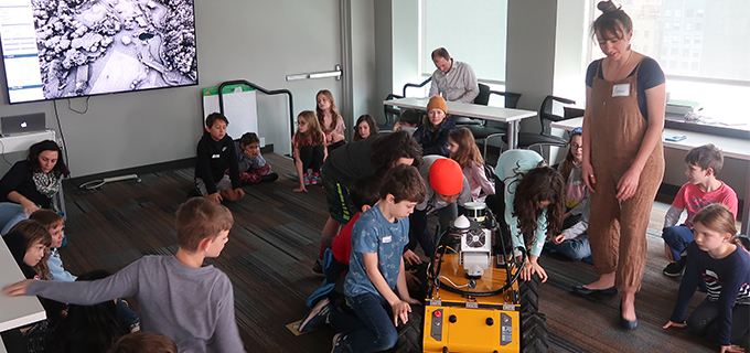
A Quantum Spatial field trip? Happy GIS Day!
To celebrate National GIS Day 2019, Quantum Spatial’s Portland office hosted a field trip from Ms. Caroline Coholan’s 3rd grade class from Llewellyn Elementary School. The class

NV5 Geospatial to Present How California is Using Advanced Remote Sensing and Analytics to Analyze Irrigated Landscape Usage of 9 Million Homes at WaterSmart Innovations
Quantum Spatial, the nation’s largest independent geospatial data firm, today announced that it will be presenting at WaterSmart Innovations Conference and Exposition on Thursday, October 3, 2019 at
Quantum Spatial’s 4th Annual Acquisition Summit
Quantum Spatial’s fourth annual acquisition is underway this week. The event brings together remote sensing and geospatial industry leaders to share new innovations, showcase emmerging
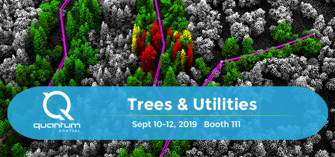
Quantum Spatial Remote Sensing Analytics Expertise to be Featured at 2019 Trees and Utilities Conference
Quantum Spatial, Inc., the nation’s largest independent geospatial data firm, announced that its use of remote sensing and analytics for vegetation management will be featured during
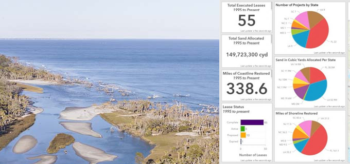
Bureau of Ocean Energy Management Uses GIS to Manage Marine Minerals
Big Data comes to life via Quantum Spatial’s eGIS application, developed for the Bureau of Ocean Energy Management. The Marine Minerals Information System (MMIS), enables the management