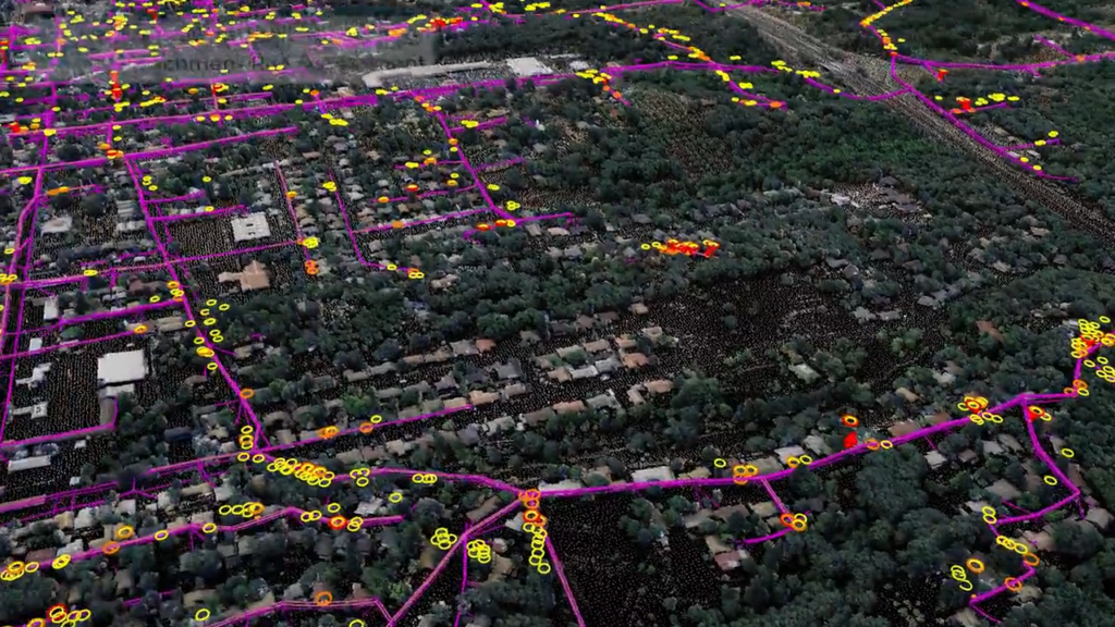
NV5 Geospatial Transforms Utility Distribution Management with Remote Sensing
Asset and Vegetation Management Applications Help Utilities Minimize Risk and Improve Reliability of Electric Distribution Network HOLLYWOOD, Fla., October 11, 2022 – NV5 Geospatial, North America’s most

Tim Saultz awarded Dept of the Interior’s Distinguished Service Award
We extend our heartfelt congratulations to our very own Tim Saultz, who was awarded The Distinguished Service Award, the highest honorary recognition an employee can
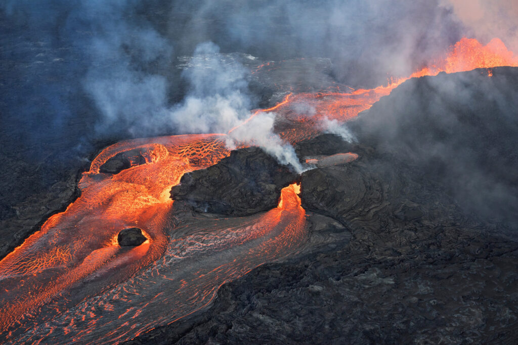
From emergency response to strategic planning: A Kilauea case study
Written by Joel Burroughs, NV5 Geospatial Account Manager When volcanoes erupt, the force of explosions and lava dramatically change the landscape, impacting the geography and
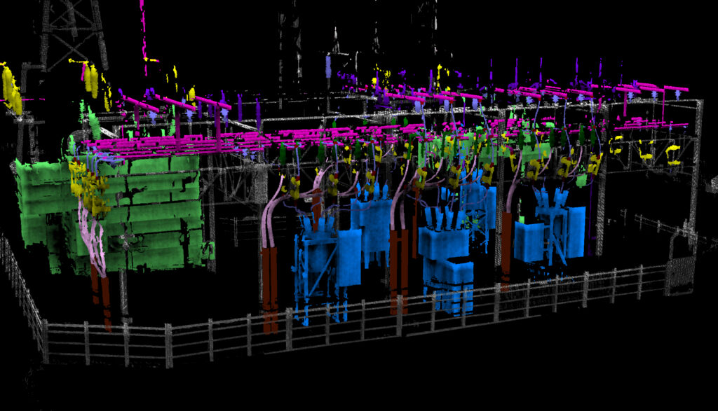
NV5 Geospatial Introduces Industry’s Most Rugged, Multifunctional Robot for Electric Substation Monitoring
Use of robots equipped with sensors and cameras are helping to automate and improve maintenance of utilities. NV5 Geospatial, North America’s most comprehensive geospatial science
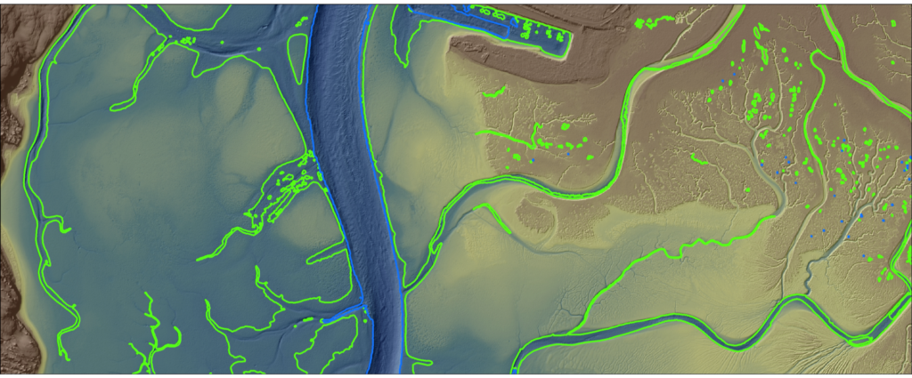
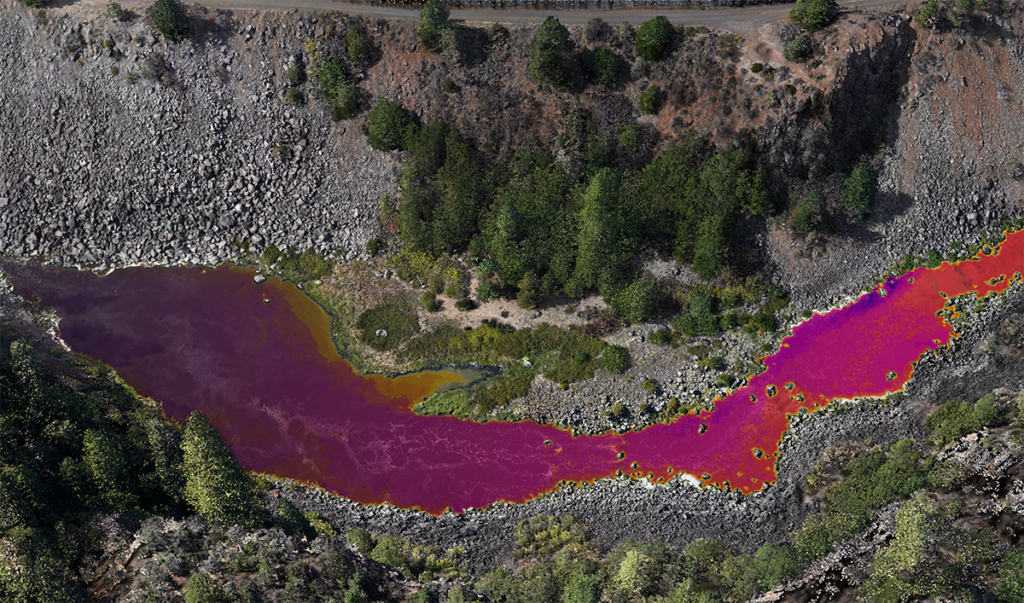
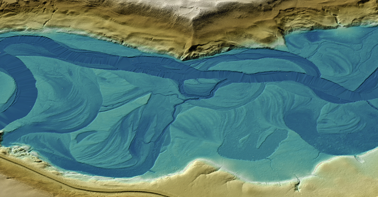
Addressing Change in Coastal Environments with Advanced Topobathymetric Elevation Modelling
The Hydrospatial Data Collection Approach in Morro Bay – By Steve Raber, Ann Kitajima, Carolyn Geraghty Morro Bay, a shallow coastal estuary located near San
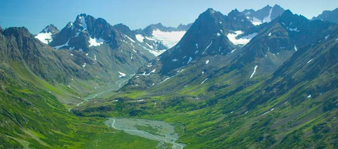
NV5 Geospatial Marks 65 Years Serving Alaska with New, Consequential Geospatial Projects
Projects include work with NOAA, USGS, Alaska Railroad Corporation, Alaska Department of Natural Resources, U.S. Fish and Wildlife and the U.S. Department of Agriculture ANCHORAGE,
Robots on the Rise in Utility Monitoring
Use of robots equipped with sensors and cameras are helping to automate and improve maintenance of utilities. Ian Berdie, VP of Innovation for NV5 Geospatial,
How Thermal Infrared Mapping is Monitoring Our World
Over the past three decades, thermal infrared technology has spread into a wide range of industries with varied applications including: monitoring river temperatures to promote
NV5 Geospatial to present at AWRA
NV5 Geospatial’s Andrew Brenner and Cathy Power present at the Americaon Water Resources Association spring conference.