
How the City of Mercer Island, Washington Implemented ArcGIS Utility Network Leveraging a Workshare Approach
Located in the Seattle metropolitan area on an island in the southern portion of Lake Washington, Mercer Island has a population of over 25,000 residents.
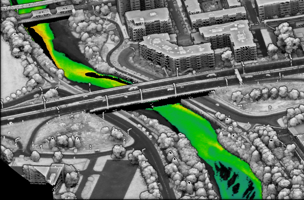
NV5 Geospatial’s Thermal Infrared Solutions Gain Traction for US Infrastructure Challenges
NV5 Geospatial’s Thermal Infrared Solutions Gain Traction for U.S. Infrastructure Challenges Pilot projects with two midwestern state’s Departments of Transportation analyze the structural integrity of
NV5 Geospatial Honored with Missouri Conservation Innovation Partner Award
NV5 Geospatial Honored with Missouri Conservation Innovation Partner Award NV5 Geospatial and Aerial Services Inc. Highlighted for Ground-Breaking 3D Elevation Derived Hydrography Project to Map
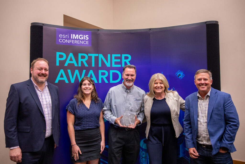
NV5 Receives 2023 Esri IMGIS Utility Network Implementation Award
NV5 has been honored with the Utility Network Implementation award at the 2023 Esri Infrastructure Management and GIS (IMGIS) Conference in Palm Springs, California. The

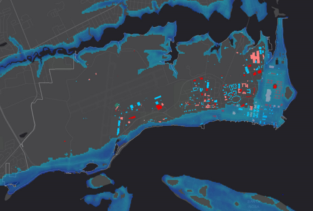
NV5 Geospatial Unveils Turn-key Airport Offerings Powered by Esri and Cityworks Platinum Partnerships
Single partner for combining engineering-grade data acquisition with geospatial analytics and solutions to support operational business decisions at airports HOLLYWOOD, Fla., August 22, 2023 – NV5
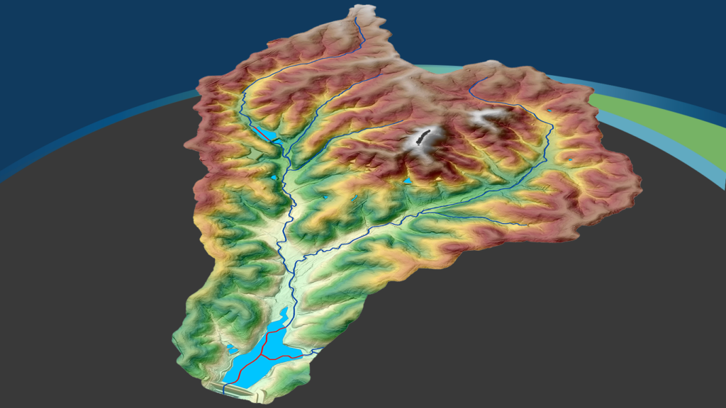
NV5 Geospatial Collaborates with Communauté Métropolitaine de Québec on Ambitious Topobathymetric Lidar Survey
CMQuébec contracted NV5 to collect the topobathymetric Lidar data during leaf-on conditions for an area of interest containing eight rivers surrounding Québec City. The community
Interactive App Visualizes Energy Consumption Data
The Navy Shore Geospatial Energy Module (NSGEM) is an interactive web map and reporting tool that provides the Navy with a standardized, transparent view of
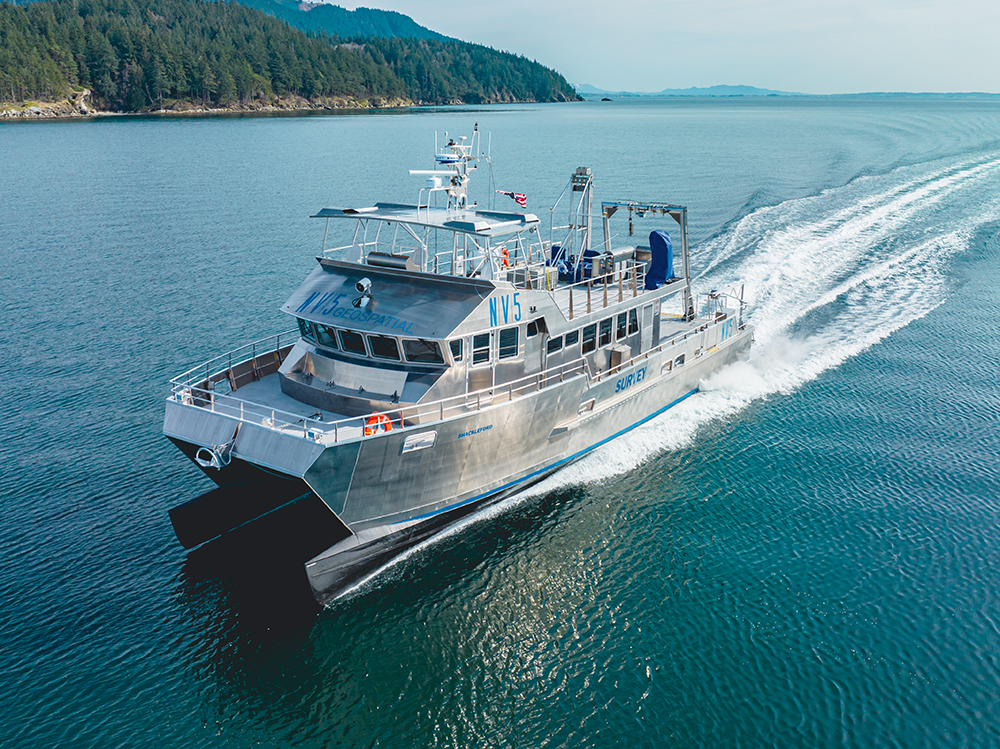
Not All Boats are Created Equal – The Importance of Dedicated Marine Survey Vessels for Offshore Wind Siting
Deploying the appropriate marine vessel is essential when locating and assessing suitable offshore wind sites. Learn how NV5 Geospatial utilizes their dedicated fleet to perform
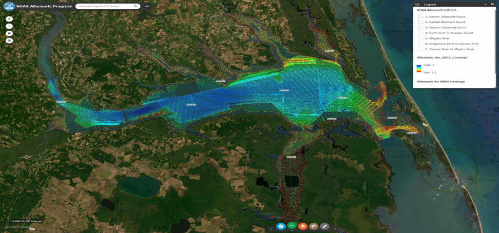
NOAA Selects Geodynamics for Extensive Hydrographic Survey in North Carolina
Task Order Features Unique Survey Approach to Deliver Valuable Charting Data that Will Also Support Environmental and Coastal Resilience Efforts Geodynamics, an NV5 company, North