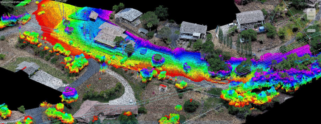
Oversize Freight Clearance Analysis
Find your way with NV5 Geospatial’s data analysis for oversize freight transport. View Flyer NV5 Geospatial uses lidar to perform three-dimensional swept path clearance analysis for
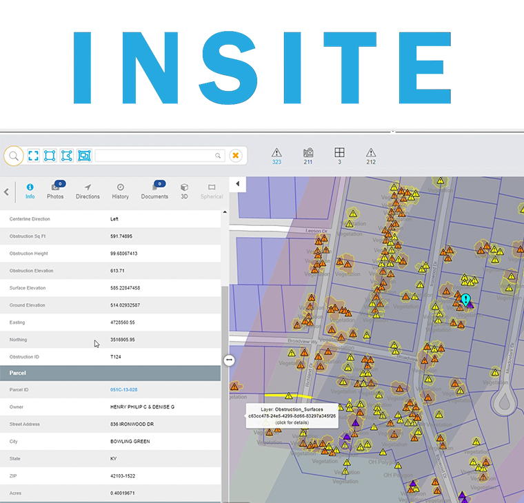
INSITE Lifecycle Project Tracker Enables & Delivers Real-Time Data Updates
Sven Cowan, Canada Program Manager for NV5 Geospatial, discusses the capabilities of INSITE Project Tracker a cloud-based data application for Go Geomatics Canada. The INSITE
UAV Podcast: Lidar Mapping with UAVs (Drones)
Listen The UAV Podcast discusses how drones and other autonomous vehicles are deployed with lidar sensors to create 3D mapping data and downstream

NV5 Acquires Geodynamics, Expanding Deep-Water Geospatial Capabilities
HOLLYWOOD, Fla., March 29, 2021 (GLOBE NEWSWIRE) — NV5 Global, Inc. (the “Company” or “NV5”) (Nasdaq: NVEE), a provider of compliance, technology, and engineering consulting

Alaska Virtual Geospatial Gathering March 1st – 4th
Registration is open for the Alaska Virtual Geospatial Gathering March 1st – 4th. We have over two dozen speakers lined up to cover geospatial topics
NV5 Geospatial Unveils INSITE, a Cloud-based Geospatial Data Management Platform
NV5 Global, Inc. (the “Company” or “NV5”) (Nasdaq: NVEE), a provider of compliance, technology, and engineering consulting solutions, announced today that NV5 Geospatial, formerly Quantum Spatial,
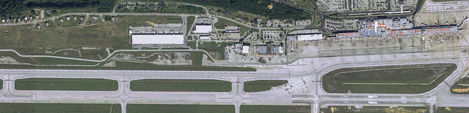
Geospatial Data for Airports
Bob Vander Meer, vice president of business development for NV5 Geospatial (Powered by Quantum Spatial), discusses NV5 Geospatial’s work with Airports on the Airplane Geeks Podcast. Bob has over
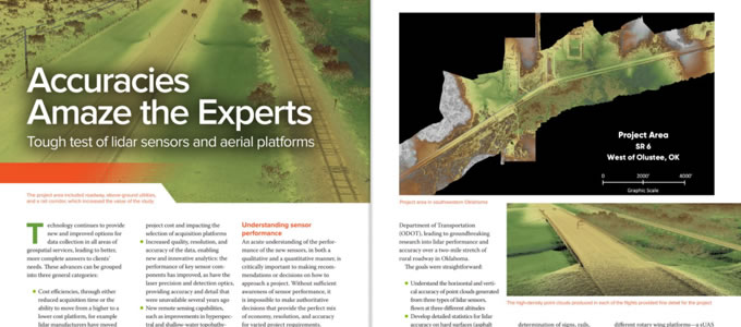
Accuracies Amaze the Experts
Lidar technology continues to advance, both in terms of sensor hardware and platform deployment. NV5 Geospatial and Oklahoma Department of Transportation performed a series of tests