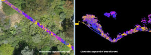
Remote Control: Drones Become Mission Critical Engineering Tool
In the latest issue of Civil + Structural Engineer, Mike Stys, Vice President at NV5, discusses how the emergence of UAV systems (drones) are transforming
In the latest issue of Civil + Structural Engineer, Mike Stys, Vice President at NV5, discusses how the emergence of UAV systems (drones) are transforming
HOLLYWOOD, Fla., June 24, 2020 /PRNewswire-PRWeb/ — Quantum Spatial, Inc., an NV5 company and the nation’s largest geospatial data firm, today announced that Cherie Jarvis has been promoted to director of

Julie Stricker, for Alaska Business Magazine reports how lidar and remote sensing data and analysis help oil and gas companies understand topography in order to make informed management decisions.
NV5 Awarded $4.6 Million Geospatial Vegetation and Asset Management Contract Extension HOLLYWOOD, Fla., June 11, 2020 – NV5 Global, Inc. (the “Company” or “NV5”) (Nasdaq:
HOLLYWOOD, Fla., May 28, 2020 – NV5 Global, Inc. (the “Company” or “NV5”) (Nasdaq: NVEE), a provider of professional and technical engineering, geospatial, and consulting
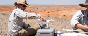
Scott Nowicki, Lead R&D Scientist at Quantum Spatial, joins the latest episode of VerySpatial to discuss some of his recent projects and emerging technologies in remoting sensing. The

HOLLYWOOD, Fla., May 20, 2020 (GLOBE NEWSWIRE) — NV5 Global, Inc. (the “Company” or “NV5”) (Nasdaq: NVEE), a provider of professional and technical engineering, geospatial, and consulting solutions, announced

Quantum Spatial, in collaboration with NOAA’s National Centers for Coastal Ocean Science (NCCOS) and Office for Coastal Management (OCM) developed a decision-support application, ShoalMATE, which informs usage and management

Quantum Spatial senior vice president Mark Meade and LIDAR Magazine Managing Editor Stewart Walker discuss Quantum Spatial’s response to the coronavirus. Read the full article here. SW: What

We continue to stay positive and work hard from afar, and we’re doing our best to stay connected and keep it fun! The more we