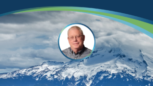
Tim Saultz awarded Dept of the Interior’s Distinguished Service Award
We extend our heartfelt congratulations to our very own Tim Saultz, who was awarded The Distinguished Service Award, the highest honorary recognition an employee can
We extend our heartfelt congratulations to our very own Tim Saultz, who was awarded The Distinguished Service Award, the highest honorary recognition an employee can
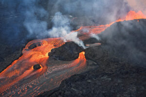
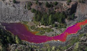
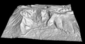
Written by Joel Burroughs, NV5 Geospatial Account Manager When volcanoes erupt, the force of explosions and lava dramatically change the landscape, impacting the geography and
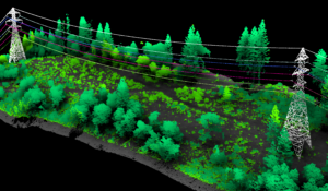
Use of robots equipped with sensors and cameras are helping to automate and improve maintenance of utilities. NV5 Geospatial, North America’s most comprehensive geospatial science
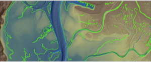
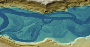
The Hydrospatial Data Collection Approach in Morro Bay – By Steve Raber, Ann Kitajima, Carolyn Geraghty Morro Bay, a shallow coastal estuary located near San
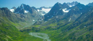
Projects include work with NOAA, USGS, Alaska Railroad Corporation, Alaska Department of Natural Resources, U.S. Fish and Wildlife and the U.S. Department of Agriculture ANCHORAGE,
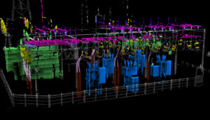
Use of robots equipped with sensors and cameras are helping to automate and improve maintenance of utilities. Ian Berdie, VP of Innovation for NV5 Geospatial,
Hollywood, FL – June 21, 2022 – NV5 Global, Inc. (the “Company” or “NV5”) (Nasdaq: NVEE), a provider of compliance, technology, engineering, and environmental consulting
Over the past three decades, thermal infrared technology has spread into a wide range of industries with varied applications including: monitoring river temperatures to promote
HOLLYWOOD, Fla., May 24, 2022 (GLOBE NEWSWIRE) — NV5 Global, Inc. (the “Company” or “NV5”) (Nasdaq: NVEE), a provider of technology, conformity assessment, and consulting solutions,
NV5 Geospatial’s Andrew Brenner and Cathy Power present at the Americaon Water Resources Association spring conference.