A New Way to Present Spatial Data
For GIS professionals, overlaying multiple geospatial data layers on a map for analysis and decision making is all part of a day’s work, but for
For GIS professionals, overlaying multiple geospatial data layers on a map for analysis and decision making is all part of a day’s work, but for

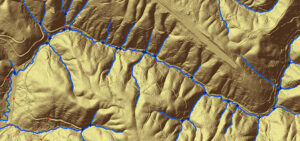
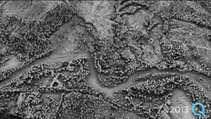
Teaming with experts from LiDAR manufacturer RIEGL, Quantum Spatial, Inc. was recently involved in an exciting new test of RIEGL’s newest sUAS technology innovation for hydrographic applications –
Here we are in Oakland for Cal GIS LocationCon ’17, running from May 22-24th! We can’t wait to learn more about some of the latest GIS
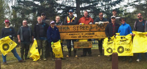
Quantum Spatial was out in force, participating in Anchorage Waterways Council’s Creek Cleanup. The volunteer crew got their feet wet, literally, as they removed trash from
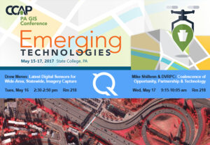
We’re excited to attend the PA GIS Conference, from May 15-17. We’re looking forward to learn more about emerging technologies across the industry as well as

We had a busy year in 2016, collecting, processing, and analyzing a wide variety of data across all 50 states and applied to a diverse
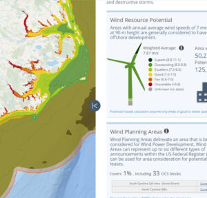
By Tarika Hanawalt While many governments and organizations use the geospatial data we provide, what the public sees is often just a detailed map or
By Kurt Allen, Quantum Spatial Vice President Federal Vertical Lead After witnessing firsthand the devastation landslides cause across a number of states, including Alaska, California and Washington,

Written by Steve Raber, Quantum Spatial Senior Program Manager April 20th marks the day when, seven years ago, BP’s offshore drilling rig Deepwater Horizon suffered
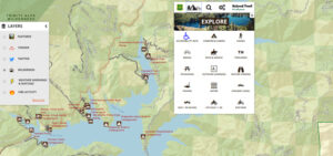
Quantum Spatial, Inc., the nation’s largest independent geospatial data firm, has worked with the U.S. Forest Service to continually improve its Interactive Visitor Map over the past