
Quantum Spatial’s 4th Annual Acquisition Summit
Quantum Spatial’s fourth annual acquisition is underway this week. The event brings together remote sensing and geospatial industry leaders to share new innovations, showcase emmerging
Quantum Spatial’s fourth annual acquisition is underway this week. The event brings together remote sensing and geospatial industry leaders to share new innovations, showcase emmerging

Quantum Spatial, Inc., the nation’s largest independent geospatial data firm, announced that its use of remote sensing and analytics for vegetation management will be featured during

Big Data comes to life via Quantum Spatial’s eGIS application, developed for the Bureau of Ocean Energy Management. The Marine Minerals Information System (MMIS), enables the management

Interested in working with lidar and learning advanced geopsatial data processes during summer break? Quantum Spatial welcomes the 2019 Portland office interns! For the third

Geospatial mapping and analytics performed by the The Bureau of Ocean and Energy Management in conjunction Quantum Spatial and Argis Solutions, is aiding in sea turtle
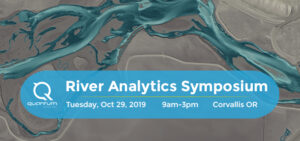
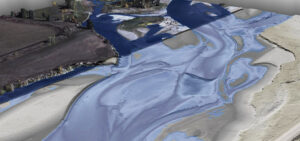
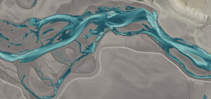
Quantum Spatial is assembling the foremost experts in water resources, hydrology, geomorphology, and habitat restoration in the Pacific Northwest for a day of presentations and
Mike Shillenn, Quantum Spatial vice president, describes how bathymetric lidar in combination with hyperspectral imagery is providing a variety of new information in shallow water
Quantum Spatial, Inc. (QSI), the nation’s largest independent geospatial data firm, today announced that Colin Cooper, senior scientist; Evon Silvia, solutions architect and chair of the
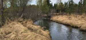
Recently, Quantum Spatial participated in the annual Anchorage Waterways Council’s Creek Cleanup. With the winter snow melted, 18 volunteers put their waders on and combed Chester

Quantum Spatial, Inc. (QSI), the nation’s largest independent geospatial data firm, today announced that Anand Iyer, Ph.D., Senior Vice President, Products & Marketing at QSI,