
The continual evolution of remote sensing platforms
Quantum Spatial’s Mike Fuller discusses the latest advancements in remote sensing platforms- drones and robots- and how their emergence has revealed new insights across a variety
Quantum Spatial’s Mike Fuller discusses the latest advancements in remote sensing platforms- drones and robots- and how their emergence has revealed new insights across a variety
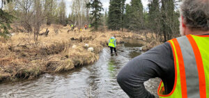
Quantum Spatial made headlines this past weekend helping to keep Anchorage’s waterways clean. Marking the third consecutive year, the team participated in Anchorage Waterways Council’s Creek Cleanup.

Colin Cooper and Russ Faux discuss the possibilities of topobathy LiDAR survey and evaluate the latest sensor technology and deployment methods in the most recent
Cherie Jarvis, Quantum Spatial’s Enterprise GIS Practice Lead, recently shared her insights into the benefits and best practices of agile software development in a SD
In celebration of National Surveyors Week, we’re spotlighting some of our dedicated surveyors and sharing their insights of a survey career. If you are interested
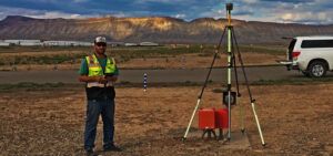
In celebration of National Surveyors Week, we’re spotlighting some of our dedicated surveyors and sharing their insights of a survey career. If you are interested

In celebration of National Surveyors Week, we’re spotlighting some of our dedicated surveyors and sharing their insights of a survey career. If you are interested
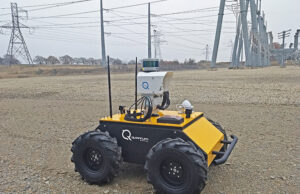
Autonomous Robotic Platform Featuring LiDAR, Thermal and Multispectral Sensors Enables Remote Change Detection in Substation Environments St. Petersburg, Fla. – March 2, 2018 – Quantum

Quantum Spatial, Inc.(QSI), the nation’s largest independent geospatial data firm, today announced that three of its LiDAR experts will be featured speakers at International LiDAR
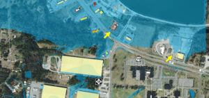
Michael Shillenn, of Quantum Spatial, details how North Carolina is managing flood risk through improved mapping and analysis of LiDAR data, made possible via the