Quantum Spatial welcomes the 2019 Portland office interns

Interested in working with lidar and learning advanced geopsatial data processes during summer break? Quantum Spatial welcomes the 2019 Portland office interns! For the third consecutive year, Quantum Spatial provides full-time summer learning opportunities for individuals beginning careers in the geospatial field.  Working directly with our expert staff on client projects, interns will gain experience with processing and analyzing a variety of data including lidar and orthoimagery.  Mentors provide focused guidance; additional enrichment is available via onsite education luncheons.  The interns will explore personal interests via a capstone project of their making, incorporating knowledge and techniques learned over the course of the three month program.
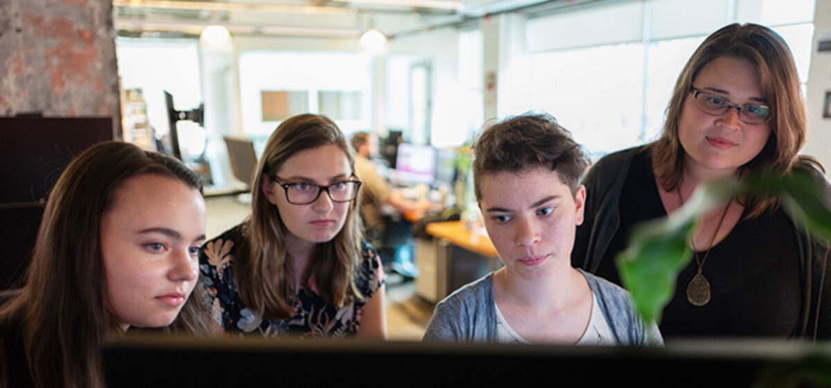
Introducing…
Cayla Sigrah recently graduated from Portland State University and is excited to start her post-student life interning here at Quantum Spatial!  She earned her B.S. in Environmental Science and Geographic Information Systems, which makes Quantum Spatial a perfect habitat for her to grow her knowledge of geospatial analysis. Cayla has collaborated with a diverse range of professionals who specialize in placed-based learning and environmental monitoring, and these experiences give her a well-rounded approach to problem solving,  which she hopes to use to discover solutions to pressing environmental issues, especially for those most vulnerable to human-caused threats, such as Climate Change.
Kaitlyn Zurcher has a background in Environmental Sciences from Oregon State University and received her GIS Certificate from Portland Community College. She is most excited about learning as many of the processes and tools as she can during her internship at Quantum Spatial. Kaitlyn is also excited to be using her GIS and Lidar skills in a professional setting and is looking forward to seeing where this summer will take her!

Madison Lawrence is a rising sophomore at Oregon State, and finds the idea of jumping into such a professional internship somewhat daunting. However, to accomplish Madison’s ambitious goals for the future, Quantum Spatial has proven to be a place with an open mind, superior knowledge and skills, and a motivation to teach students about the world of GIS. Madison hopes to use the internship as preparation for the future, and is looking forward to the projects that Madison will work on for the duration of the internship.

Margaret Walters is a Computer Science and Digital Communications major at Oregon State University.  She’s excited to be interning at Quantum Spatial and already loves the company culture! This summer, she hopes to get an in-depth look at the GIS field as well as the company’s workflow.

Fill out the form below to download the handbook.

Form #1 - Redirection to PDF

Form #2 - Sends email containing the link to the PDF

"*" indicates required fields

This field is for validation purposes and should be left unchanged.

eNewsletter - NV5 Real Estate Transaction Services

Contact NV5 Real Estate Transaction Services

Download NV5 2022 Compliance Calendar

Please fill out the form below. After successful form submission, you will be redirected to the requested file. Thank you.

  • We are an equal opportunity employer. All applicants will be considered for employment without attention to race, color, religion, sex, sexual orientation, gender identity, national origin, veteran or disability status. We ensure nondiscrimination in all programs and activities in accordance with Title VI of the United States Civil Rights Act of 1964. If you need more information or special assistance for persons with disabilities or limited English proficiency, contact MaryJo OBrien at (954) 495-2112. Persons with hearing-and speech-impairments can contact the NV5 by using the Virginia Relay Service, a toll-free telecommunication device for the deaf (TDD). Call 711 for TTY/TDD.

Hyperspectral Imaging - Technically Speaking

Our internal innovation and development team constantly analyzes new technology and develops solutions to meet our client’s challenges. Our Technically Speaking series is one way we share our technical findings with the professional community. 

Please tell us a little about yourself by filling out the form below, and we’ll share the document with you, thanks!

Accuracy Part 1- Technically Speaking

Our internal innovation and development team constantly analyzes new technology and develops solutions to meet our client’s challenges. Our Technically Speaking series is one way we share our technical findings with the professional community. 

Please tell us a little about yourself by filling out the form below, and we’ll share the document with you, thanks!

Prune Optimization Webinar Recording

NV5 Geospatial releases a new predictive modeling platform for vegetation management that uses existing lidar and historical data to identify the relative level of asset risk from trees by quantifying the potential for causing asset damage. 

Please tell us a little about yourself by filling out the form below, and we’ll share the document with you, thanks!

Topobathy Lidar - Technically Speaking

Our internal innovation and development team constantly analyzes new technology and develops solutions to meet our client’s challenges. Our Technically Speaking series is one way we share our technical findings with the professional community. 

Please tell us a little about yourself by filling out the form below, and we’ll share the document with you, thanks!

Contact Geospatial

Contact Geospatial